Illinois DOT Maps

Some parts of the US have a variety of roads that, while technically maintained as public road by some combination of county, state, US forest service, bureau of land management, etc., have more of the character of offroad “trails” than what most people think of as a “road”. Many offroading videos available on youtube feature “trail riding” activities on what are actually just really lackadaisically maintained roads. (this is actually not a good thing, as explained below)

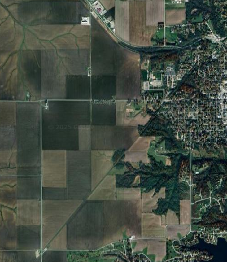
Illinois is emphatically not one of those states! Most of the roads, even backroads far from any city, are as level as a tabletop, straight as an arrow, and often paved. If not with regular blacktop asphalt, then at least with chipseal. Especially in the counties that have cities in them, even the very rural areas tend to have paved roads.

(I was not familiar with chipseal until I moved here. In the south, I think, any road that Illinois would chipseal is just left as plain gravel, aka what we called a “dirt road”.)

There are exceptions. The counties known collectively as Forgottonia, which are mainly the far western counties cut off from the rest of the state by the Illinois river, have lot more unpaved roads, and more central counties have some if they don’t contain one of the region’s cities.

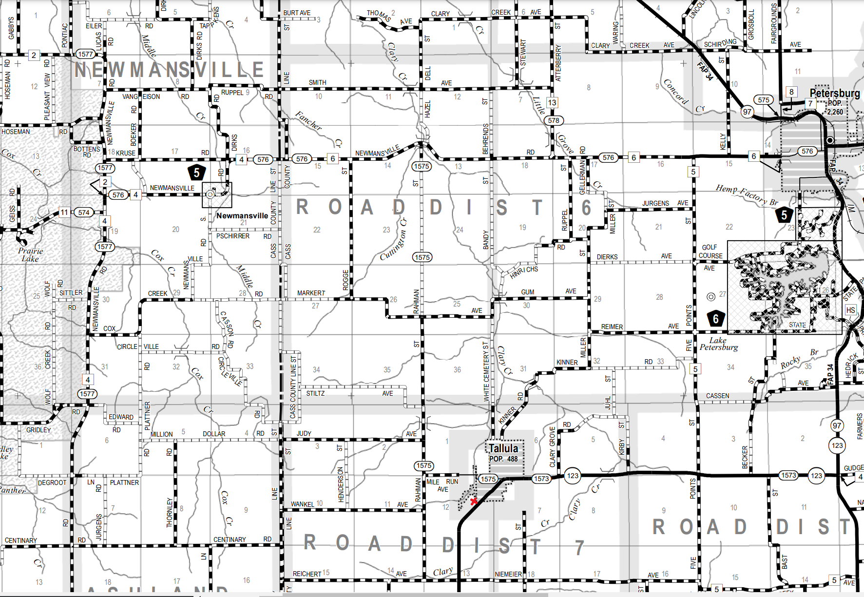
As in most all states, commercially available maps are generally terrible at indicating which roads are paved and unpaved. Pretty much the only source of this information are state Department of Transportation maps published on a county-by-county basis, and available as PDFs.

These maps are your key to dirt roads in the state. There are, of course, private off-road trails in Illinois, but we are talking about public roads here.

Main index:

https://idot.illinois.gov/transportation-system/network-overview/highway-system/maps/highway.html

Individual counties of particular interest near Springfield:

  • Menard – one county away from Springfield
  • Christian – ditto
  • Cass – borderline Forgottonia
  • Pike – full-on Forgottonia

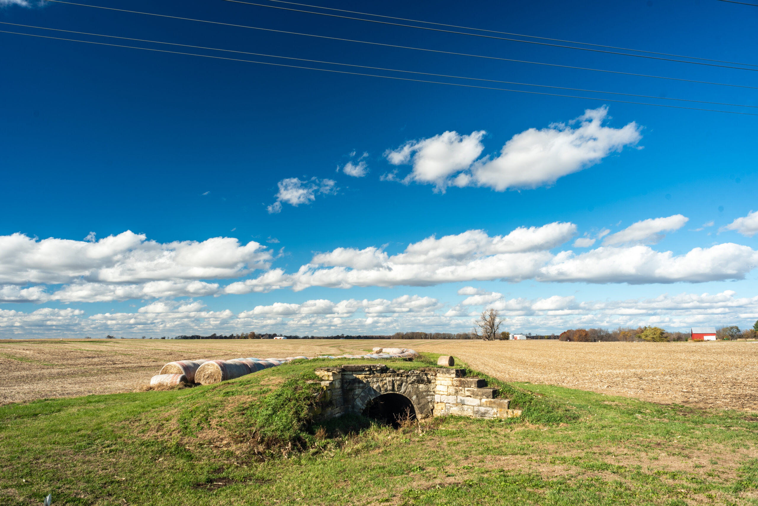
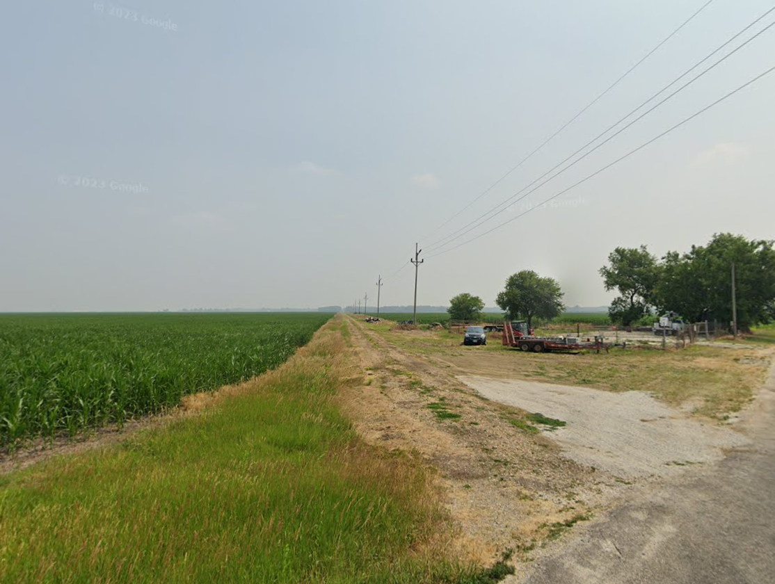
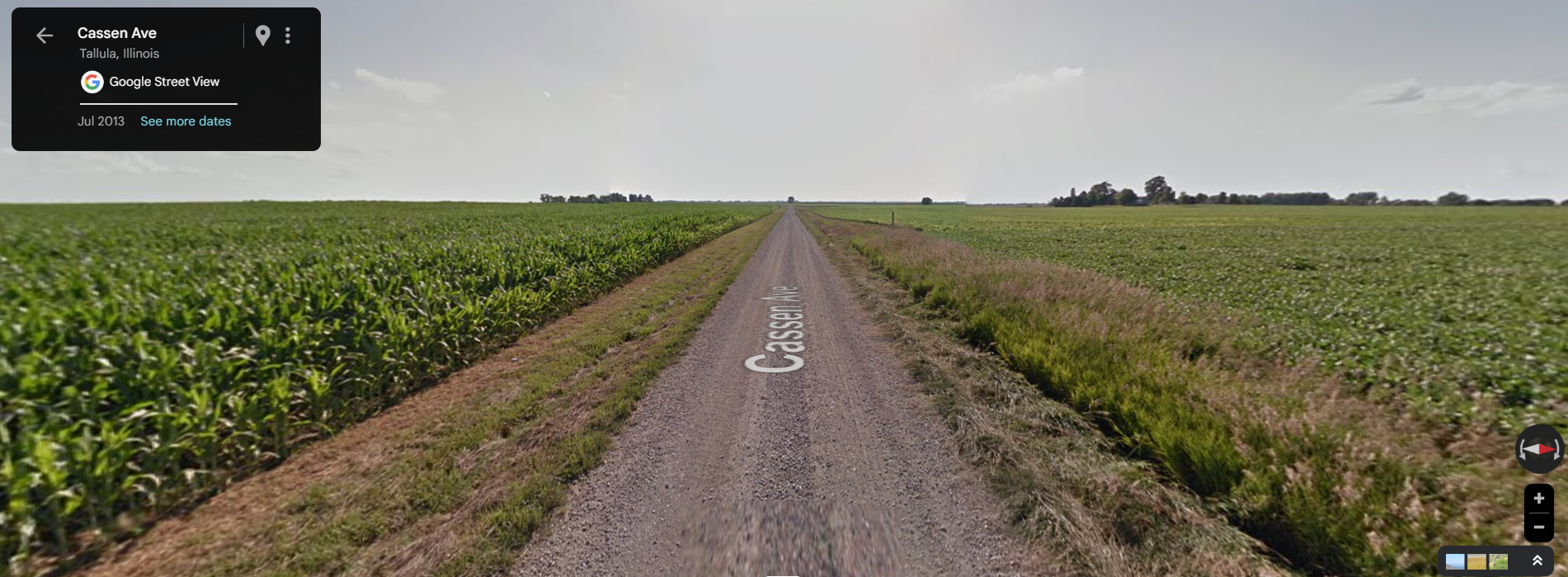
Mind you, most of these unpaved roads just look like this:

Cassen Road near Tallula would qualify as a highway in some states.

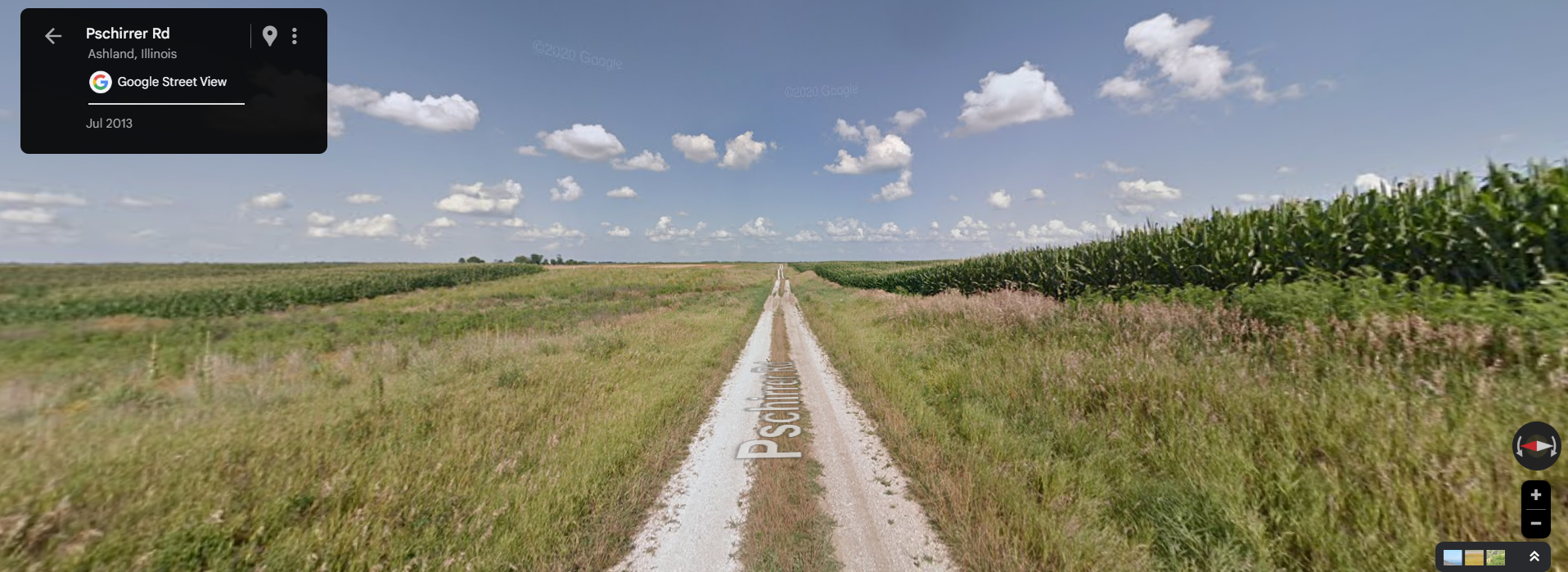
Some of the less-maintained ones look like this:

Pshirrer Road near Newmansville, is two separate strips of gravel, one for each wheel.

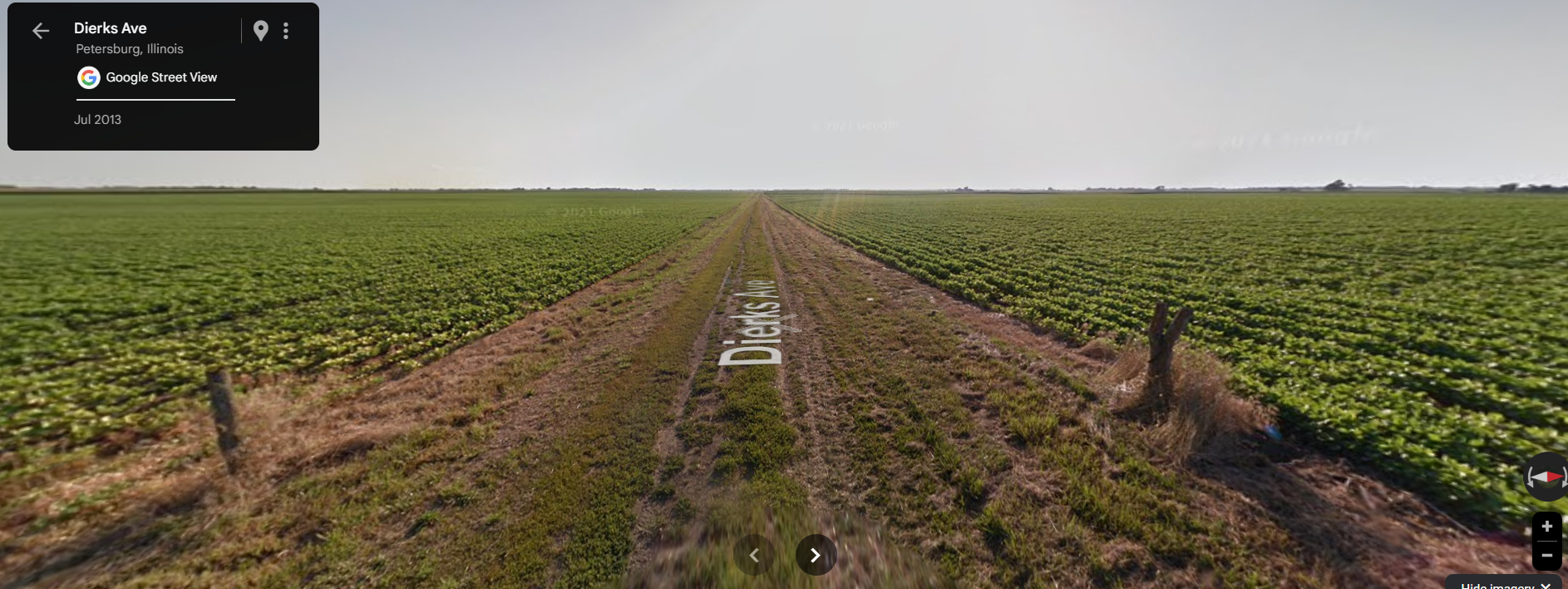
And a few have been allowed to deteriorate to this point:

Dierks Ave near Petersburg, is basically dirt in this photo. But there’s actually old gravel under there. Note it has been re-graveled since this photo and no longer looks anything like this.

But still, very flat, mostly straight, no sense of adventure in warm season weather. When it can get interesting is in winter, when counties like Cass seemingly don’t bother to snowplow these minor roads at all.

There is more variety in Pike Country, where the river bluffs provide changes of altitude, wooded locales, twistier roads. There is stuff like washouts, fallen trees on the roads, fording creeks, etc. Pike is one of the most active hunting areas in Illinois, and you see a lot of folks on ATVs on those roads.

I am not providing photographic evidence of these because one thing I learned from living in Georgia for many years is that once someone publicizes the exact location of an “interesting road” the first thing that happens is groups of people start riding convoys of 40 jeeps down it for youtube videos, and the next thing that happens is the state/county/etc paves or regrades it and takes all the fun out of it, or else closes it entirely.

Springfield Rail Improvement Project

This partially completed project is finally back “on track” after the final federal funding was approved in May.

Because the official maps of the project show separate “before” and “after” maps, I’ve taken it upon myself to draw the “before” line myself onto the “after” map, I’ve taken it upon myself to create a composite using MS Paint. The red drawn line is the current UP (ex-SP, ex-ICG, ex-GM&O, ex-Alton) line that will be abandoned. The blue drawn line is the new route.

Map taken from project website, modified by me.

To date, the overpasses for the new line have been built from the south end up to and including Carpenter Street. The only sign of the planned overpass over North Grand is the fact that the McDonalds at 9th and North Grand has already been demolished for some months. The state EPA office has also moved to White Oaks Mall to make way for this construction.

From a railfan perspective, this is both good and bad. It is bad because it will move the trains 7 blocks further from my house, and also eliminate several grade crossings which can currently be used for trainwatching. It is good because it concentrates both UP and NS onto one right of way (still separate railroads, but right next to each other) for a long stretch, allowing one to “double dip”. Currently the only place that can be done is a short stretch south of town. As these are by far the roads with the most trains in Springfield, this means the vast majority of all the rail traffic in town would now go right past the new passenger station on 9th street.

No, I don’t know what they plan to do with the current line when it is abandoned. In 2022 at a community meeting I asked then-Mayor Jim Langfelder about it, and he said something about a light rail / trolley line. I did not believe it then and don’t believe it now. Downtown Springfield is too small to need a trolley to get from one place to another within it.

Plans for a 3rd Street Greenway seem more realistic, but still pretty ambitious for Springfield where, as we’ve seen, things change slowly. Anyone who was in Atlanta when the Beltline was being planned knows that these kinds of things can take much longer than expected, even in a much larger city,

The Jack Line

An old stone culvert near Tallula, IL

I’d been seeing this little stone arch in a field next to IL-123 for a couple years.

Not because I was looking for it, but because it’s on the way to one of closest (to me) parts of Illinois where there’s enough public dirt roads to put in the “recommended” 10 miles of 4×4 driving of a 4runner.

Road map stitched together in Paint from the PDFs of Cass and Menard counties, showing the abundance of unpaved gravel roads in the vicinity. The approximate location of the photo is marked with red.

Anyway, it somehow escaped me that this was in fact part of the abandoned railroad line that I already knew was in the area. I just didn’t put 2 and 2 together. Until I ran into it on Bridge Hunter, one of those last great pre-FB, pre-Twitter old school resources on the web. IMO for the (admittedly niche) subject it covers, its up there with any wiki.

The site identifies this location as:

“Abandoned stone arch bridge over Intermittent strean on Abandonded Chicago & Alton Ry”

You can clearly see the “ghost line” of this railroad line on the following images. It is the line running diagonally from southwest to northeast.

Satellite image centered on Tallula, IL
Satellite image centered southwest of Petersburg, IL

Info about the line on Abandoned Rails, another of those great vanishing internet resources:

“This is the famous Jack Line that had one of the last “Doodlebug” runs untgil April 14, 1960. The double- car, motor car with trailing coach, train went daily from Bloomington, Il to Kansas City, MO and return. Trains from each direction met in Louisiana, Missouri. It was possible to make a round trip from Bloomington to Louisiana and return in a day. That was one of the longest doodlebug runs in the country and one of the latest.”

Doodlebug train from Bloomington to KC, final trip on 4/14/1960. Photo by  Edward Wayne Bridges, posted to Facebook by John Woodrow on 12/6/2023.

This line was the western side of a triangle that had Bloomington, Roodhouse, and Godfrey at its corners, and included Springfield along its eastern side. This can be seen on the map from the Wikipedia article on the Alton Railroad.

1885 map of the Chicago and Alton Railroad.

From the points of this triangle, lines connected to Chicago, St. Louis, and Kansas City. So while this location seems remote at present, in the railroad’s heyday it was part of the connections between the Alton’s three principal cities.

So what happened? Well, what happened to many, many midwestern and midsouthern lines. The Alton was absorbed into the GM&O in 1947, which was in turn absorbed into ICG in 1972. In the 80s, ICG spun off most of its not-originally-Illinois Central trackage. They were spun off as shortlines which were eventually purchased by other Class I railroads.

The Chicago to St. Louis main line, through Springfield, is now Union Pacific and is a very busy intermodal route and the route of the Texas Eagle.

The St. Louis to KC branch did not fare as well. It ended up as KCS, and now CPKC. It currently connects KC, St. Louis, and Springfield (via the former Alton/GM&O “air line” from Murrayville to Springfield which was built in 1907 after the map shown above). It is much lower in traffic than the other line. This was the line that, during the CP and KC merger talks, CN tried to buy to extend their ex-IC line (that currently ends south of Springfield) to Kansas City.

The third leg of the triangle, which is what we’re discussing here, was completely abandoned between Bloomington and Jacksonville.

Many parts of the line are followed still by roads, power lines, or both.

Power line access road southwest of Petersburg that was once the railroad.