Eastern Continental Divide: North of Gainesville

Picking up where the last one left off, this gets you out of the burbs and into the woods. At the northern end, it gets you into the mountains, even.

The route through Gainesville is rather arbitrary and I’m not sure how close it follows the divide.

You are pretty much running parallel to US 23 (when you are not actually on US 23) all the way.

The early parts of this route are very close to Lake Lanier.

From Lula through Mt. Airy, you are running directly beside the Norfolk Southern main line.

I have only been as far north on this route as Alto, so I can’t really say what the remainder of it looks like.

The end point here looks to be about as far as you can follow the ECD on public roads. From here, the ECD turns westward and generally forms the Habersham/Rabun county border until meeting the Tennessee Valley Divide at Young Lick.  I don’t see any roads that directly follow this ridge, not even dirt Forest Service roads. From Young Lick, the ECD continues north on the Appalachian Trail. At that point, following the divide becomes more of a matter of hiking than driving.

ecd3-fixed

Google Maps Link

Start on Aviation Blvd, continue east from last time
Right on GA 60
Left on West Ridge Rd
Right on Athens St
Left on East Ridge Rd
Left on Old Cornelia Highway
Right on US 129
Left on White Sulphur Rd
Left to stay on White Sulphur Rd
Left on Cagle Rd
Right on GA 52
Sharp left on GA 51
Continue onto Main Street (Lula)
Continue onto Gainsville Highway
Continue onto Old Cornelia Highway
Continue onto Willingham Ave
Continue onto Main Street (Cornelia)
Right on Highland Ave
Left to stay on Highland Ave
Continue on Chenocetha Dr
Right on Wyly St
Continue on Dicks Hill Pkwy
Left on Rock Rd
Left on Antioch Church Rd
Right on US 23/US 441
Right on John Wood Rd
Left on Tom Born Rd
Right on Old Historic US 441
Left on The Orchard Rd
Right on Bear Gap Rd

Eastern Continental Divide: Duluth to Gainesville

Picking up where the previous route through Atlanta ended, this follows the ECD (within the limits of road placement) through the northeastern metro area. To be honest this is a rather boring drive through the suburbs. You can skip to the next post to pick it up where things get mildly interesting again.

The earlier part has some shenanigans with Old Peachtree Road, leaving it without turning and turning to stay on it at different points.

The segment on GA 20 is an area where no road follows the ECD. If you look close at a topo map you’ll see this section crosses a creek, not something you’ll see when following a ridge line.

The segment on GA 124 passes the site of Ft. Daniel, one of the original endpoints of the trail that became Peachtree Road.

The GA 13 portion mostly runs closely parallel to I-985.

Gainesville’s airport is an arbitrary stopping point dictated mainly by limitations on the number of route modifications that Google Maps allows you to make.

ecd2-fixed

(Aside: notice how close the divide is to Lake Lanier? The western edge of Lake Lanier’s drainage basin is also visible on this map, over near GA highway 9. The lake is really not very far at all from the boundaries of the area drained by it.)

Google Maps Link

Start at Old Peachtree Rd and I-985, go east
Left on Northbrook Pkwy
Continue on Old Peachtree Rd
Continue on Horizon Dr
Left on Old Peachtree Rd (yes, again)
Left on Rock Springs Rd
Right on GA 20
Left on Old Peachtree Rd
Left on GA 124/Braselton Hwy
Left on Hamilton Mill Rd
Right on Ridge Rd
Continue onto Hog Moutain Rd
Right on GA 13
Right on Industrial Blvd
Right on Aviation Blvd

Bayou La Batre and Coden

This is the first time I’ve posted anything of my hometown on this blog since I restarted it on WordPress.

On a recent visit “home”, I went around Instagramming not the usual sights of the town (that is, boats and the water) but other aspects.
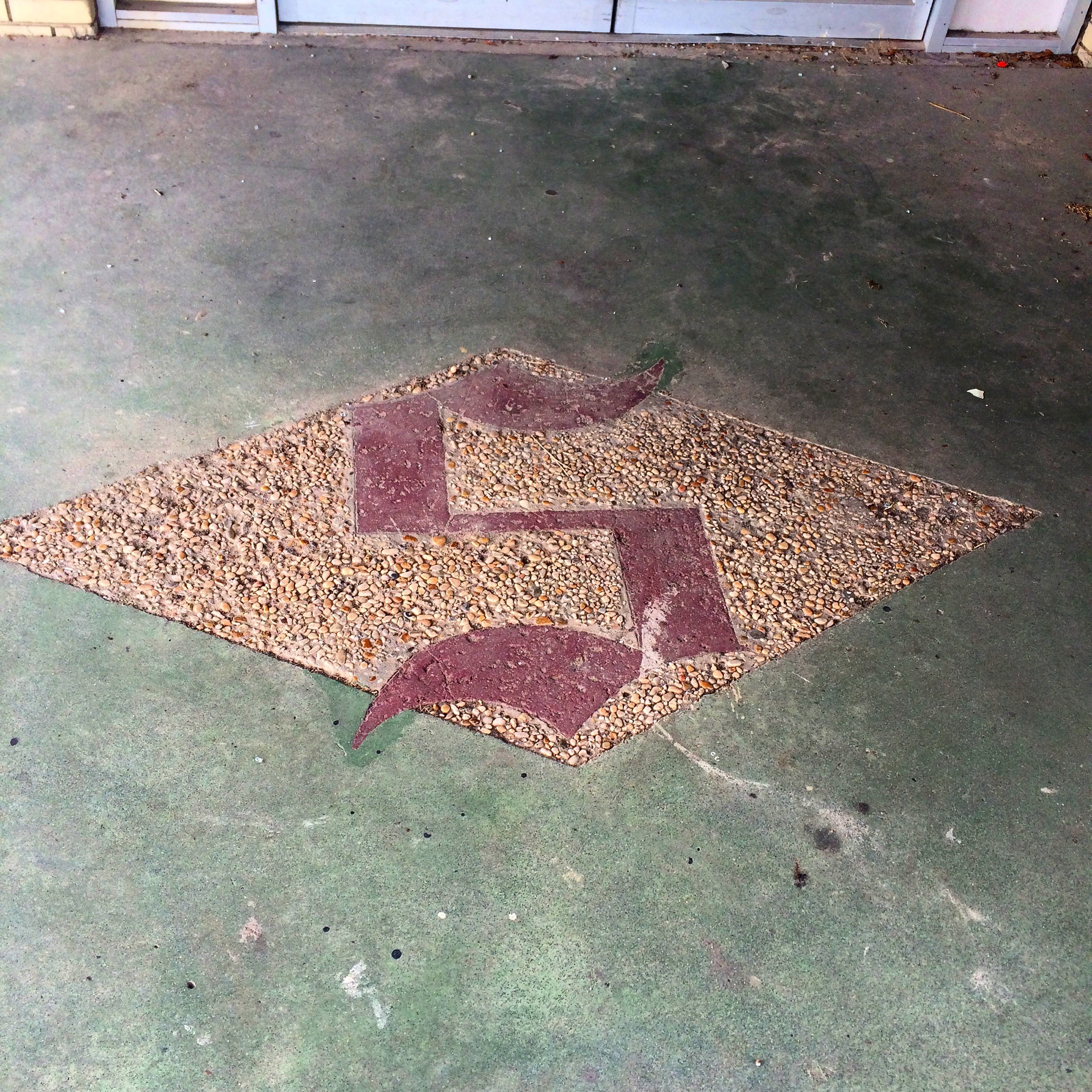
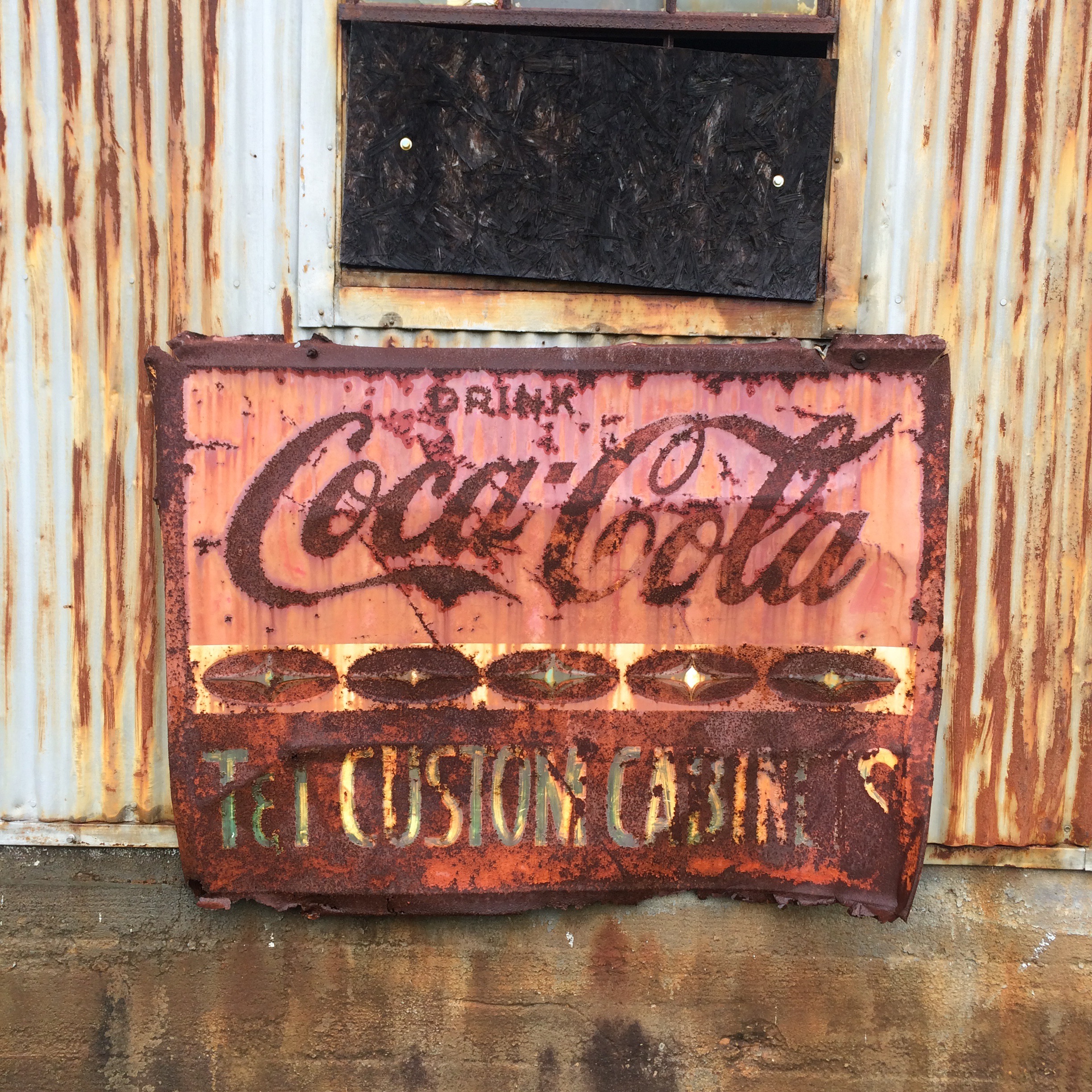
Schambeau’s

“S” logo on the sidewalk in front of the old Schambeau’s store. Schambeau’s, or Crum’s as the old folks called it (the propreitor was A. C. “Crum” Schambeau) was one of the most important businesses in town. They sold groceries, hardware, lumber, paint, you name it.

IMG_7854.JPG
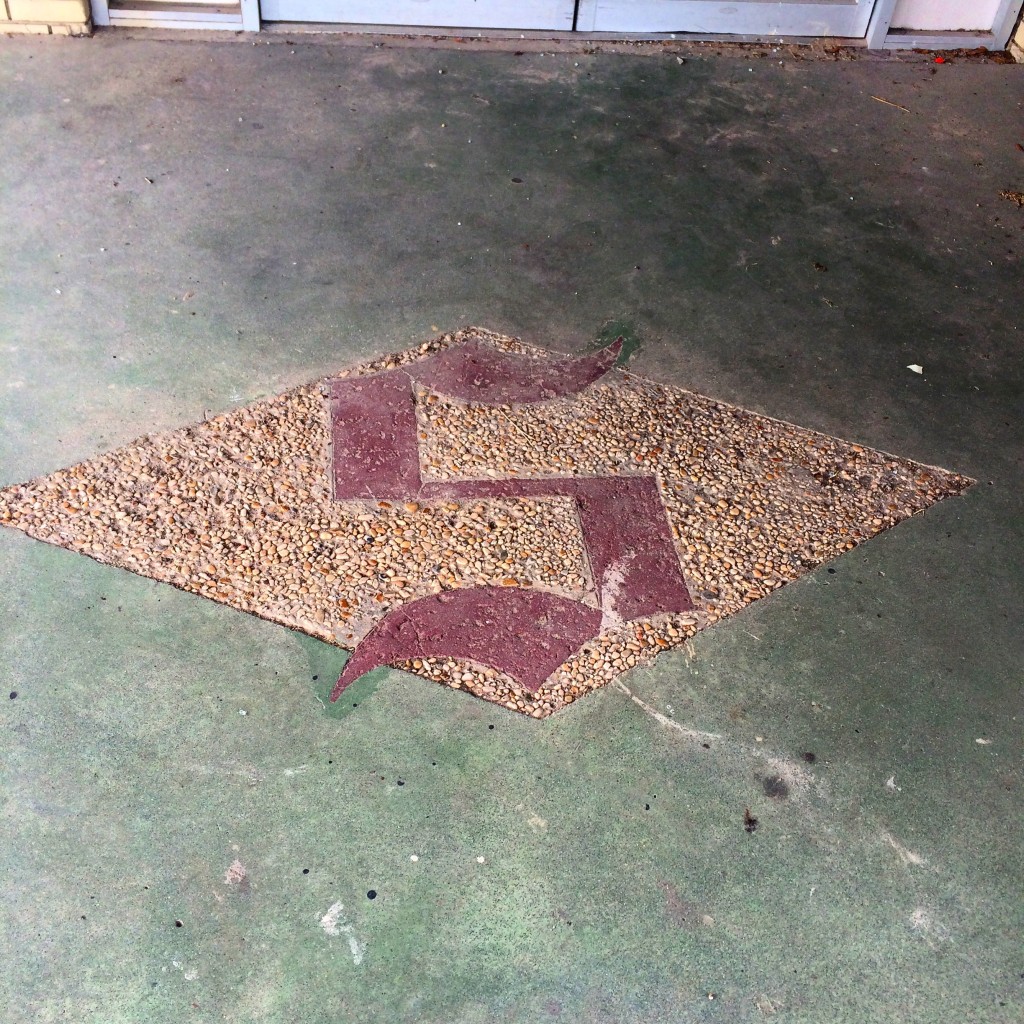
Schambeau’s was one of the two main sources in town (along with Modern Drug, not pictured but believe me it was not very modern at all) for comic books, an essential ingredient of late childhood and early adolescence in the 1980s as now.

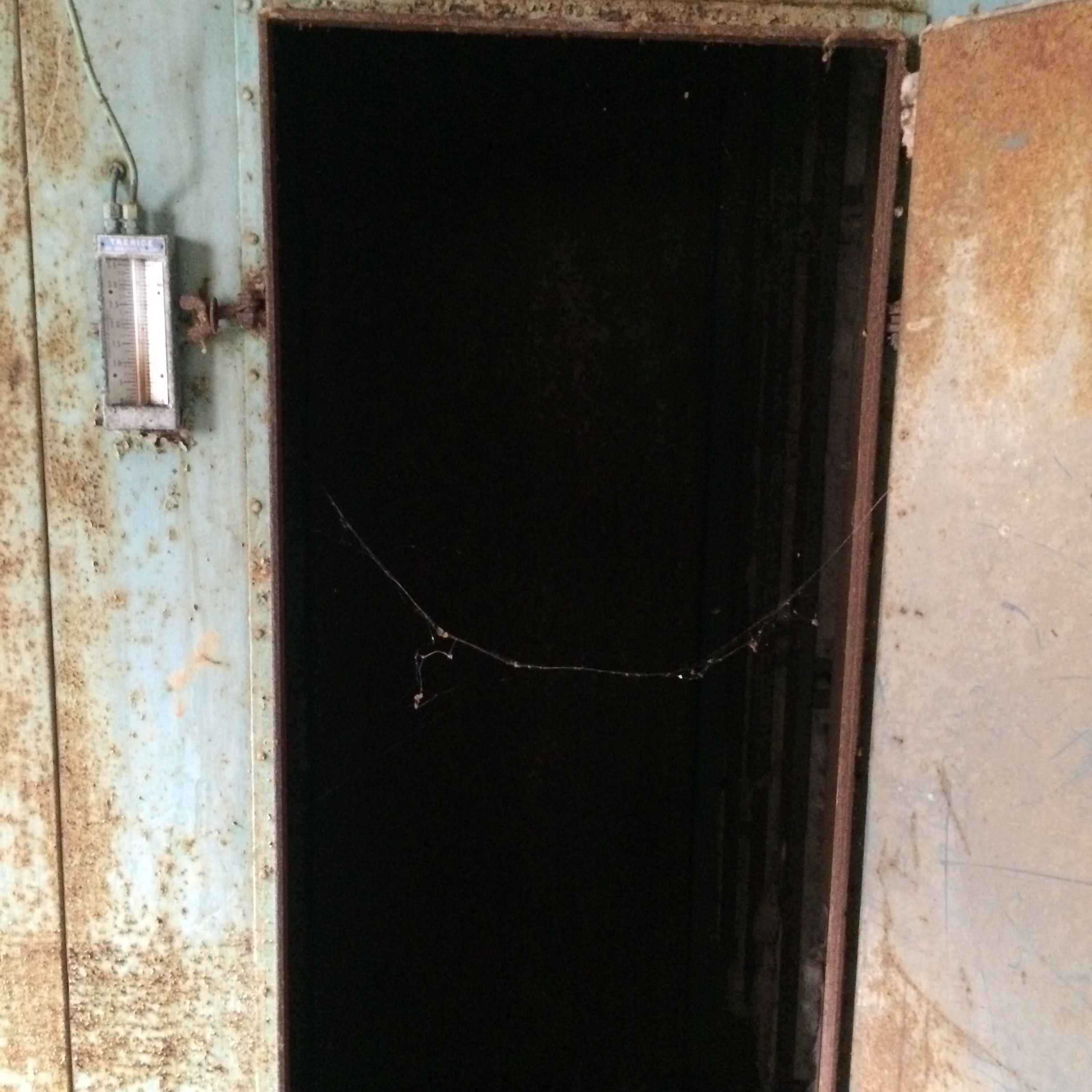
If you had to go to the bathroom in Schambeau’s, you had to go back behind the meat department and up a set of stairs, past the office where Mr. Crum did his accounting on some kind of electromechanical monstrosity of a 1960s calculator, to a single unisex toilet with an oddly religious painting decorating the wall.

That isn’t remotely all there is to say about that place.
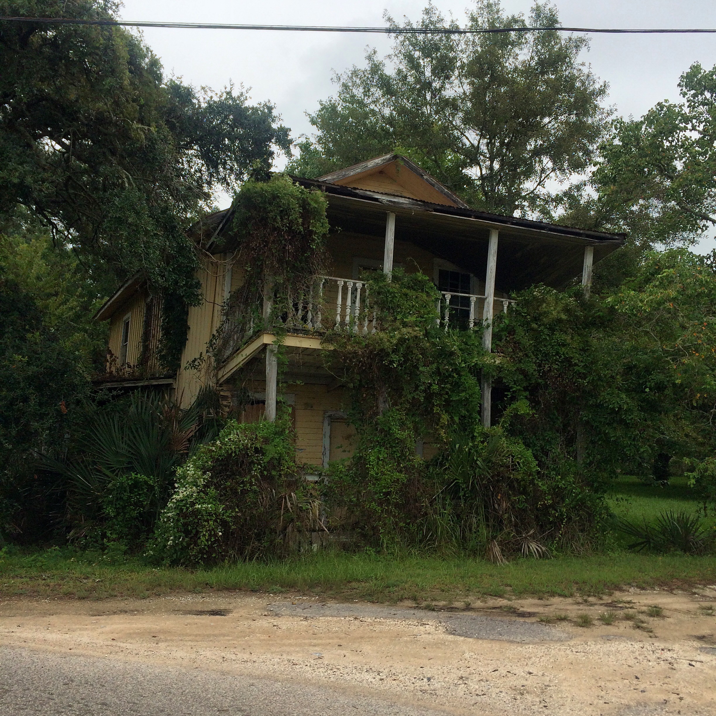
The Yellow House

This next picture was a house around the Coden Belt road that, back in the 80s and early 90s, was (per my mother) a boarding house where all the known homosexuals in town lived. The landlord was another one of the Schambeau family. I assume the house reached this state of disrepair from Hurricane Katrina. According to my mother, this photo is of the wrong house, the correct one is the other (also yellow) house next door.

IMG_7851.JPG

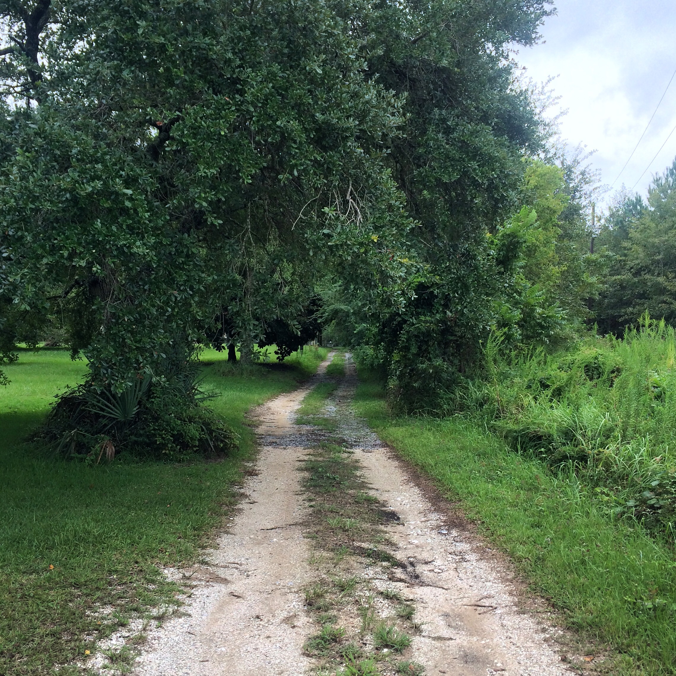
This is what the dirt lane beside that house looks like:
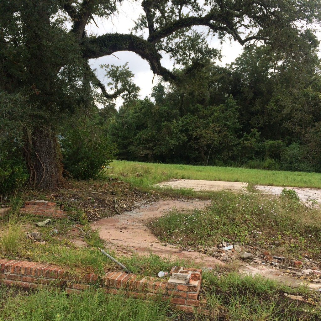
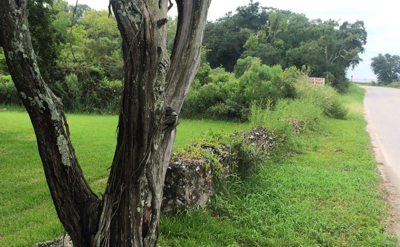
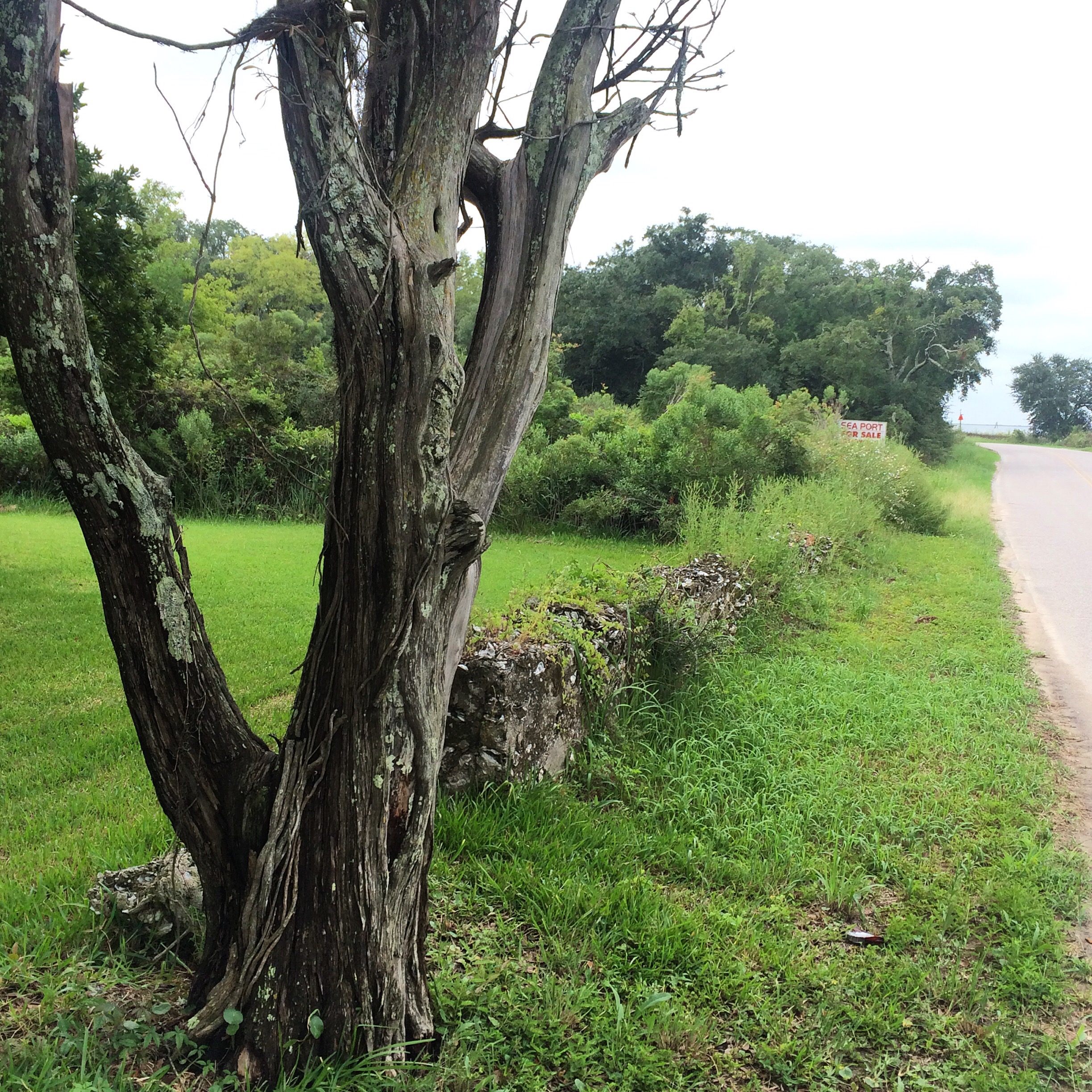
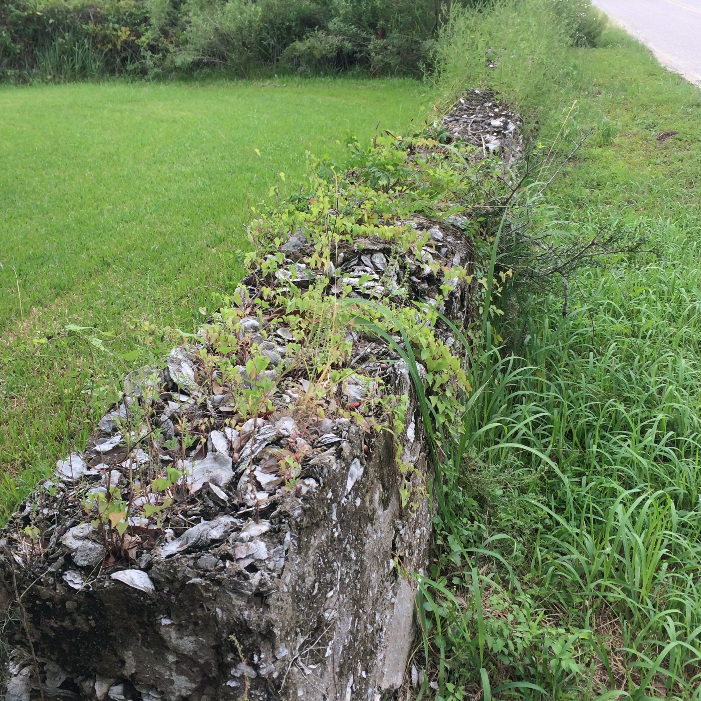
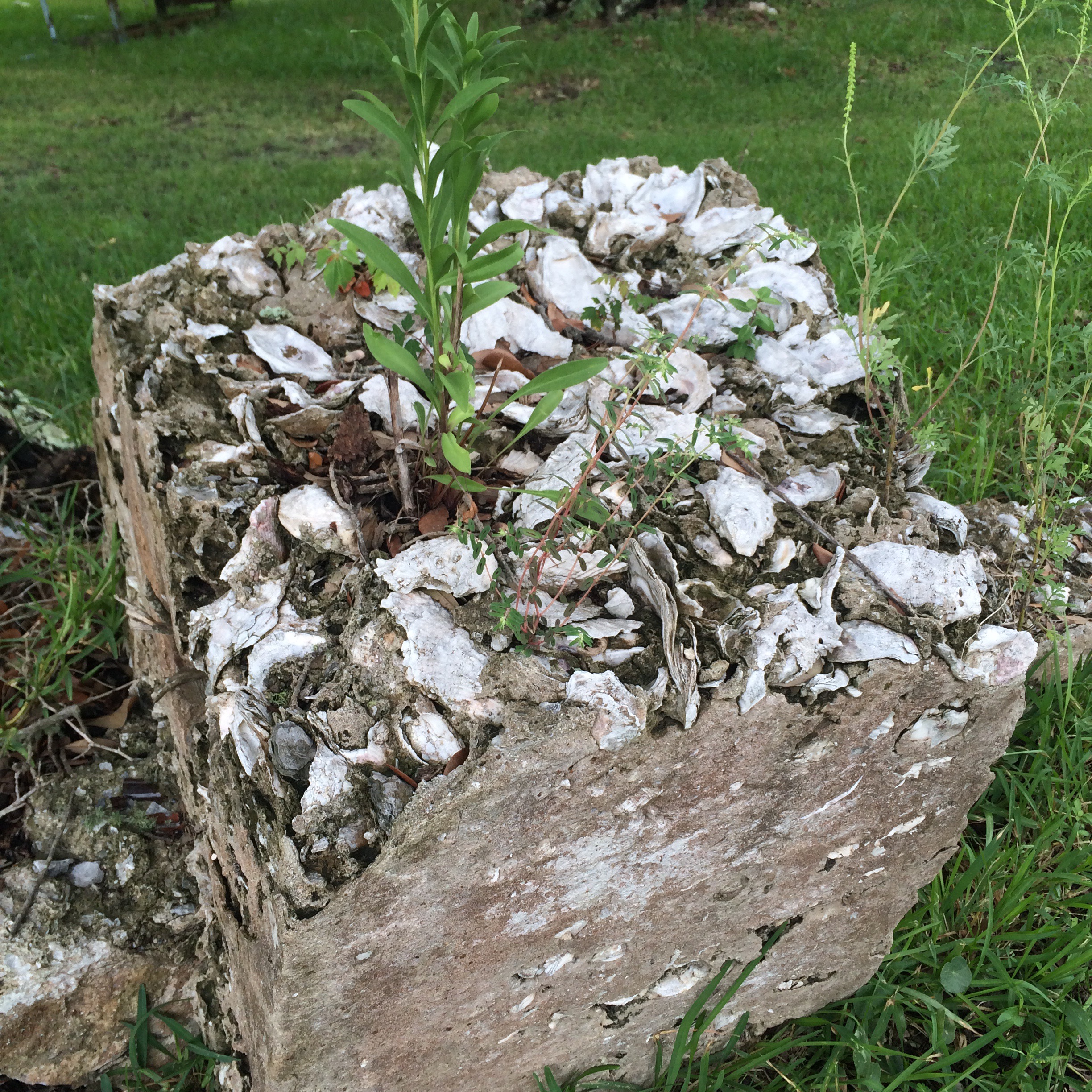
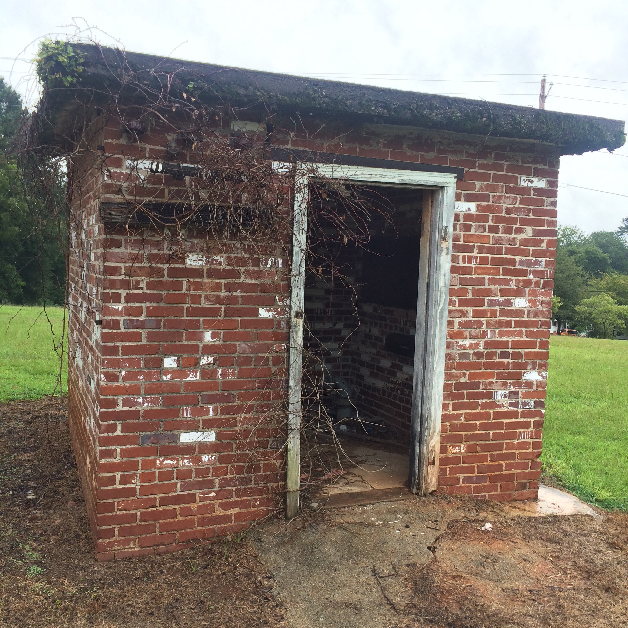
IMG_7852.JPG

The Shell Fence

Just down the road a piece is the place with the oyster shell fence. This was, I am told, once a common local building material – there was once a “shell house” in town made entirely of it.
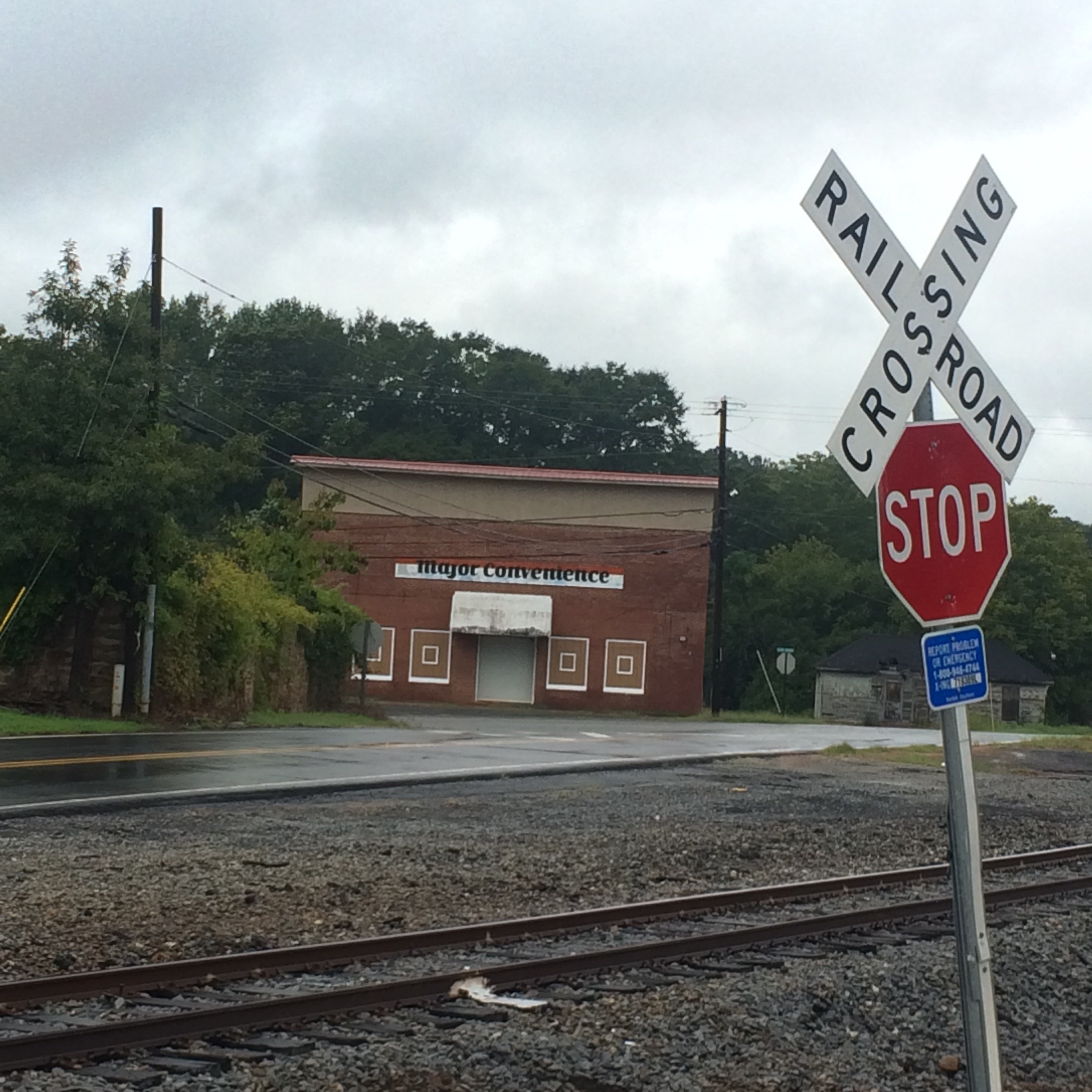
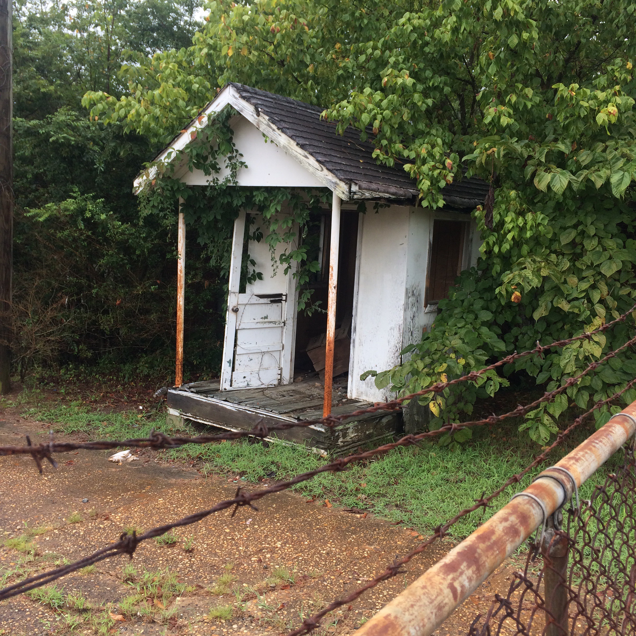
IMG_7850.JPG

IMG_7805.JPG

IMG_7809.JPG

Coden Drive-In

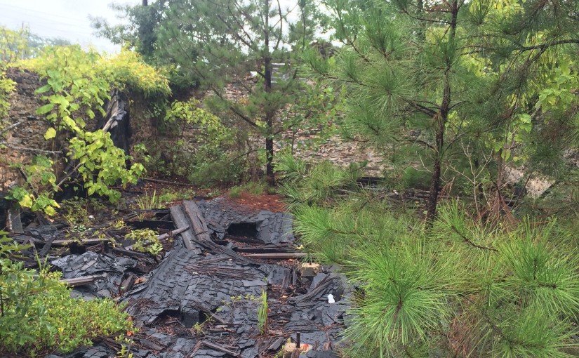
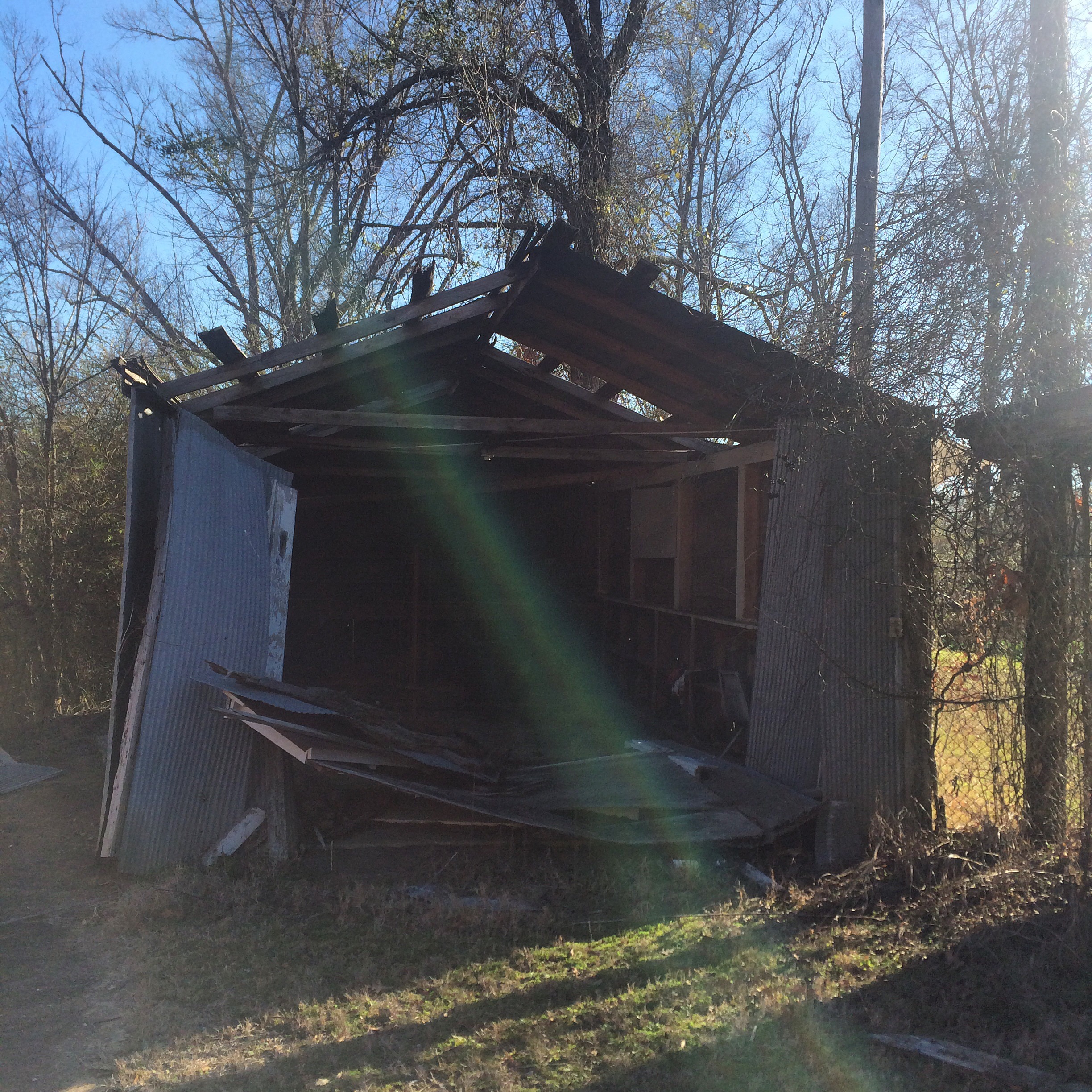
The “Coden Drive-In”. You need to understand that “Coden” is pronounced something like “Code-Inn”, so the name of this place rhymed. The building got like this from Katrina but I don’t remember if it was in business right up until then or not.
IMG_7848.JPG

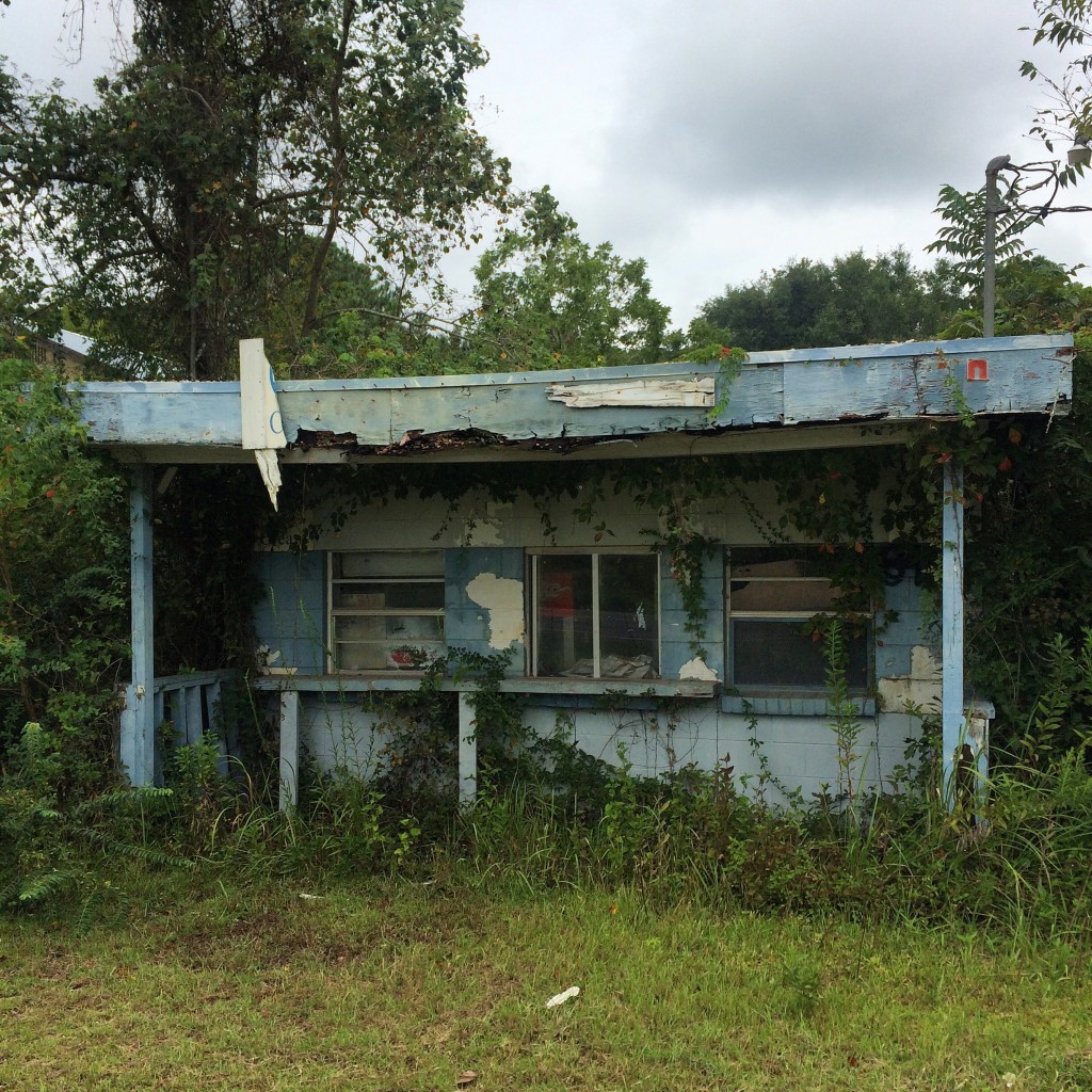
There wasn’t much to do in Bayou La Batre and Coden back in the late 70s and early 80s, so my family’s idea of a fun evening when I was about 5 years old was to come to this place and get ice cream cones, and then go driving around watching the sun set on the bay while we ate them.

The Catalina

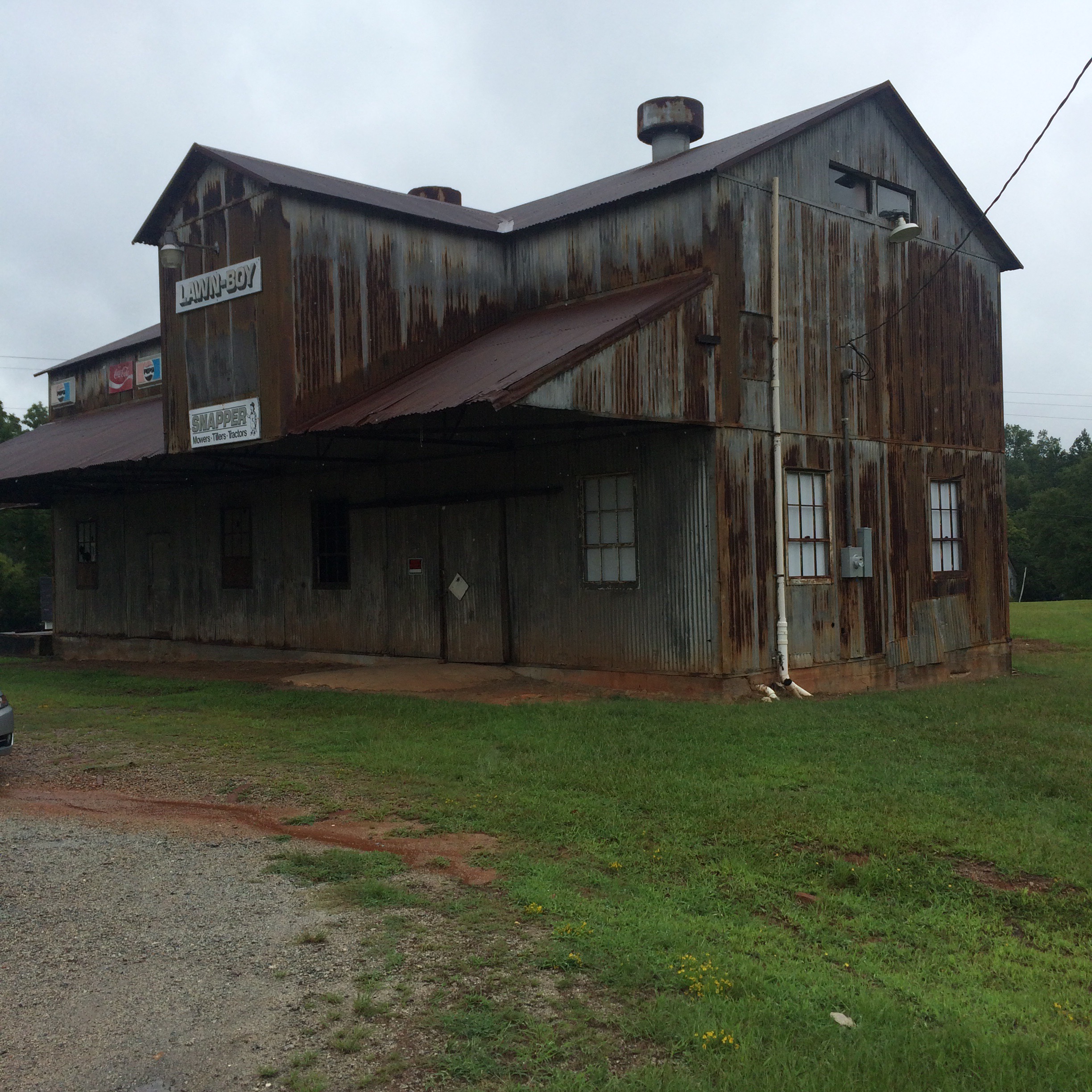
The ruins of the old location of the Catalina seafood restaurant, which everybody called “Ory’s”. The restaurant was closed for years after the hurricane but now is open in the old Schambeau’s building:
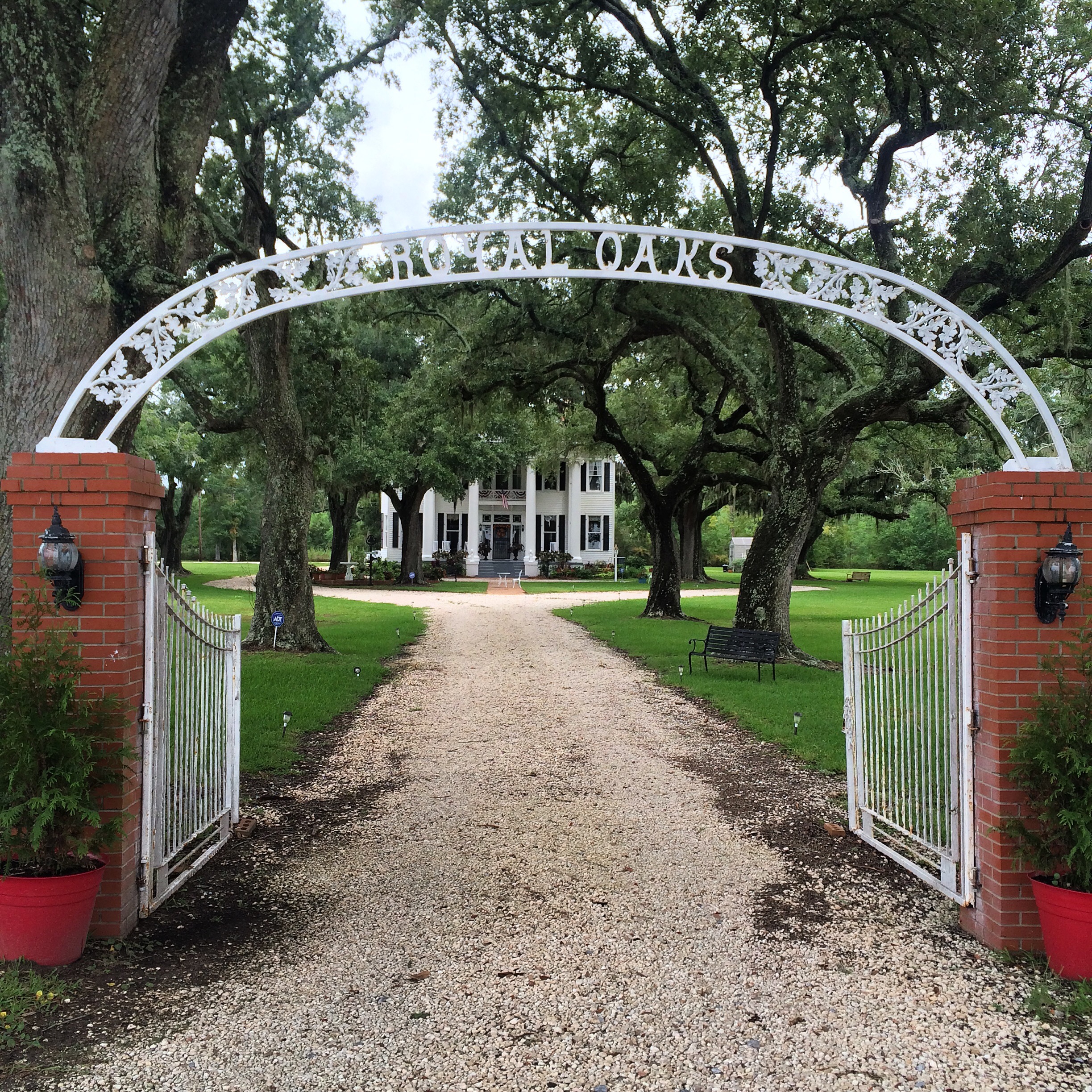
IMG_7817.JPG

Royal Oaks

“Royal Oaks” is one of the few remaining homes from Coden’s days as a seaside resort in the l890s. This period of prosperity was ended by disastrous hurricanes in 1906 and 1916. They had no names then, just “the 1906 storm”.

IMG_7849.JPG

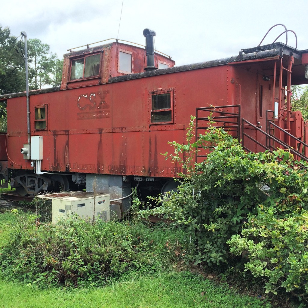
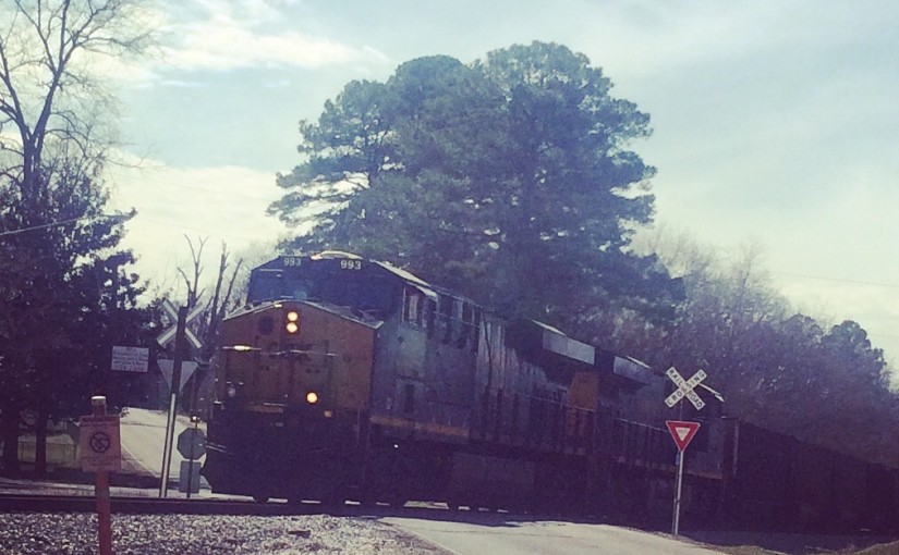
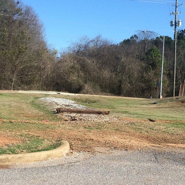
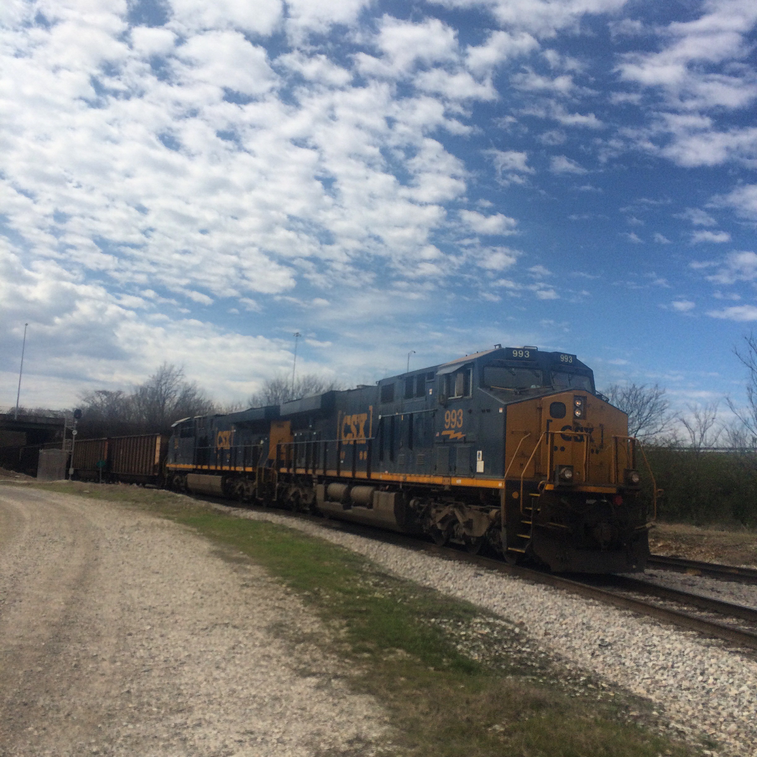
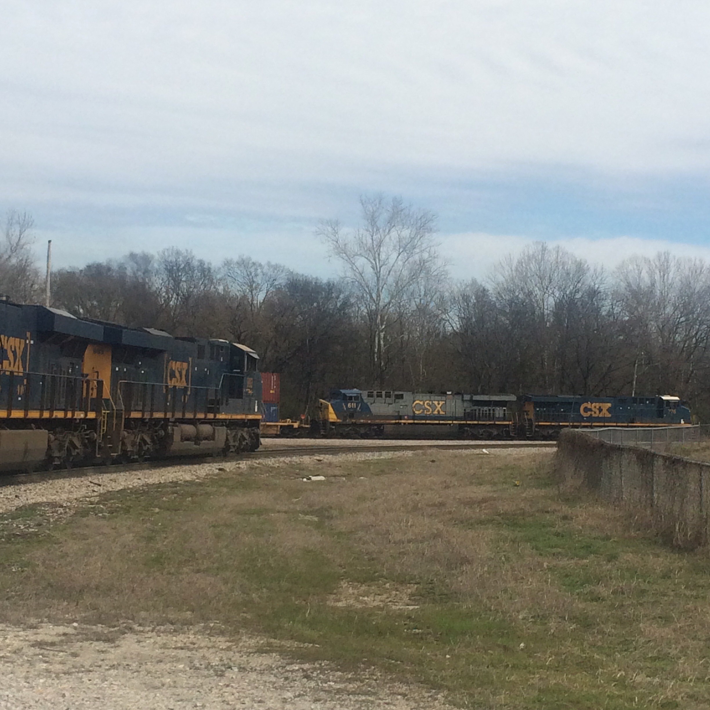
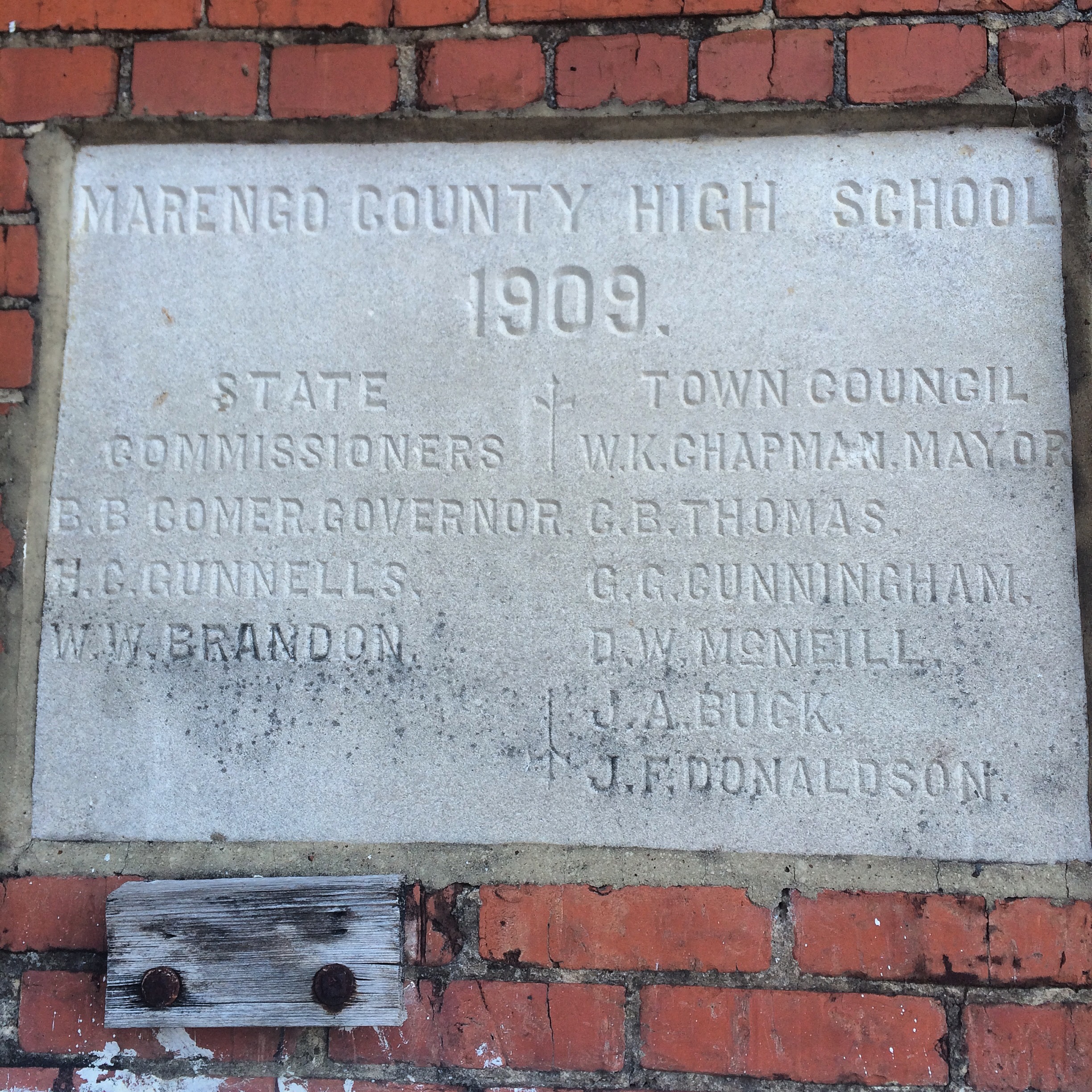
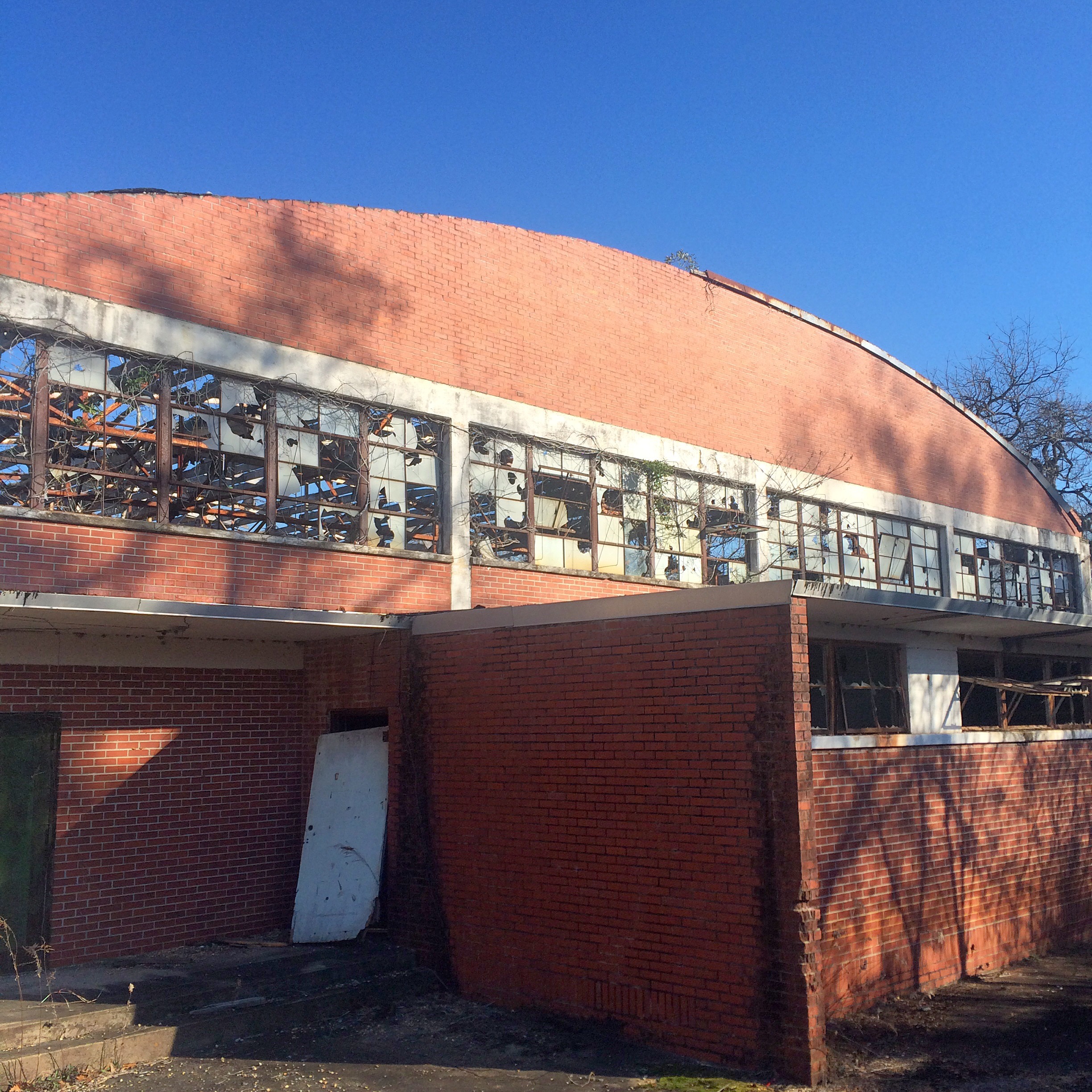
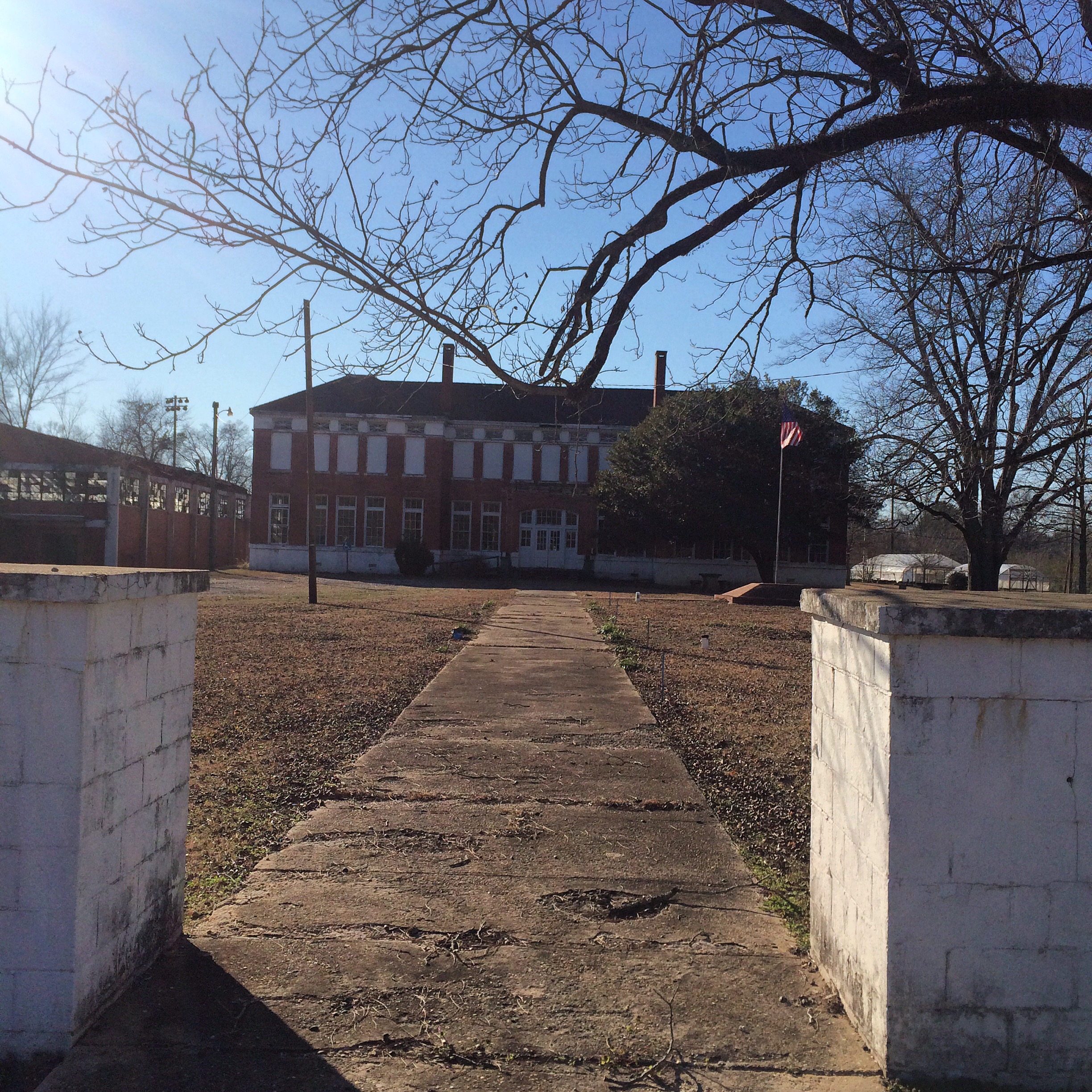
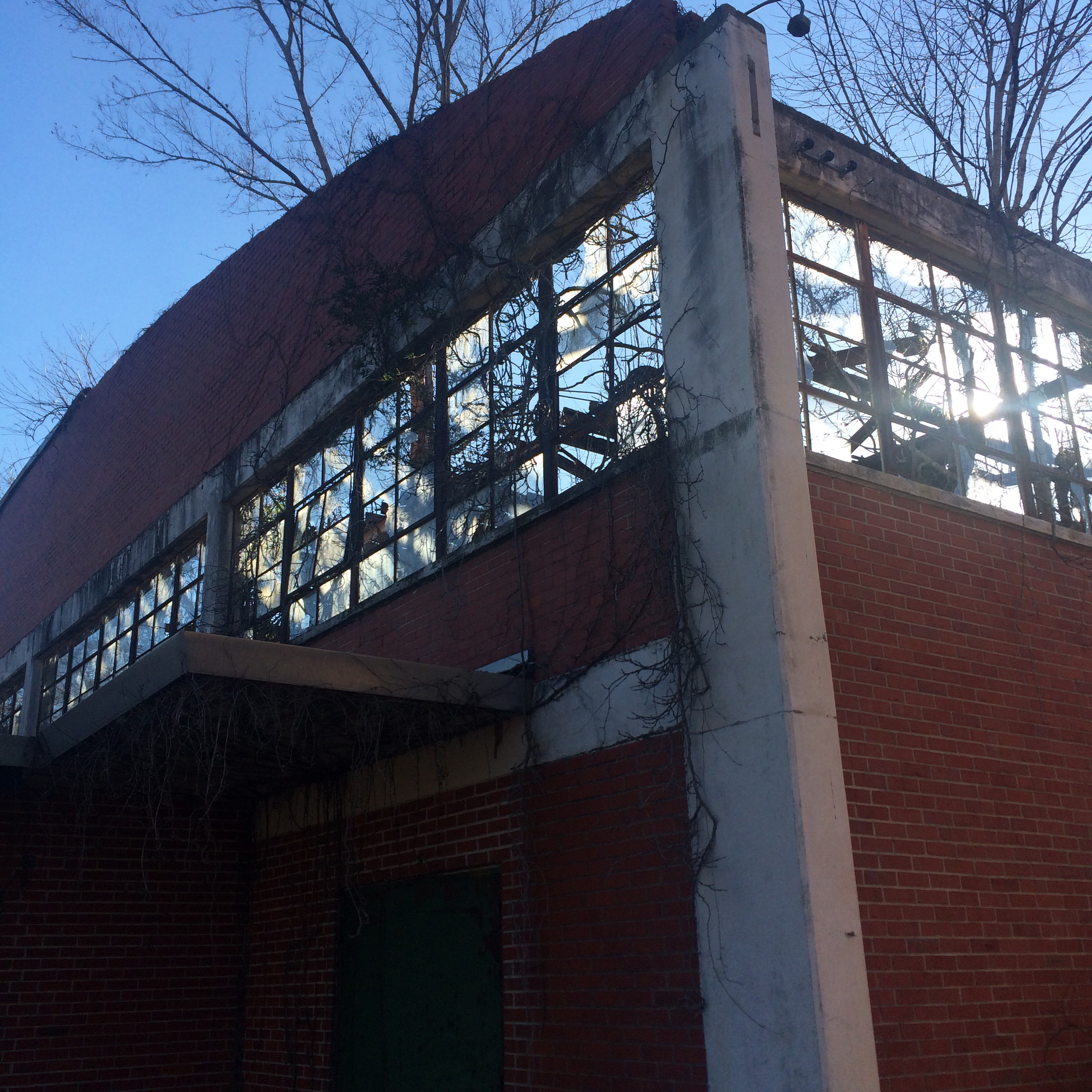
Peter F. Alba School

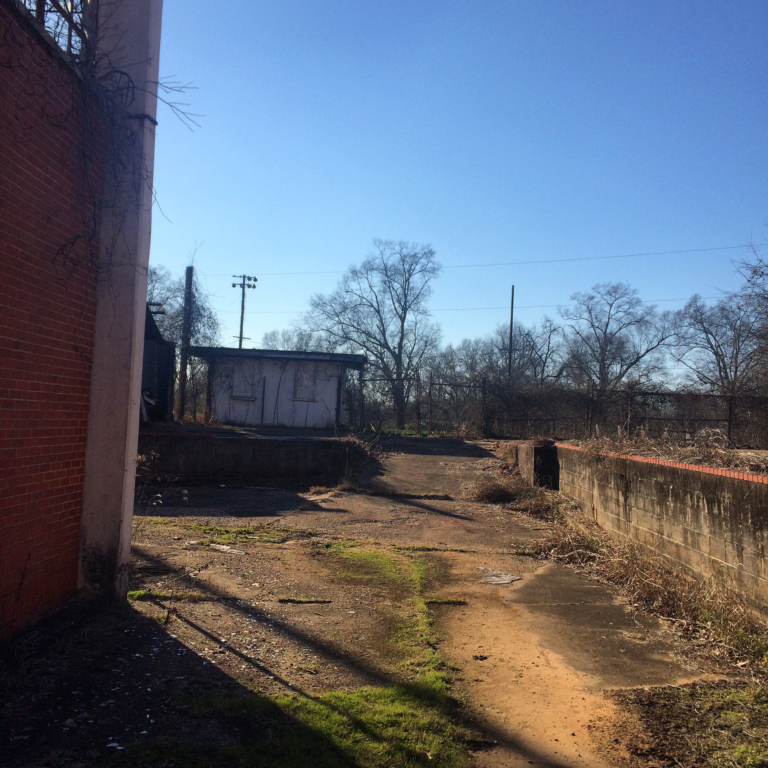
And now, Alba. The school where I spent the blerst of my childhood. Now only a middle school, in my days Alba served  kindergarten through 12th grade.

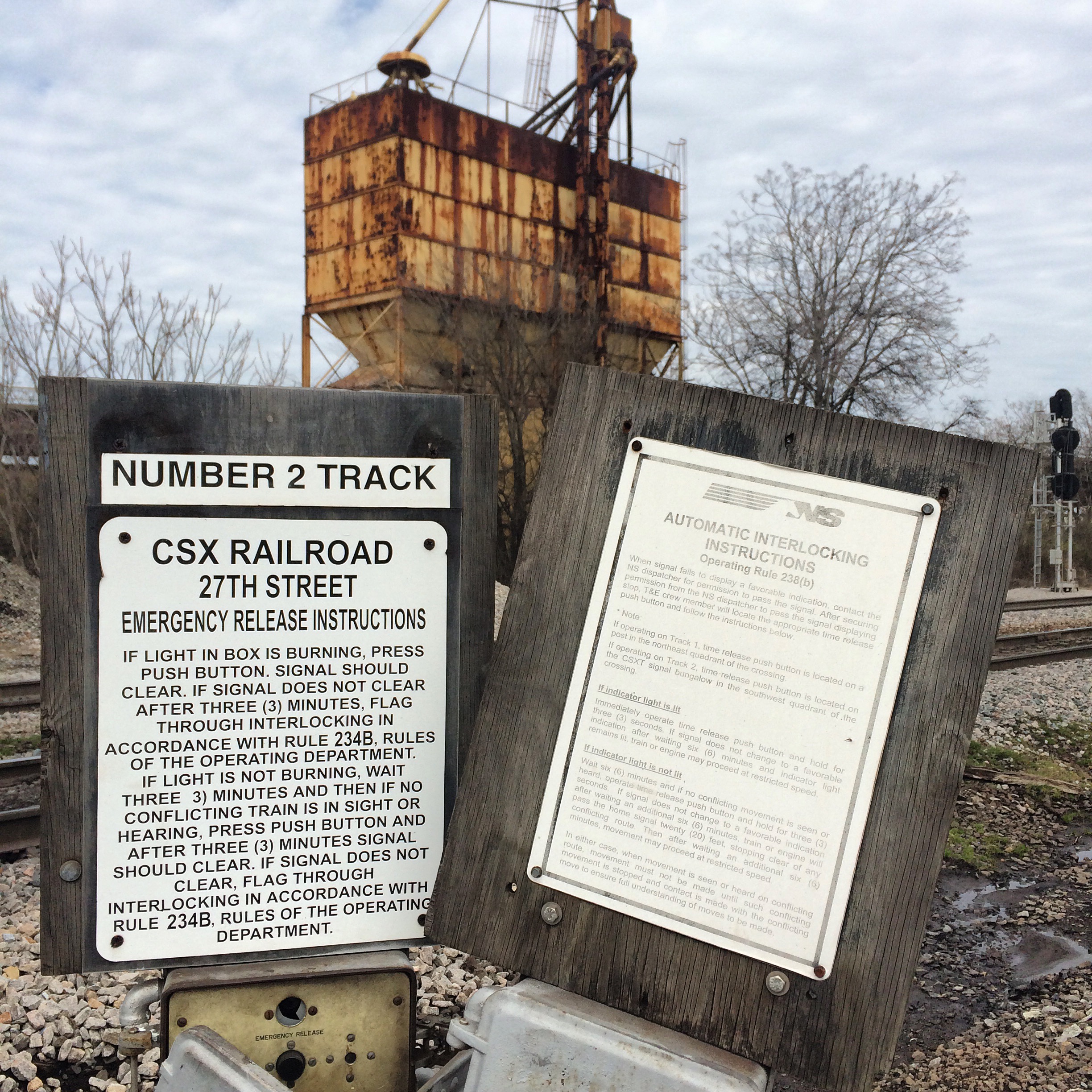
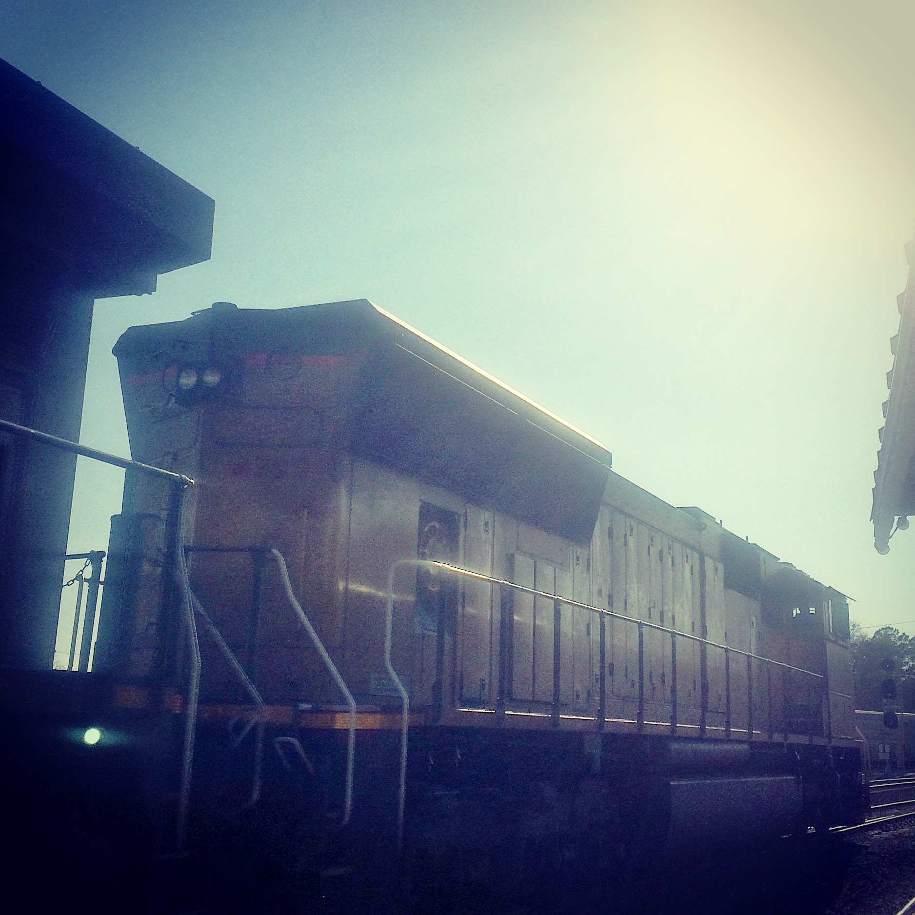
This caboose was installed when I was in high school. No predecessor of CSX ever ran to Bayou La Batre. (The only railroad in town, long since gone, was the Mobile and Bay Shore, a Mobile and Ohio subsidiary. If it had not been abandoned or sold, it would be part of Canadian National now.)

IMG_7847.JPG

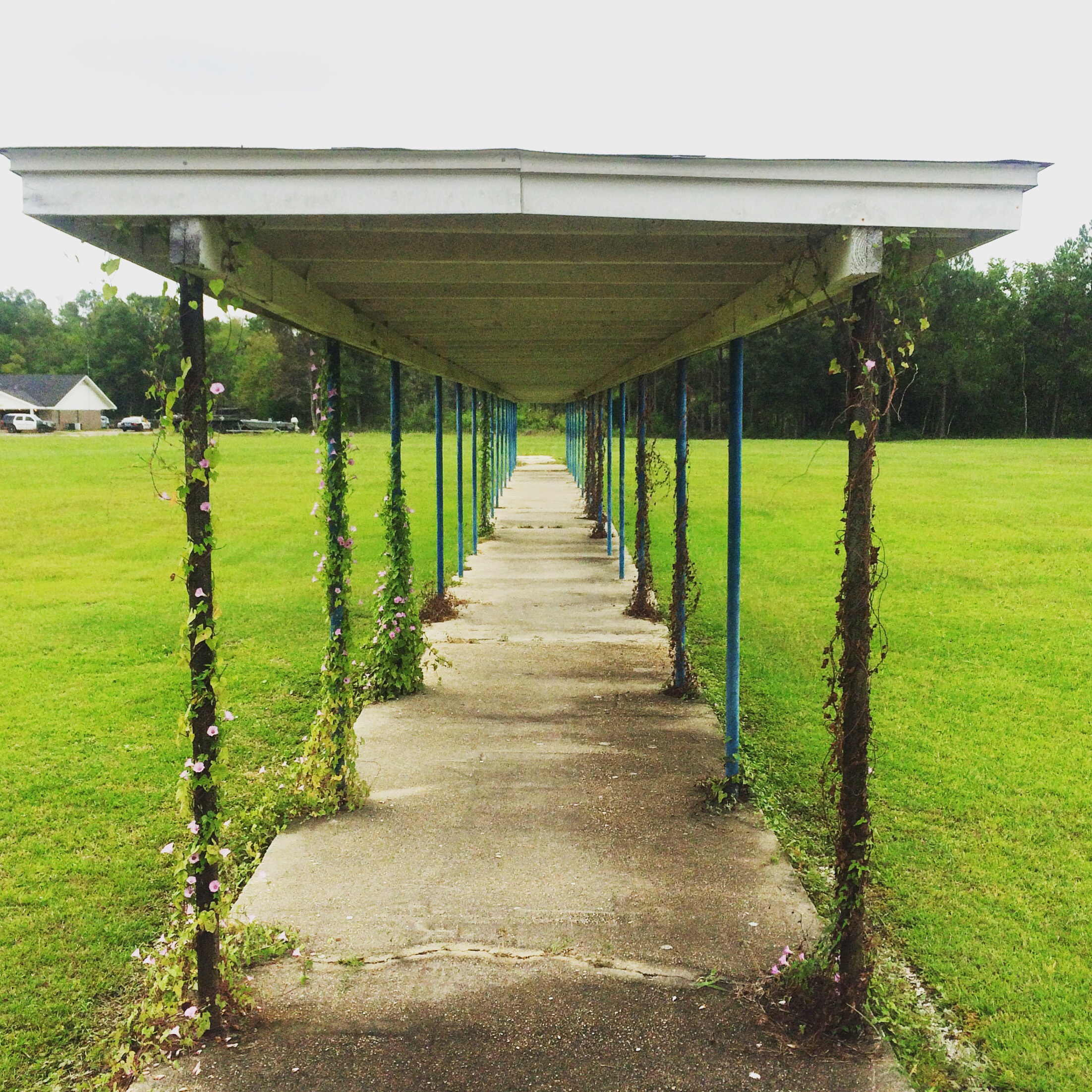
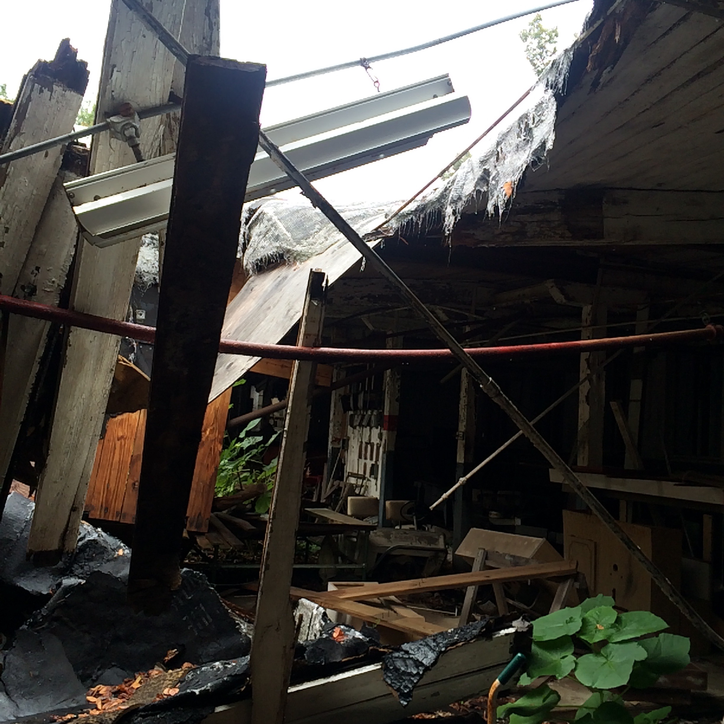
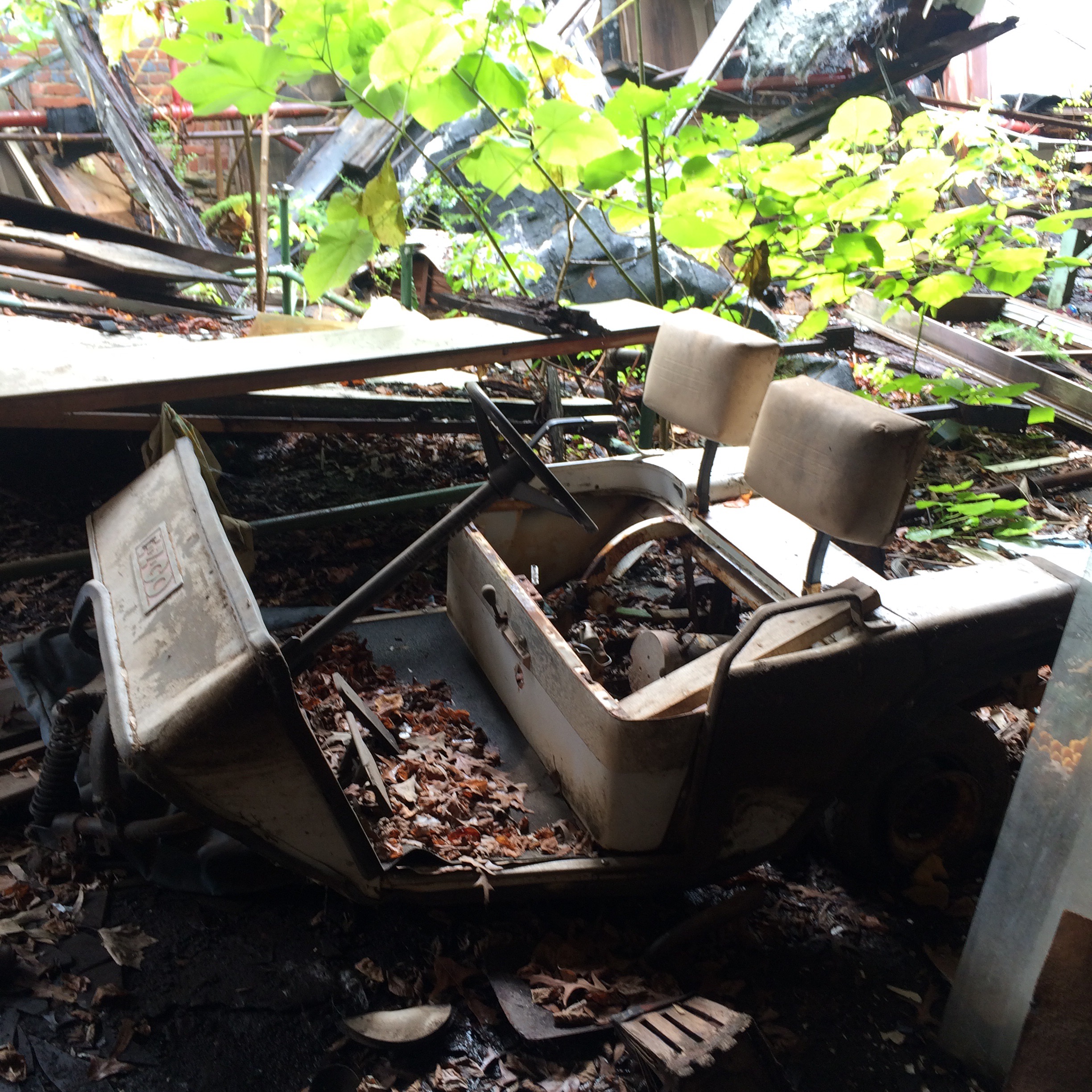
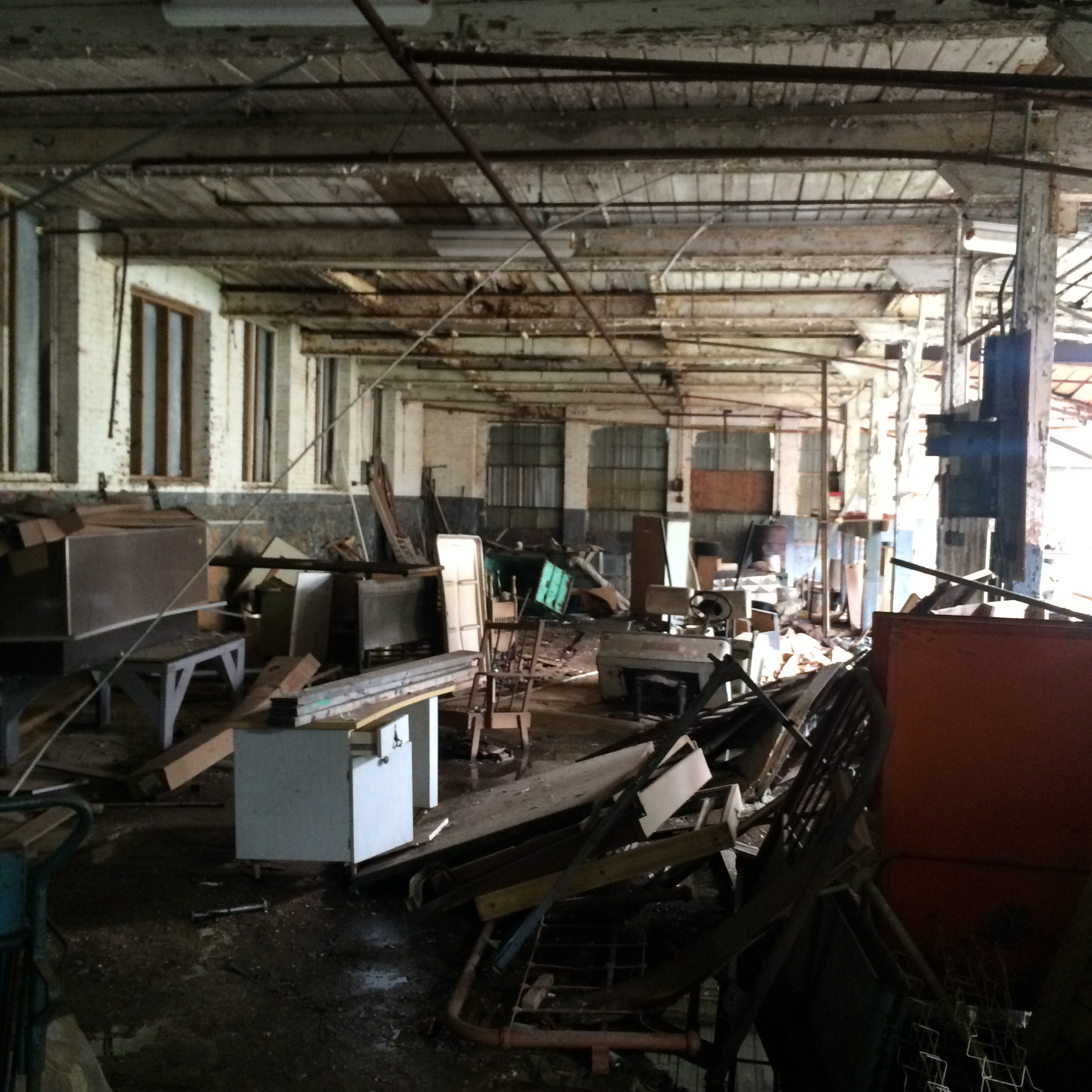
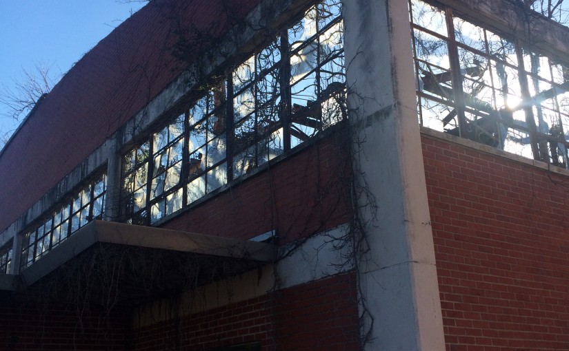
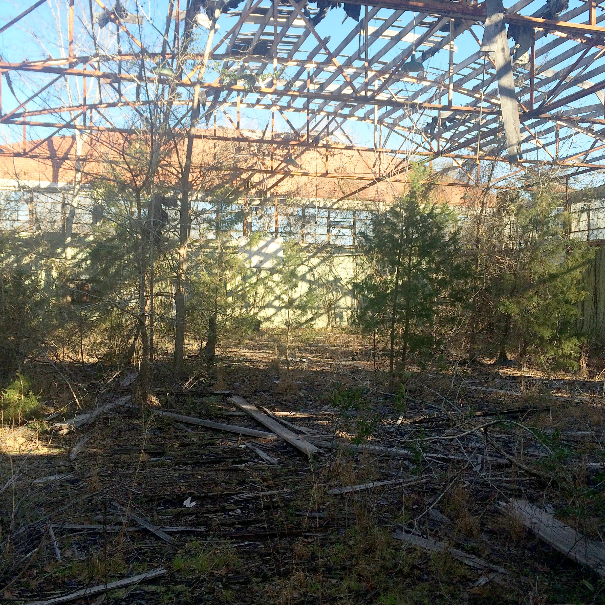
All of Alba’s “portables” – that was what they called a classroom trailer back then, a “portable” classroom – are gone. I don’t know if the hurricane got them, or if the school wasn’t crowded enough to need them anymore after the new schools opened and took most of the students. Now this was once a covered walkway that kept students out of the rain on our way to class, now it is just sitting in the middle of nowhere.

IMG_7840.JPG

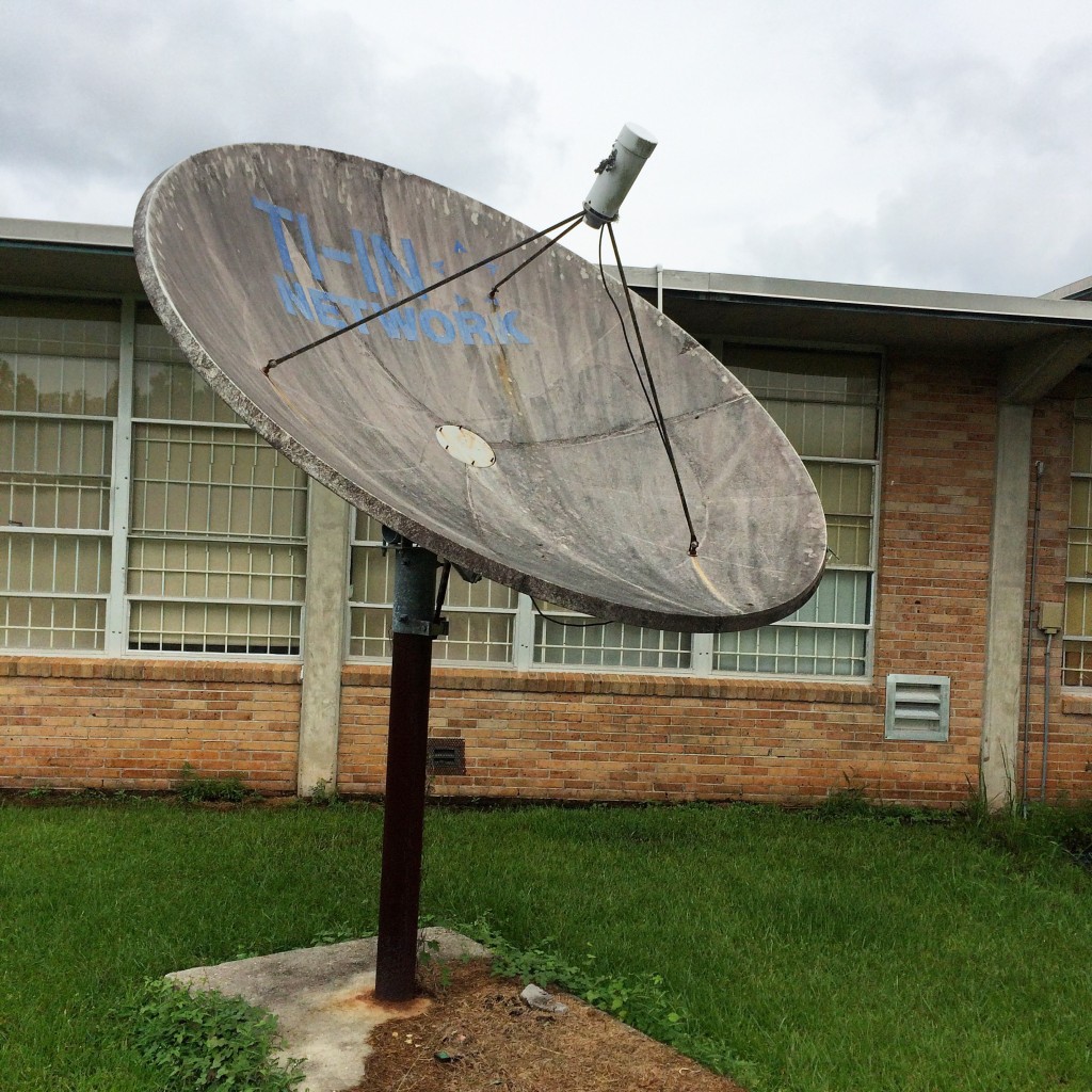
This was the satellite dish that we used to receive “Channel One” broadcoasts in the 90s:

IMG_7846.JPG

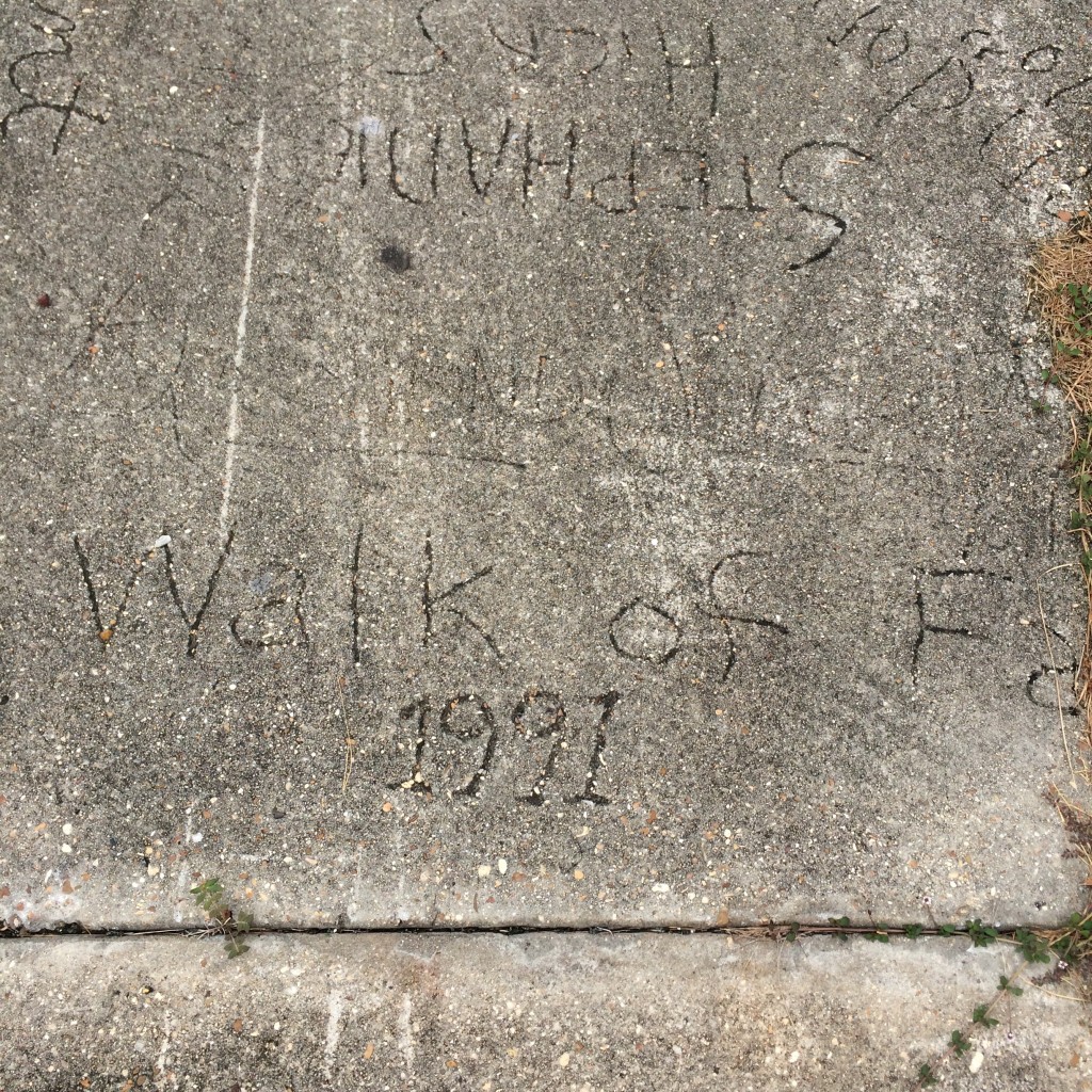
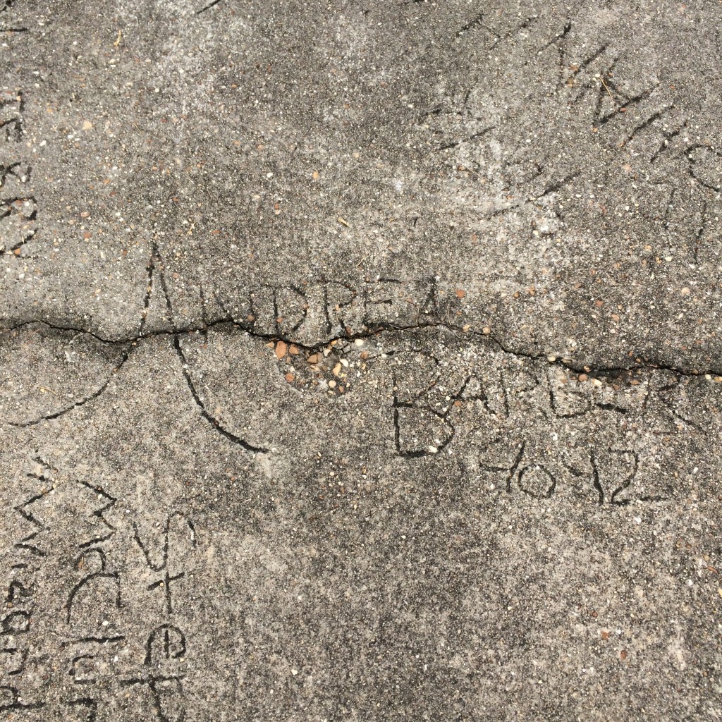
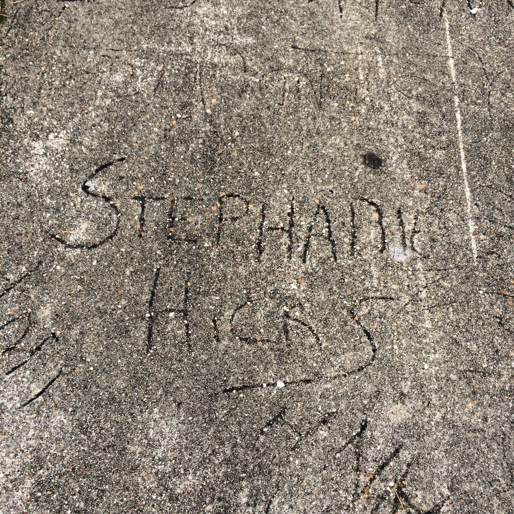
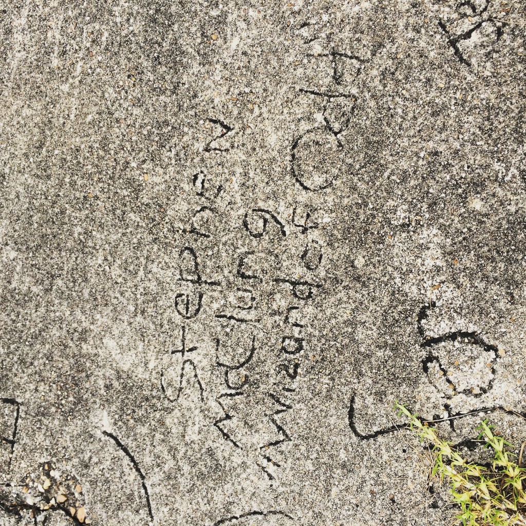
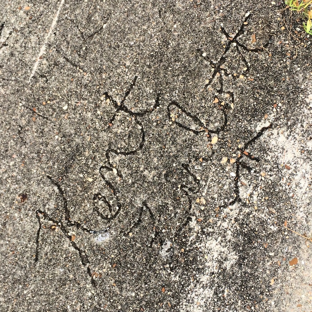
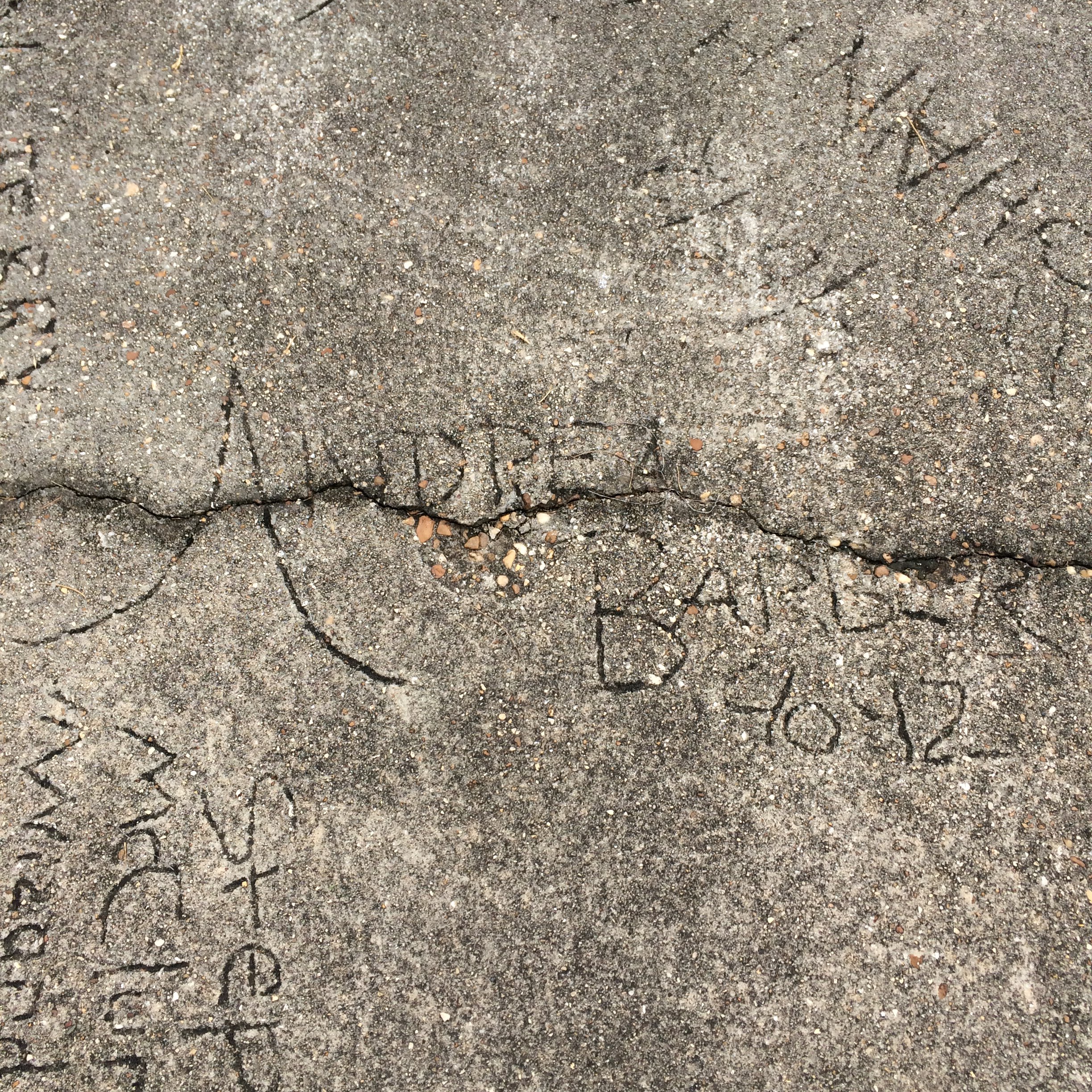
And now, the Walk of Fame of 1991. That year, the school put in a new sidewalk and allowed students to sign it. I looked and looked for my own name, but could not find it. I know almost all of the names as people I went to school with though.

IMG_7827.JPG

IMG_7830.JPG

IMG_7842.JPG

IMG_7844.JPG

IMG_7845.JPG

IMG_7843.JPG

Sargent, Georgia

“Never go in there again!” – a longtime Newnan resident after being shown these pictures and recognizing the location.

 This old place looks to be some kind of workshop. I did not mess around it other than peek in the window.  

I’m guessing this was a pump house.  Looks about the size of the pump house at my Nana’s old place anyway.  

All this stuff is right by the NS railroad but I didn’t see any trains.


This structure whatever it was, has no roof is just stone walls now.


And then there’s this place. An old guard house I guess.
  

And this is what it was “guarding”. A partially collapsed warehouse full of random shit. 


I shined the light from my phone into this door but it still was too dark to see anything beyond it.


Do all Class 1 US railroads connect?

I know they all connect into a single system, I mean is there one city or area that is directly served by all seven of them.

Looking at their route maps on all their wikipedia pages (and also using this), I actually don’t think there is. The closest you get is Chicago which has every railroad except KCS (the closest it gets is Springfield), and New Orleans which has everything except Canadian Pacific (which doesn’t come any further south than Kansas City).

So the answer to the question is no, they don’t.

But a drive around the Midwest would probably allow you to see all seven in one day. Hmm…


Again with Alabama train pictures

A last-minute one-night trip to Tuscaloosa afforded me the opportunity to do some rail fanning on the way back, mostly CSX in the Birmingham area.

I did not go looking for trains in Tuscaloosa itself. This is the only photo taken in Tuscaloosa, and it shows the remaining ballast and ties of the L&N line from Birmingham to Tuscaloosa. This was taken near the city water works along Jack Warner.

(null)

Rest assured there is still plenty of active rail in Tuscaloosa but we won’t be visiting it today.

Now in between here and Birmingham a couple of things happen. This line crosses the Alabama Southern shortline, which operates the former ICG eastward from Mississipi into Alabama. Eastward from that crossover, the dead L&N line goes active and used by Alabama Southern to send trains to CSX in Birmingham.

At Brookwood, the track comes under CSX ownership, the direct successor to the L&N. This is the “Birmingham Mineral subdivision” and it serves the still-active mines in that area.

This is a coal train that I caught next the the Lowe’s store off of I-20/59 in Bessemer, where the line from Brookwood joins with tracks that make a loop around the western side of Birmingham.

(null)

Here you can see another train waiting for this one to pass:

(null)

I was able to stay ahead of the train for a while and caught it again a couple of times.

(null)

Now back to downtown Birmingham. I got Amtrak 19 as it came into the station, and an intermodal train that passed immediately after.

(null)

(null)

These are views taken from the 1st avenue north viaduct that overlooks the 27th street interlock. I stood out on that bridge long enough for three trains to go under it before leaving Birmingham.

(null)

(null)

(null)

Downtown Birmingham Railfanning

Downtown Birmingham is not only better-preserved than downtown Atlanta, it is also much easier to watch trains. It’s almost like they let a railfan design the place.

bham

Viaducts

Birmingham has its own equivalent of Atlanta’s “gulch”, sort of. NS and CSX run right beside each other through the very center of town. Both railroads are double-track, and there are additional sidings and such, so a fairly wide path through downtown is devoted to rail.

Birmingham’s downtown street grid is (as in Atlanta) grade-separated from the railroads, except that in Birmingham many of the surface streets go under the tracks rather than uniformly over. The freeways and a few surface roads go over the tracks on viaducts that provide a good view of the trains below.

Birmingham has not built any structures completely over the top of the tracks, as Atlanta has. Therefore the view from the viaducts relatively unobstructed.

The bridges on 22nd street and Richard Arrington Blvd (which occupies the place of “21st” street in the grid) have curbside parking spaces on the bridge, so you can pull your car over right in the middle and stand next to it waiting for trains to come by.

You shouldn’t have to wait long, because these viaducts span main lines of both NS and CSX. (Birmingham’s other Class 1, BNSF, is a topic for another day)

The 24th street viaduct provides no such parking, and the sidewalk is only on one side of the road, so it is not as good as the others.

This is a view looking southwest from the Arrington Avenue viaduct. To the right of the tracks in the distance you can see the platforms of the Amtrak station. These two photos show two trains that went by in rapid succession, you can see the end of the first train still in the second picture.

IMG_5072.JPG

IMG_5089

This is looking northeast from the same place (and same train). Mountains loom ominously on the horizon.

IMG_5091

Some blatantly “instagrammed” pictures of the same trains. You can see the Sloss Furnaces pretty clearly in the background of these.

IMG_5092

IMG_5075

Sloss Furnaces

Speaking of which, before getting back to the rail pictures, let’s throw in a few of the Sloss site itself. If you don’t look at these and say “I want to go to there“, then I don’t really understand how you like trains either.

IMG_5103

IMG_5099

IMG_5096

IMG_5097

27th Street Interlocking

As shown on the map above, this is a major intersection of NS and CSX lines. In spite of its name, it not directly viewable from 27th Street. I got a good view of it from the extreme western end of the Sloss property.

The shortline Alabama and Tennessee River also comes into play here, but I saw no sign of their trains.

“Emergency release instructions” for both roads :

IMG_5169

An NS train is about to cross the double CSX tracks, with the downtown skyline in the background.

IMG_5119

A train approaches on the CSX with a BNSF unit in the lead:

IMG_5141

The Crescent train 19:

IMG_5166

Anoether NS train waits under the 1st Avenue North viaduct before proceeding. The viaduct itself might have provided a good overhead view of all this stuff, had I managed to find a place to park near its approach.

IMG_5168

Railroad Park

At the other end (southwest) of the downtown corridor shared by NS and CSX, lies Railroad Park. It is a nice park, but I think if you are really out just to see trains rather, then you will get a better view from the viaducts.

IMG_5181

IMG_5182

 Easy Livin’ in Irondale

These last were not taken in downtown Birmingham at all, but out in the suburb of Irondale where the NS tracks enter Norris Yard. Here these is a covered wooden platform beside the tracks with benches and picnic tables, so you can just sit in the shade and relax as the trains roll by.

I did drive around Norris as much as possible without entering obvious NS property, but I didn’t really feel like stopping anywhere to take pictures, so these are all taken from the platform. The sun was pretty low by this point, as can be seen in these pictures.

IMG_5200 IMG_5204  IMG_5209 IMG_5210


Marengo County High School, 1909

As some of you may have heard me remark, I have driven from Atlanta to Mobile so many times that I will go to great lengths to avoid the normal I-85/I-65 route and get some variety.

This time I went to Tuscaloosa on Friday, spent the night and Saturday morning there, and headed south in the afternoon.

Ignoring the route suggested by Google maps, I decided to follow the way that was burned into my memory from 20 years ago. The route that at that time most Mobile-area UA students followed:

AL 69 to Greensboro, then AL 25 down to AL 5, which very shortly leads to US 43, which takes you all the way to I-65 north of Mobile.

The 25 stretch is the most rural. It is almost nothing but farmland alternating with the manmade lakes where catfish are raised.

The towns along the way are tiny, one traffic light (if that) affairs. The kind of places that have feed and seed stores. The kind of places where the main road in the middle of town has a passive railroad crossing with no lights or swinging gate arms.

In Thomaston a sign proclaiming “Eat Pepper Jelly!” caught my eye. Smaller signs indicated the “Alabama Rural Heritage Center” was nearby.

I know now the center was closed (it’s Saturday hours are only 10-1), but it would not have mattered anyway because I was too clueless to realize which building it was in.

Instead I thought the signs were directing me to a large old building that once I got up to it, turned out to be an abandoned high school. The doors were padlocked, the window glass was broken, and the wooden wheelchair ramp was rotting. Clearly this place has been unused for some time, although the mere presence of such a ramp showed it had probably still been in use in the 1990s.

I was at this point still confused thinking this was the heritage center, which I imagined as some kind of museum. Signs had promised a gift shop at least, and pepper jelly. Yet here it was, abandoned and decaying.

The gym was in even worse shape than the main building. Trees were growing out of its roof.

The ground around these buildings was not overgrown, indicating it is still cared for. A flag was loudly flapping atop the school’s flagpole, which presumably someone had to raise and lower.

I decided to walk around between the school and its gym. Behind the gym the tattered tin roof of an old shed was groaning in the breeze, metal scraping against metal with each gust of wind.

The back door to the gym was off its hinges, so I went inside to take pictures. The main roof was gone except for its skeletal ribs, the sun shining in fueling plant growth in what had presumably once been the basketball court and the scene of many a prom and homecoming dance. Nice touch for Valentine’s Day.

The actual heritage center turned out to be in a renovated outbuilding on the side of the school opposite the gym, actually closer to the Pepper Jelly sign. But like I said it was closed. No pepper jelly today.

(null)

(null)

(null)

(null)

(null)

(null)

(null)

(null)

(null)

Coming Soon: the most unique guided tours in Atlanta

I am about to start dabbling in the tour guide business. For a small fee (tbd), I will take a carload of site-seekers on a driving and walking tour of the greatest city of the modern south. Tours will be conducted only with pre-arrangement, and will need to fit around my work and life schedule.

Ads are going to be placed on Craiglist and other places. I don’t expect to make much money. I might get rolled. But it should be interesting.

The tours will cover overlapping areas. For example, more than one will include downtown, but each tour will have a unique emphasis.

Eastern Continental Divide Driving Tour

The ECD, little known and little remarked upon, is actually one of the important natural features of the area. This tour will follow the divide and include my ramblings about history and the areas through which it passes.

Railroad Tour

This tour emphasizes railroad history and trivia. Portions will take place on MARTA trains, for which the fare is not included in the tour price.

Gentrification Tour

Combined walking and driving tour, will visit many of the Intown neighborhoods that have bounced back from urban decay to affluence, or at least hipness.

Buford Highway

Driving tour with multiple stops at local businesses.

Crazy Weekend Roadtrip Plans

Horseshoe Curve

altoona

Friday:

  1. Leave work in time to beat rush hour, drive up I-85 to Charlotte
  2. Turn north up I-77, to I-81
  3. Head up 81 until I get sleepy
  4. Flop somewhere for the night

Saturday:

  1. Drive to Horseshoe Curve near Altoona PA
  2. Watch trains for as long as I feel like
  3. Drive to Gettysburg
  4. Visit Civil War stuff
  5. Stay the night

Sunday:

  1. Get up early and drive all the way home, Googles say about 10 hours.


Folkston Funnel Florida Fun

folkston

No schedule for this one yet, but it involves:

  1. Watching trains in Folkston, GA
  2. Watching space launch at Cape Canaveral


Bourbon Country

This will probably require more than a weekend.

cincy