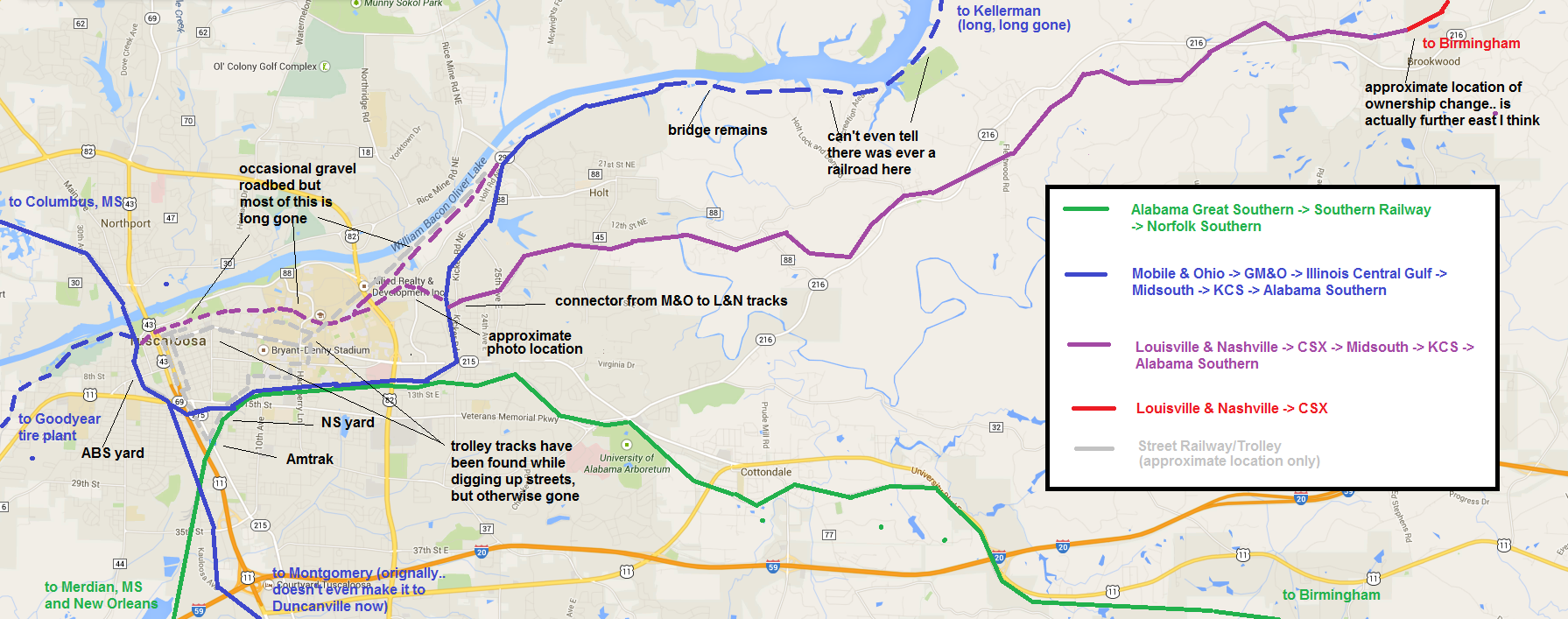
The explanation I tried to give about the abandoned tracks in Tuscaloosa in my last post probably makes more sense if you look at this map. Click the map to enlarge it.
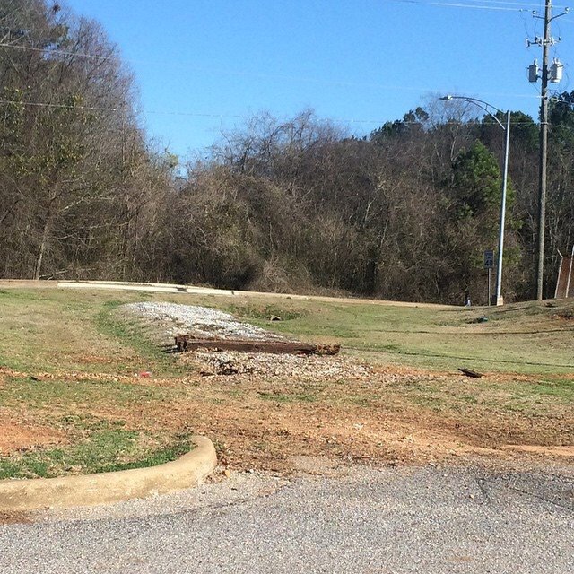
For reference, this is the photo of the “approximate photo location”:
The main reference for the location of the street railway is here.
Do you have the 1960s city map with the raill\ lines ID’d. It was a fold out map produced by the city with clear rail line and yards ID’d. It was plain white map with black text and graphics. also do you have maps showing the service lines to the Paper Mill and Hunt oil.
I need to see those lines and wjat do you have or know of the rail tracks that ran into the Allen & Jemison build exiting out towards Greensboro Ave
I have been looking for a map that shows the L7N line as it enters Tuscaloosa and runs on the backside of the Universuity thru Guilds Woods then it tressels across 25th Ave into the Timmerson scraps metal yard onto the L&N passenger station. But where did it go after that?