Eastern Continental Divide: North of Gainesville

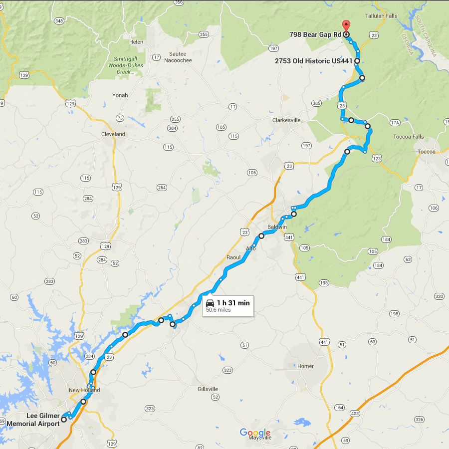
Picking up where the last one left off, this gets you out of the burbs and into the woods. At the northern end, it gets you into the mountains, even.

The route through Gainesville is rather arbitrary and I’m not sure how close it follows the divide.

You are pretty much running parallel to US 23 (when you are not actually on US 23) all the way.

The early parts of this route are very close to Lake Lanier.

From Lula through Mt. Airy, you are running directly beside the Norfolk Southern main line.

I have only been as far north on this route as Alto, so I can’t really say what the remainder of it looks like.

The end point here looks to be about as far as you can follow the ECD on public roads. From here, the ECD turns westward and generally forms the Habersham/Rabun county border until meeting the Tennessee Valley Divide at Young Lick.  I don’t see any roads that directly follow this ridge, not even dirt Forest Service roads. From Young Lick, the ECD continues north on the Appalachian Trail. At that point, following the divide becomes more of a matter of hiking than driving.

ecd3-fixed

Google Maps Link

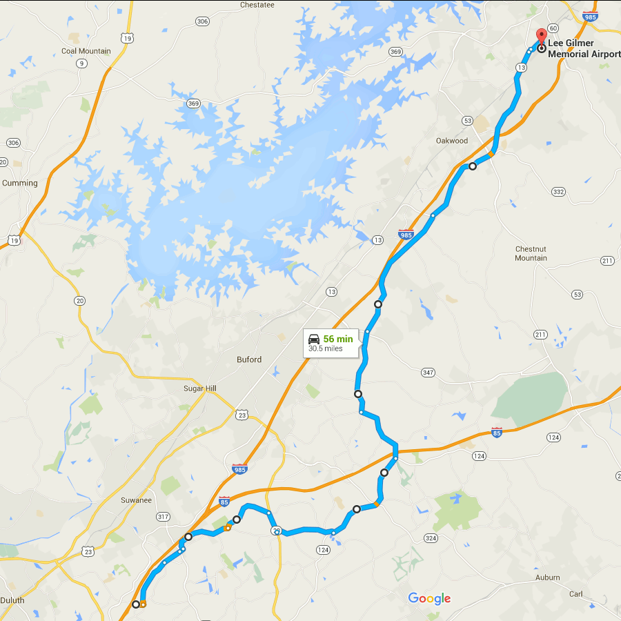
Start on Aviation Blvd, continue east from last time
Right on GA 60
Left on West Ridge Rd
Right on Athens St
Left on East Ridge Rd
Left on Old Cornelia Highway
Right on US 129
Left on White Sulphur Rd
Left to stay on White Sulphur Rd
Left on Cagle Rd
Right on GA 52
Sharp left on GA 51
Continue onto Main Street (Lula)
Continue onto Gainsville Highway
Continue onto Old Cornelia Highway
Continue onto Willingham Ave
Continue onto Main Street (Cornelia)
Right on Highland Ave
Left to stay on Highland Ave
Continue on Chenocetha Dr
Right on Wyly St
Continue on Dicks Hill Pkwy
Left on Rock Rd
Left on Antioch Church Rd
Right on US 23/US 441
Right on John Wood Rd
Left on Tom Born Rd
Right on Old Historic US 441
Left on The Orchard Rd
Right on Bear Gap Rd

Eastern Continental Divide: Duluth to Gainesville

Picking up where the previous route through Atlanta ended, this follows the ECD (within the limits of road placement) through the northeastern metro area. To be honest this is a rather boring drive through the suburbs. You can skip to the next post to pick it up where things get mildly interesting again.

The earlier part has some shenanigans with Old Peachtree Road, leaving it without turning and turning to stay on it at different points.

The segment on GA 20 is an area where no road follows the ECD. If you look close at a topo map you’ll see this section crosses a creek, not something you’ll see when following a ridge line.

The segment on GA 124 passes the site of Ft. Daniel, one of the original endpoints of the trail that became Peachtree Road.

The GA 13 portion mostly runs closely parallel to I-985.

Gainesville’s airport is an arbitrary stopping point dictated mainly by limitations on the number of route modifications that Google Maps allows you to make.

ecd2-fixed

(Aside: notice how close the divide is to Lake Lanier? The western edge of Lake Lanier’s drainage basin is also visible on this map, over near GA highway 9. The lake is really not very far at all from the boundaries of the area drained by it.)

Google Maps Link

Start at Old Peachtree Rd and I-985, go east
Left on Northbrook Pkwy
Continue on Old Peachtree Rd
Continue on Horizon Dr
Left on Old Peachtree Rd (yes, again)
Left on Rock Springs Rd
Right on GA 20
Left on Old Peachtree Rd
Left on GA 124/Braselton Hwy
Left on Hamilton Mill Rd
Right on Ridge Rd
Continue onto Hog Moutain Rd
Right on GA 13
Right on Industrial Blvd
Right on Aviation Blvd

Driving Tour of the Eastern Continental Divide in Atlanta

ecd_driving

This is about as good as I can do, the part in downtown Atlanta is particularly sloppy because the ECD actually runs through the Gulch.

Click For Google Map

To future-proof it against changes in the Google Maps site, this is the text:

Start at I-75 exit 223
Head north on Jonesboro Rd
Turn right onto N Lake Dr
Turn left onto Forest Pkwy
Turn right onto Jonesboro Rd
Turn left at the 1st cross street onto Courtney Dr
Slight left onto Main St
Turn left onto Hale Rd
Turn right onto Central Ave
Continue onto Old Dixie Hwy
Continue onto Porsche Ave
Continue onto S Central Ave
Turn left onto Irene Kidd Pkwy
Turn right onto GA-14 N/US-29 N/Main St
Continue to follow GA-14 N/US-29 N
Continue straight onto Peters St SW
Peters St SW turns slightly right and becomes Trinity Ave SW
Turn left onto Forsyth St SW
Turn right onto Marietta St NW
Continue onto Decatur St SE
Continue onto DeKalb Ave NE
Continue onto W Howard Ave
Turn right onto N McDonough St
Turn left at the 1st cross street onto GA-10 E/US-278 E/E College Ave
Continue to follow GA-10 E/US-278 E
Turn left onto N Clarendon Ave
Slight right at Wells St
Slight right onto E Ponce De Leon Ave
Turn left onto Mountain Industrial Blvd
Turn left onto Hugh Howell Rd
Turn right onto GA-236 W/GA-8 E/US-29 N
Turn left onto Lavista Rd
Slight right onto Chamblee Tucker Rd
Continue straight onto Tucker Norcross Rd
Turn right to stay on Tucker Norcross Rd
Continue onto S Norcross Tucker Rd
Turn left onto Jimmy Carter Blvd
Turn right onto S Peachtree St
Slight left to stay on S Peachtree St
Turn left onto Park Dr
Turn right onto N Peachtree St
N Peachtree St turns slightly left and becomes Medlock Bridge Rd NW
Turn right onto S Old Peachtree Rd
Continue onto Industrial Park Dr NW
Turn right onto N Berkeley Lake Rd NW
Turn left onto GA-13 N/US-23 N
Turn left onto S Peachtree St
Turn left onto Hardy Industrial Blvd
Turn right onto Hill St NW
Turn right onto Abbotts Bridge Rd
Turn left onto Main St
Turn right onto Brock St
Turn right onto Old Peachtree Rd NW
End at I-85 exit 109

“53.9 mi, 1 hour 54 mins”


Eastern Continental Divide GPS Maps

As far as we can determine, there is no map of this dividing line in existence as of 2003. This being the case, it was decided to research the Divide in Georgia.

via Eastern Continental Divide GPS Maps.

Back in 2012 I used the information at this page to make a set a turn-by-turn directions for following the ECD through Atlanta as close as possible on current roads.

Unfortunately changes in the Google maps algorithm means that the “permalink” I saved no longer works. I will attempt to recreate it in a less-fragile format.

Eastern Continental Divide (probably not the last you’re going to see of it here)

Atlanta was not built at a natural seaport (like Savannah) or at the head of navigation of a major river (like Macon and Augusta). Atlanta is near the Chattahoochee river, but is not actually centered on it, and is also much too far upstream for steamship navigation.

No, Atlanta was built as a railroad junction. You probably knew that. But what you may not know is that some of the oldest railroad lines, and some of the oldest roads, were built on top of the Eastern Continental Divide. This is the boundary that divides the rivers that drain to the Gulf of Mexico from those that drain eastward to the Atlantic.

There are good reasons why roads and railroads would be built on top of a natural watershed boundary. They avoid they need for bridges over streams, since by definitions the boundary lies between all the streams. They avoid low, swampy areas where early roads would get bogged down. The ridge can provide a relatively consistent elevation at the expense of being a bit twisty. “Ridgeways” have been in use worldwide for a long time. There is a trail in England called The Ridgeway which is over 5000 years old.

The ECD is not much remarked upon in Atlanta, mostly because it is a very gentle boundary. Atlanta is not mountainous. The ECD twists around through gently rolling hills. Because so many roads were built near it, you can drive through the city on it, and you get no sense of being on top of any kind of ridge. So most people don’t actually know it even exists, much less where it runs.

It is supposed to be a common belief that Peachtree Street runs along the ECD, but this is only true of a short section which was formerly called Whitehall Street. The main portion of Peachtree Street has little to do with the ECD.

I could not resist taking the 1895 topo map and adding a red line that vaguely approximates the ECD.  The map gives a mostly unobstructed view of the contours and streams, so the divide almost jumps out on its own. Click on this thumbnail to get the whole map.

ecd_1895_thumb

So many towns are centered on this invisible line. Jonesboro, Morrow, Hapeville, East Point, Atlanta, Decatur, Clarkston, Tucker, Norcross.

As you can see on the full map, the divide is actually not that far from the Chattahoochee. In fact you can see all the way from one side of the Chattahoochee’s drainage area to the other on this map.

This image from Wikipedia shows the entire Chattahoochee, Flint, and Apalachicola river system. The yellow area is that drained by these rivers.

Notice how narrow this drainage area is upstream from Atlanta. That is our water supply. All of the city’s (and several surrounding counties’) water comes from rain that falls on that small yellow area. This is why Atlanta’s water supply is threatened by drought every few years.

1895 map of Atlanta and surrounding areas

Another gem from the USGS store.

This thumbnail shows the long-abandoned Roswell Branch of the Southern Railway where it joins the main line in Chamblee. Click to get a much larger map covering a much larger area.

Notice that most of the Chattahoochee are still ferries on this map, rather than bridges. Holcomb Ferry is located more or less where Holcomb Bridge road is now, and so are the others.

The Eastern Continental Divide is rather easier to see on this map than on a modern map, if you know where to look.

roswell_railroad