Not shown: West Peachtree Street, Peachtree Battle Avenue, Peachtree Corners Circle, and a million more. Boundary between Peachtree Street and Peachtree road is guesswork and probably wrong. The city makes no real distinction between them. The boundary has something to do with where the city limits were and/or where the pavement gave way to dirt, at some arbitary time in the past.
I think this might be the only map like this around; I would not have bothered to make it if I could have found one.
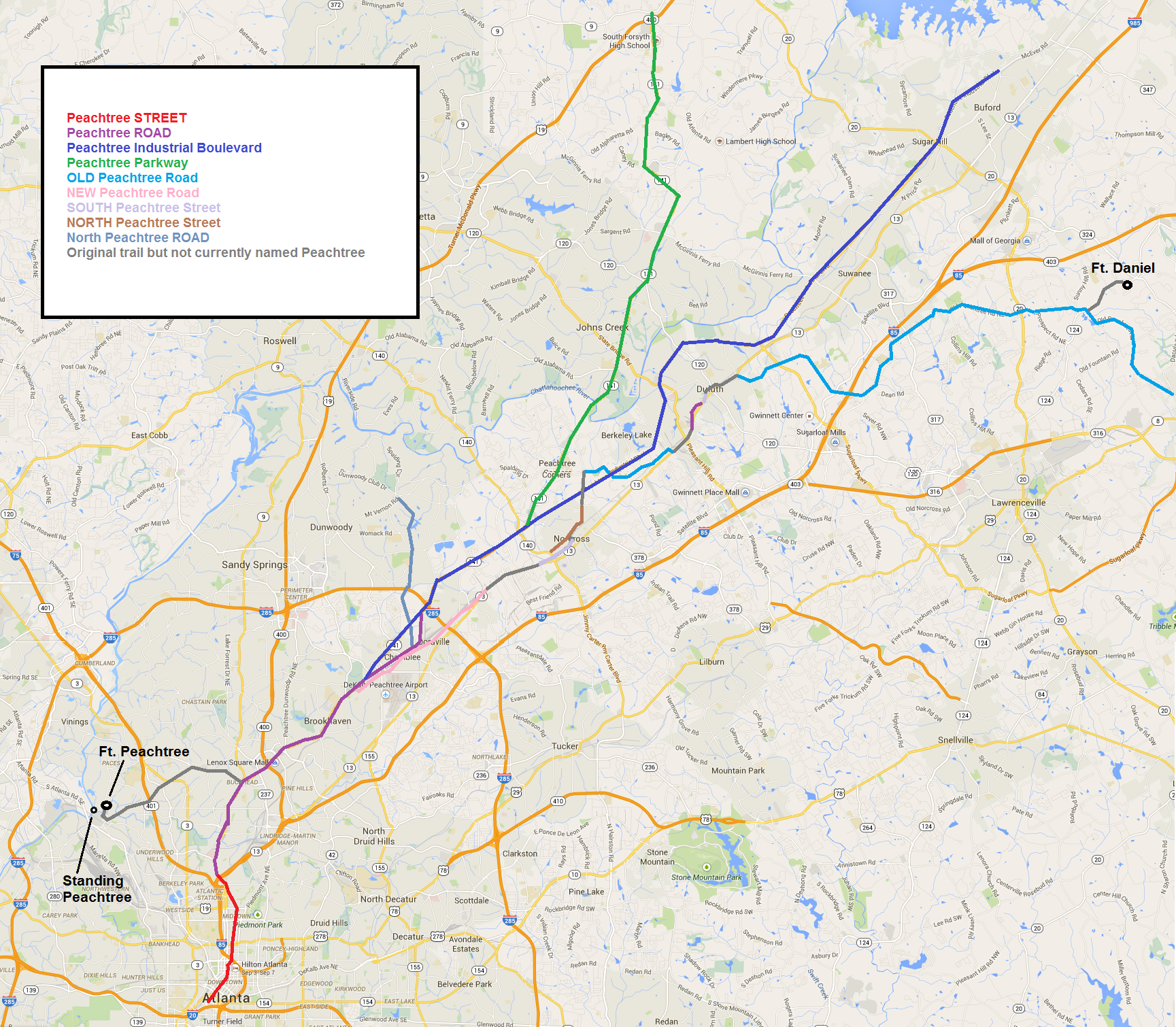
For Non-Atlanta people, when someone says “Peachtree” with no other qualifier, they mean Peachtree Street or Peachtree Road from downtown northward to the point where Peachtree Industrial Boulevard begins. Anything else requires more information to differentiate what you mean. (Those are also the only Peachtrees that are considered important, at least by people who live ITP. The others are just curiously named extensions)
Don’t get worked up about the blocky lines or inexactness. I made this thing in MS Paint for crying out loud.
Notice that from Norcross to the northeast, the older roads tend to follow the Eastern Continental Divide.
This is my source for information about the original Peachtree trail.