Atlanta was not built at a natural seaport (like Savannah) or at the head of navigation of a major river (like Macon and Augusta). Atlanta is near the Chattahoochee river, but is not actually centered on it, and is also much too far upstream for steamship navigation.
No, Atlanta was built as a railroad junction. You probably knew that. But what you may not know is that some of the oldest railroad lines, and some of the oldest roads, were built on top of the Eastern Continental Divide. This is the boundary that divides the rivers that drain to the Gulf of Mexico from those that drain eastward to the Atlantic.
There are good reasons why roads and railroads would be built on top of a natural watershed boundary. They avoid they need for bridges over streams, since by definitions the boundary lies between all the streams. They avoid low, swampy areas where early roads would get bogged down. The ridge can provide a relatively consistent elevation at the expense of being a bit twisty. “Ridgeways” have been in use worldwide for a long time. There is a trail in England called The Ridgeway which is over 5000 years old.
The ECD is not much remarked upon in Atlanta, mostly because it is a very gentle boundary. Atlanta is not mountainous. The ECD twists around through gently rolling hills. Because so many roads were built near it, you can drive through the city on it, and you get no sense of being on top of any kind of ridge. So most people don’t actually know it even exists, much less where it runs.
It is supposed to be a common belief that Peachtree Street runs along the ECD, but this is only true of a short section which was formerly called Whitehall Street. The main portion of Peachtree Street has little to do with the ECD.
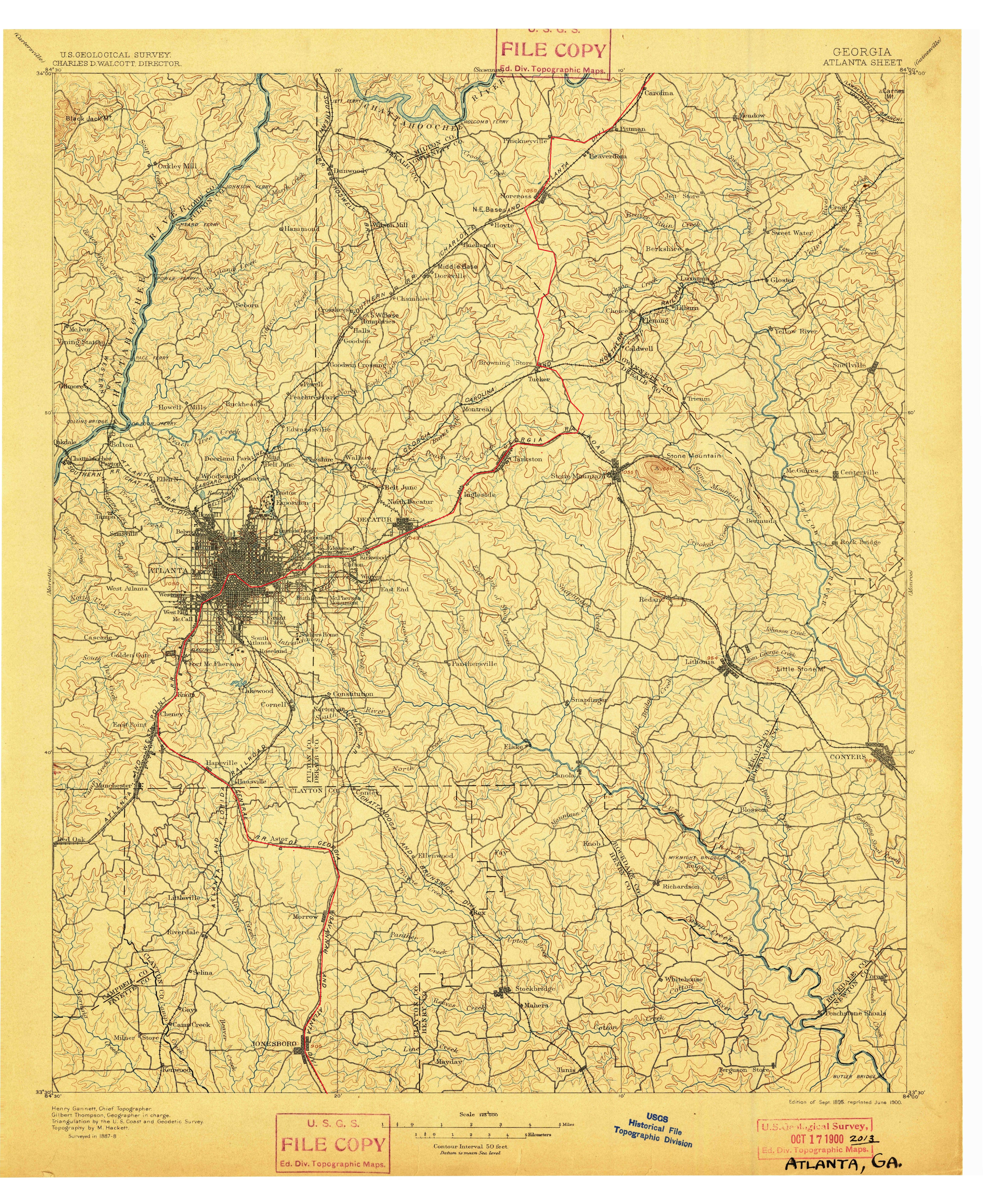
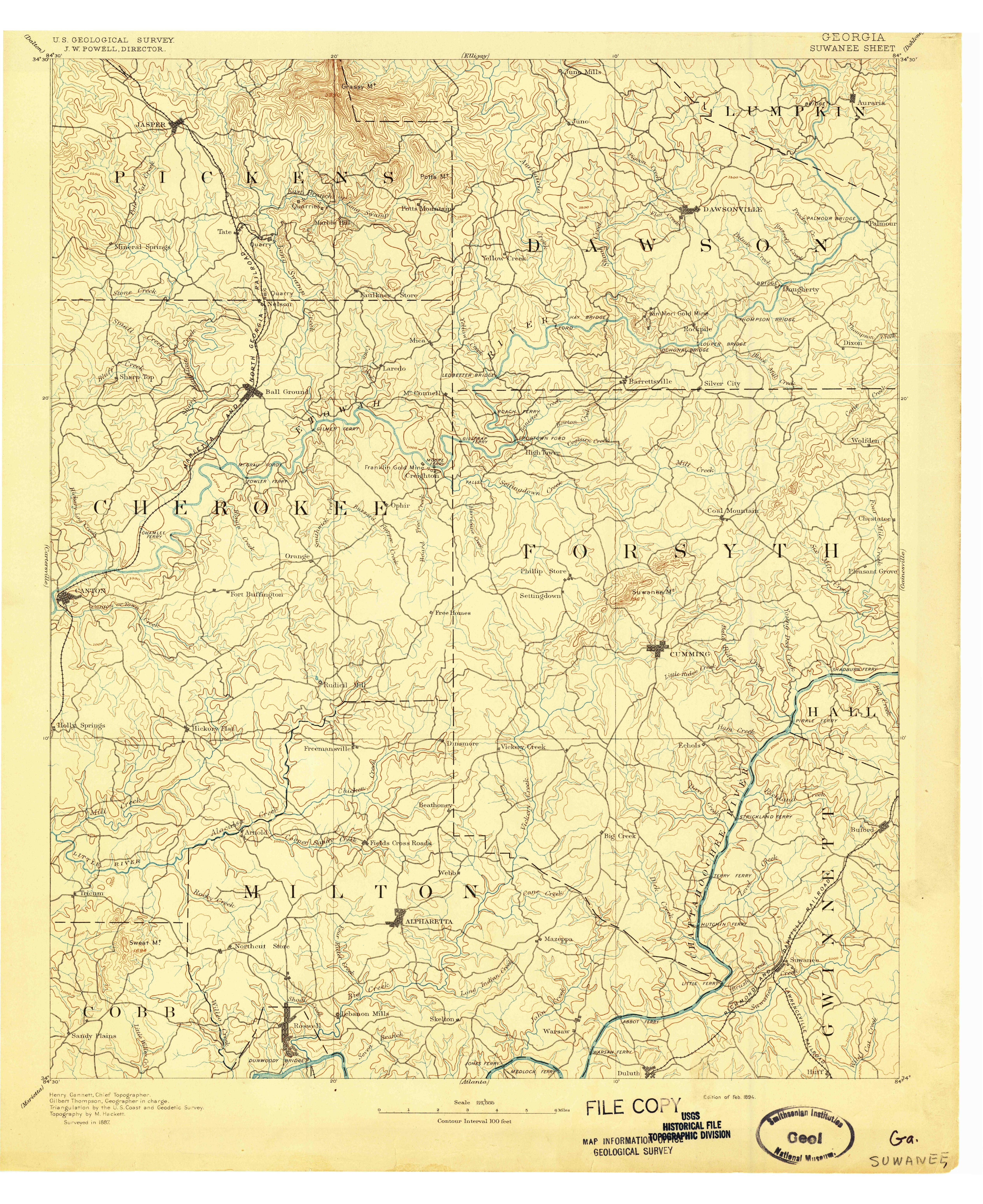
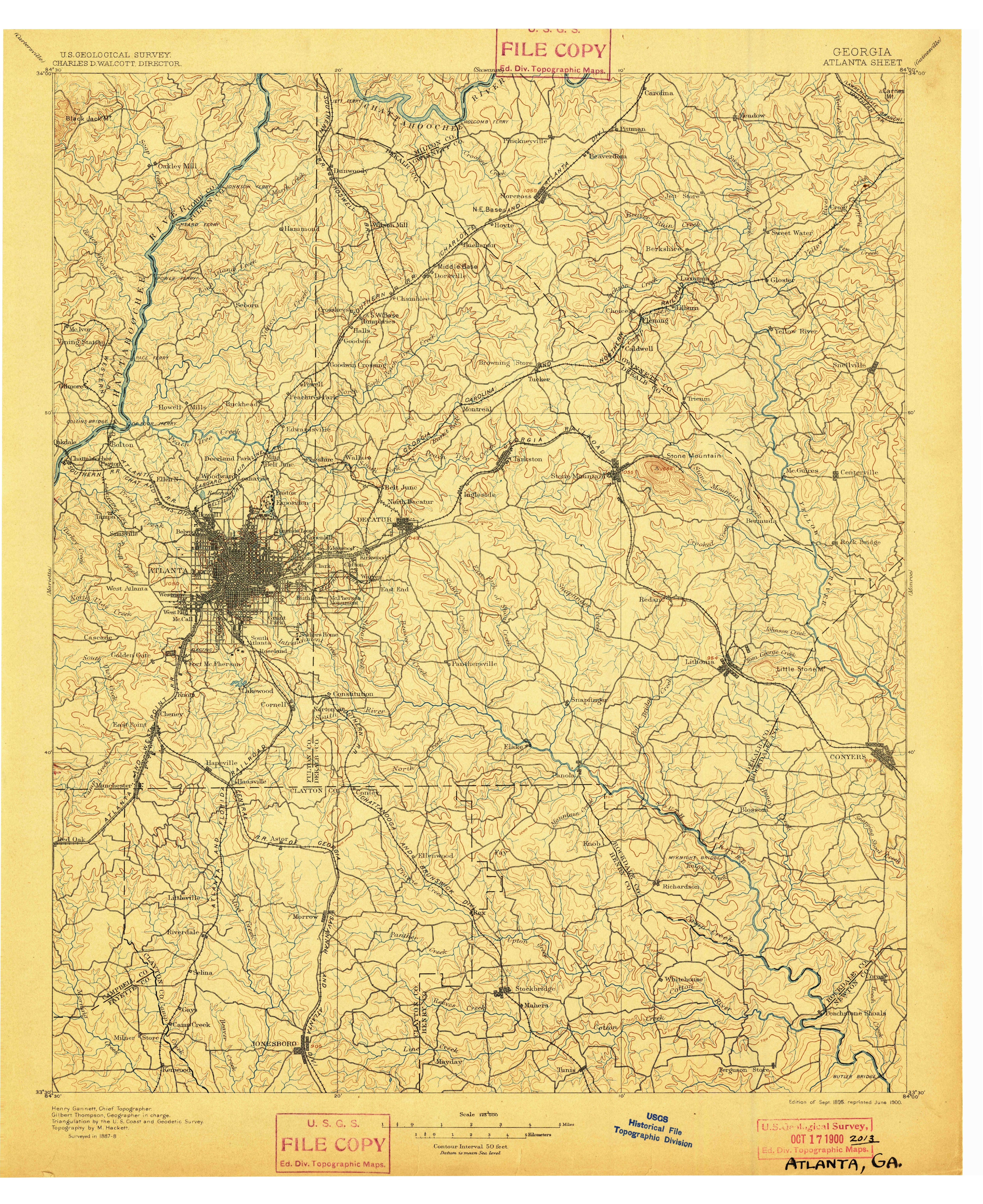
I could not resist taking the 1895 topo map and adding a red line that vaguely approximates the ECD. The map gives a mostly unobstructed view of the contours and streams, so the divide almost jumps out on its own. Click on this thumbnail to get the whole map.
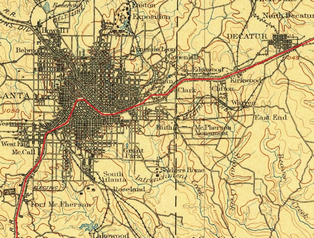
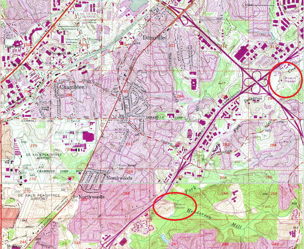
So many towns are centered on this invisible line. Jonesboro, Morrow, Hapeville, East Point, Atlanta, Decatur, Clarkston, Tucker, Norcross.
As you can see on the full map, the divide is actually not that far from the Chattahoochee. In fact you can see all the way from one side of the Chattahoochee’s drainage area to the other on this map.
This image from Wikipedia shows the entire Chattahoochee, Flint, and Apalachicola river system. The yellow area is that drained by these rivers.
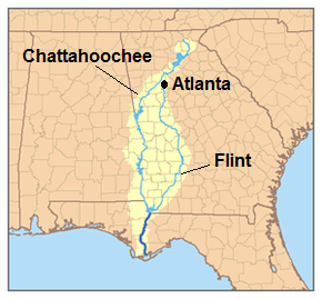
Notice how narrow this drainage area is upstream from Atlanta. That is our water supply. All of the city’s (and several surrounding counties’) water comes from rain that falls on that small yellow area. This is why Atlanta’s water supply is threatened by drought every few years.