This partially completed project is finally back “on track” after the final federal funding was approved in May.
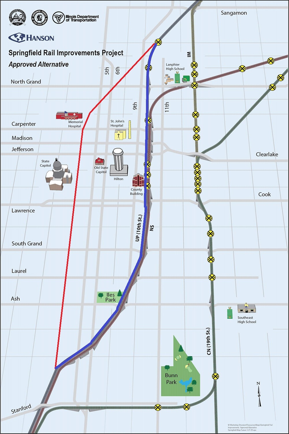
Because the official maps of the project show separate “before” and “after” maps, I’ve taken it upon myself to draw the “before” line myself onto the “after” map, I’ve taken it upon myself to create a composite using MS Paint. The red drawn line is the current UP (ex-SP, ex-ICG, ex-GM&O, ex-Alton) line that will be abandoned. The blue drawn line is the new route.
Map taken from project website, modified by me.
To date, the overpasses for the new line have been built from the south end up to and including Carpenter Street. The only sign of the planned overpass over North Grand is the fact that the McDonalds at 9th and North Grand has already been demolished for some months. The state EPA office has also moved to White Oaks Mall to make way for this construction.
From a railfan perspective, this is both good and bad. It is bad because it will move the trains 7 blocks further from my house, and also eliminate several grade crossings which can currently be used for trainwatching. It is good because it concentrates both UP and NS onto one right of way (still separate railroads, but right next to each other) for a long stretch, allowing one to “double dip”. Currently the only place that can be done is a short stretch south of town. As these are by far the roads with the most trains in Springfield, this means the vast majority of all the rail traffic in town would now go right past the new passenger station on 9th street.
No, I don’t know what they plan to do with the current line when it is abandoned. In 2022 at a community meeting I asked then-Mayor Jim Langfelder about it, and he said something about a light rail / trolley line. I did not believe it then and don’t believe it now. Downtown Springfield is too small to need a trolley to get from one place to another within it.
Plans for a 3rd Street Greenway seem more realistic, but still pretty ambitious for Springfield where, as we’ve seen, things change slowly. Anyone who was in Atlanta when the Beltline was being planned knows that these kinds of things can take much longer than expected, even in a much larger city,
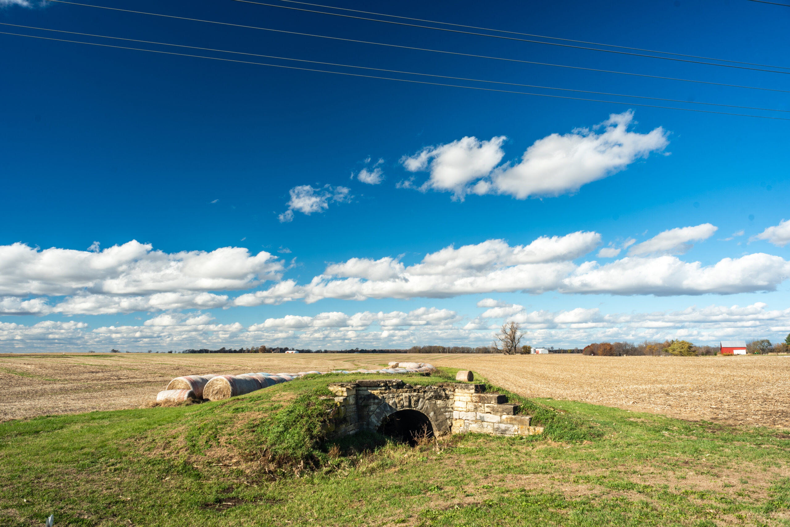
I’d been seeing this little stone arch in a field next to IL-123 for a couple years.
Not because I was looking for it, but because it’s on the way to one of closest (to me) parts of Illinois where there’s enough public dirt roads to put in the “recommended” 10 miles of 4×4 driving of a 4runner.
Road map stitched together in Paint from the PDFs of Cass and Menard counties, showing the abundance of unpaved gravel roads in the vicinity. The approximate location of the photo is marked with red.
Anyway, it somehow escaped me that this was in fact part of the abandoned railroad line that I already knew was in the area. I just didn’t put 2 and 2 together. Until I ran into it on Bridge Hunter, one of those last great pre-FB, pre-Twitter old school resources on the web. IMO for the (admittedly niche) subject it covers, its up there with any wiki.
The site identifies this location as:
“Abandoned stone arch bridge over Intermittent strean on Abandonded Chicago & Alton Ry”
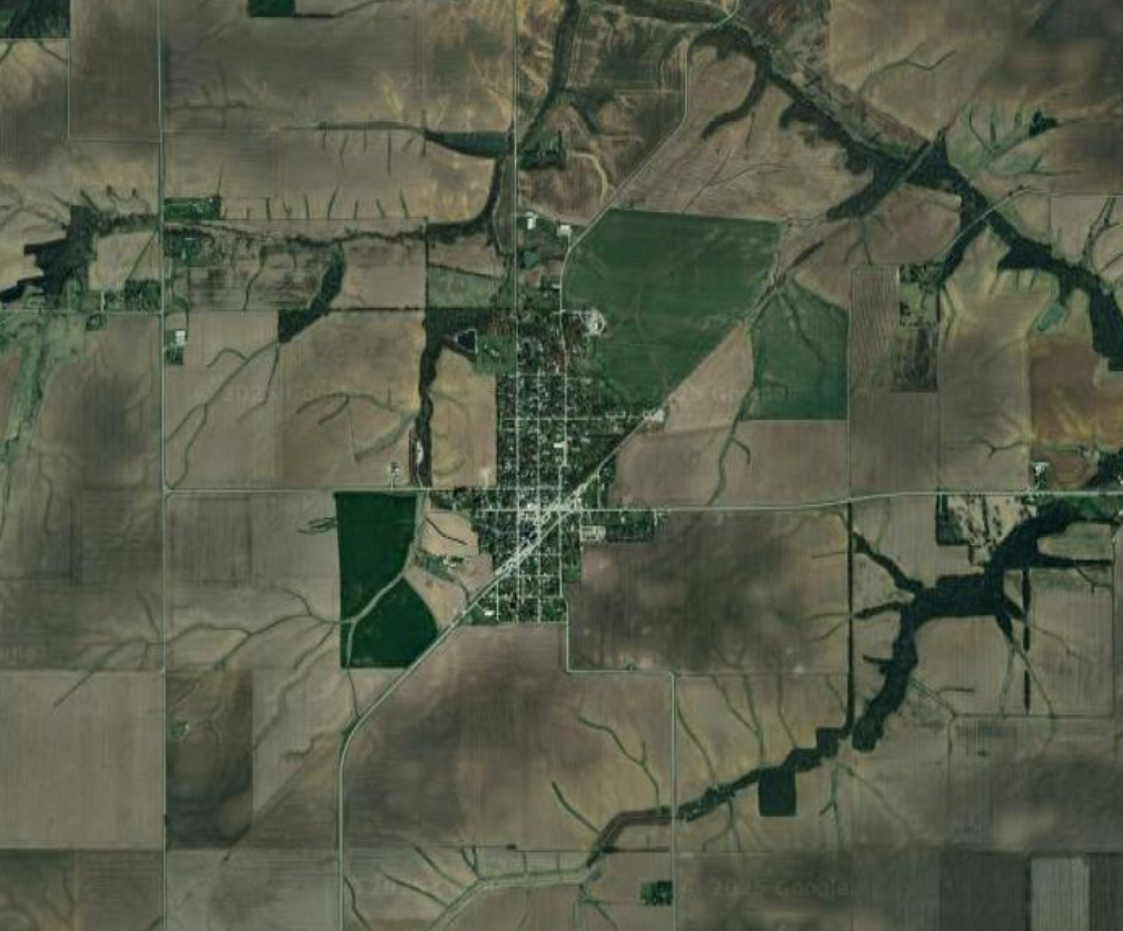
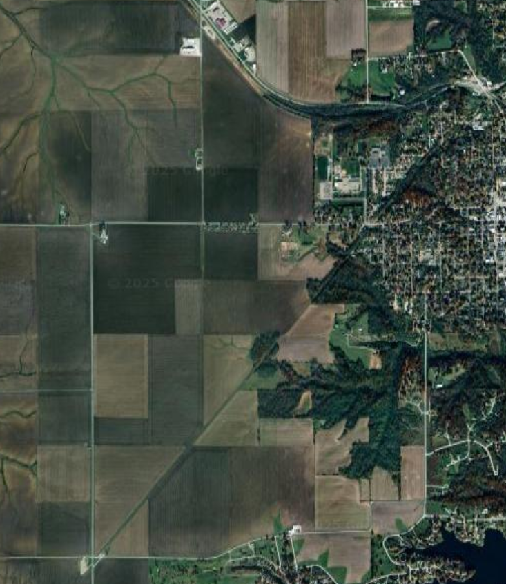
You can clearly see the “ghost line” of this railroad line on the following images. It is the line running diagonally from southwest to northeast.
Satellite image centered on Tallula, ILSatellite image centered southwest of Petersburg, IL
Info about the line on Abandoned Rails, another of those great vanishing internet resources:
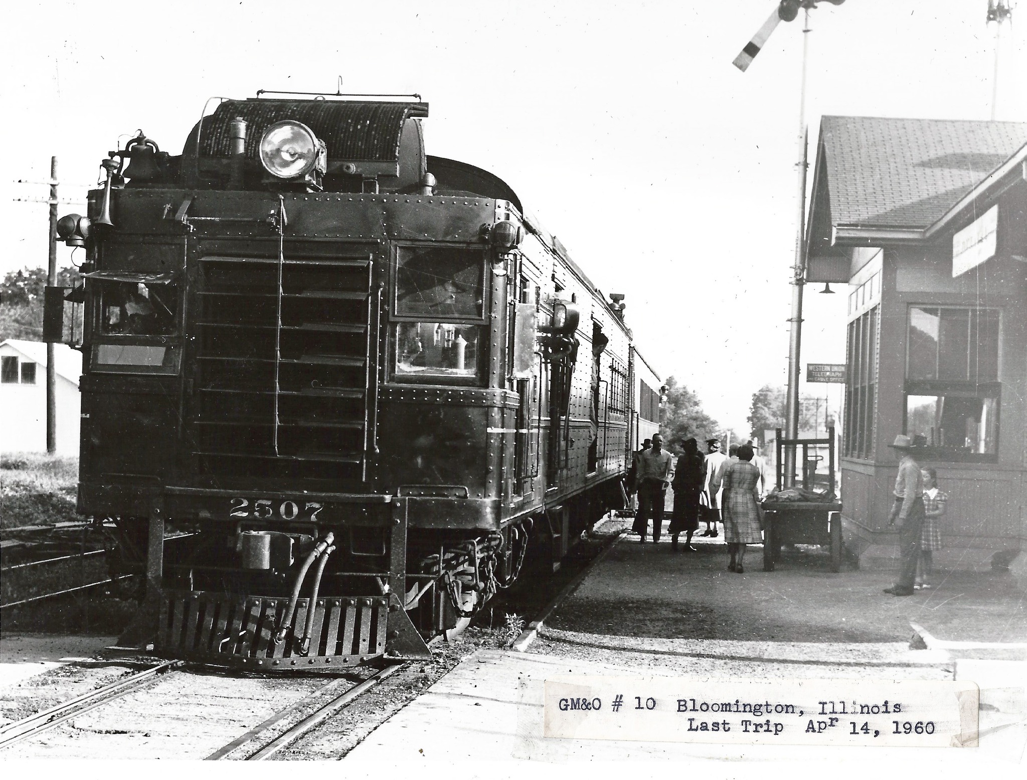
“This is the famous Jack Line that had one of the last “Doodlebug” runs untgil April 14, 1960. The double- car, motor car with trailing coach, train went daily from Bloomington, Il to Kansas City, MO and return. Trains from each direction met in Louisiana, Missouri. It was possible to make a round trip from Bloomington to Louisiana and return in a day. That was one of the longest doodlebug runs in the country and one of the latest.”
Doodlebug train from Bloomington to KC, final trip on 4/14/1960. Photo by Edward Wayne Bridges, posted to Facebook by John Woodrow on 12/6/2023.
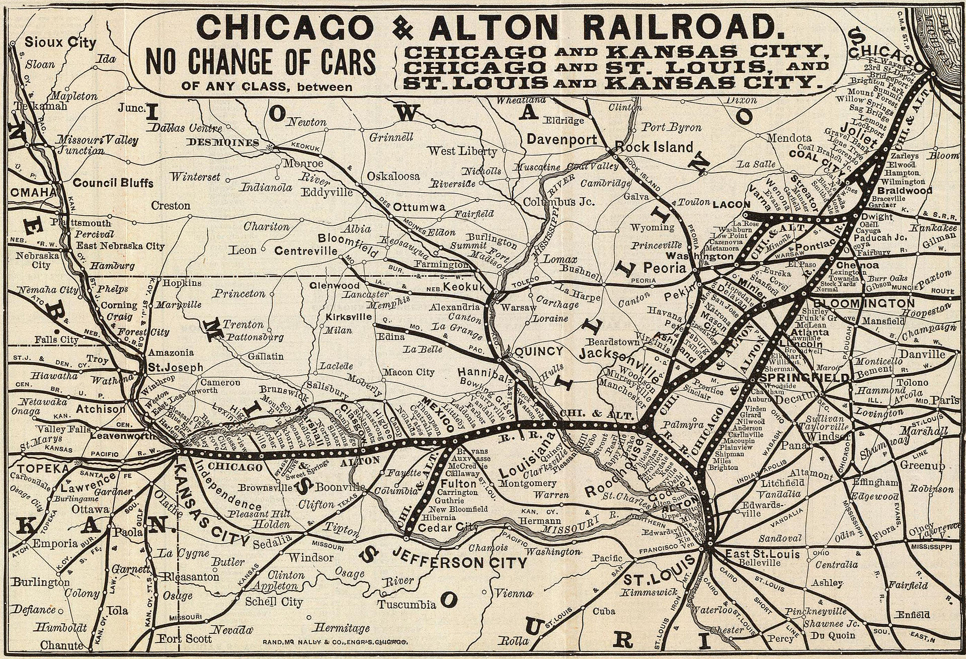
This line was the western side of a triangle that had Bloomington, Roodhouse, and Godfrey at its corners, and included Springfield along its eastern side. This can be seen on the map from the Wikipedia article on the Alton Railroad.
1885 map of the Chicago and Alton Railroad.
From the points of this triangle, lines connected to Chicago, St. Louis, and Kansas City. So while this location seems remote at present, in the railroad’s heyday it was part of the connections between the Alton’s three principal cities.
So what happened? Well, what happened to many, many midwestern and midsouthern lines. The Alton was absorbed into the GM&O in 1947, which was in turn absorbed into ICG in 1972. In the 80s, ICG spun off most of its not-originally-Illinois Central trackage. They were spun off as shortlines which were eventually purchased by other Class I railroads.
The Chicago to St. Louis main line, through Springfield, is now Union Pacific and is a very busy intermodal route and the route of the Texas Eagle.
The St. Louis to KC branch did not fare as well. It ended up as KCS, and now CPKC. It currently connects KC, St. Louis, and Springfield (via the former Alton/GM&O “air line” from Murrayville to Springfield which was built in 1907 after the map shown above). It is much lower in traffic than the other line. This was the line that, during the CP and KC merger talks, CN tried to buy to extend their ex-IC line (that currently ends south of Springfield) to Kansas City.
The third leg of the triangle, which is what we’re discussing here, was completely abandoned between Bloomington and Jacksonville.
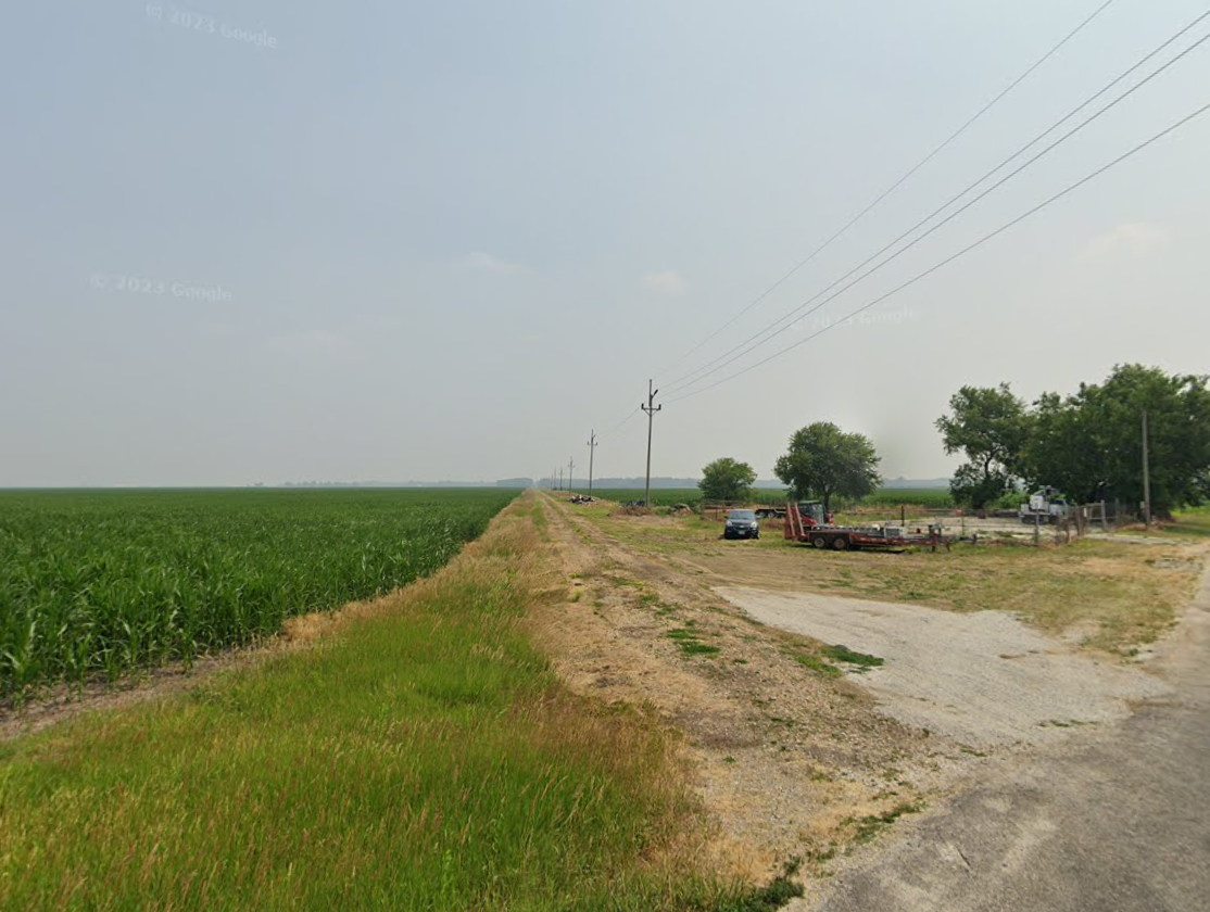
Many parts of the line are followed still by roads, power lines, or both.
Power line access road southwest of Petersburg that was once the railroad.
USGS TopoView – entry point for all current and historical topographic maps published the US government; can download maps or display them overlayed within the main viewer
Georgia Wildlife Resources Division – Interactive Map – shows state Wildlife Management Area locations, hunting, fishing, camping, shooting ranges, roads. I have learned not to trust these maps to be up to date about road closures!
MyTopo – Online Maps – these are older USGS topo maps overlayed with some such as forest service road numbers. In spite of some maps being outdated, the simple interface makes for a quick reference.
Georgia DOT Maps – Index to county road maps, which are basically the only maps online that actually show the paved or dirt status of all roads outside of national/state forests! Reasonably up to date. Unfortunate interface requires downloading individual county maps one by one.
Trails Off-Road Map – detailed trail guides for individual roads, including photos, videos, reviews. Requires sign-up with email address, facebook, etc. Some features (including to view all trails on the map at the same time) require paid membership.
Example historical map (1895) in TopoViewExample of Fed. Railroad Admin mapExample US Forest Service MapExample GA Dept. of Natural Resources MapExample MyTopo mapexample of GA DOT maps
RailGA.com was the most comprehensive site on the net for information about railroads in Georgia, until a couple of months ago when it just mysteriously went down.
Fortunately most of the pages were archived by the Wayback Machine.
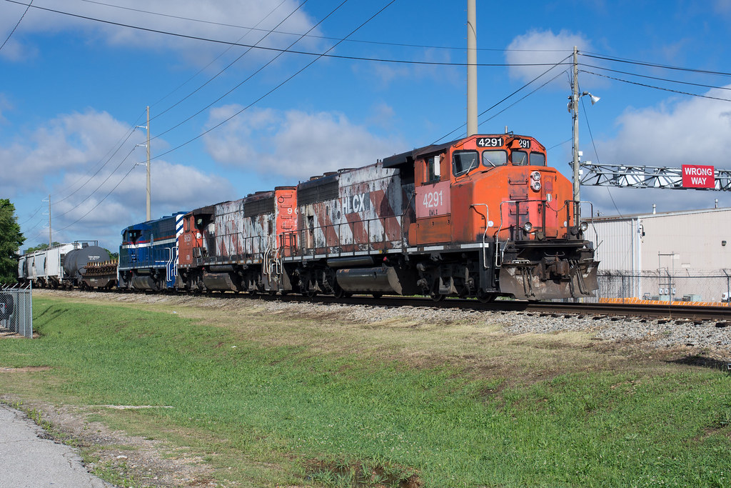
Because while writing about wide nose variations I realized there also didn’t really exist such a catalog of non-wide cabs. Conventional road-switchers only!
Except for the railroad custom jobs at the end, standard cabs are not being built new since the 1990s. However, so many were sold over the years that they remain ubiquitous in all situations other than the lead unit on a mainline train: trailing power, locals, switching; not to mention museum-pieces.
EMD
Early high nose
The classic, original EMD look of the 1950s. Used on early road-switchers such as the GP7, GP9, GP18, etc.
Used on a very small number of GP9s, and then on GP18, GP20, etc. The factory low nose sloped downward from back to front. I have seen divided and undivided windshields, not sure if both are original or not.
Most of the low-nose first generation EMD’s are the result of modification by the owners. These vary wildly in appearance depending on who rebuilt them and when.
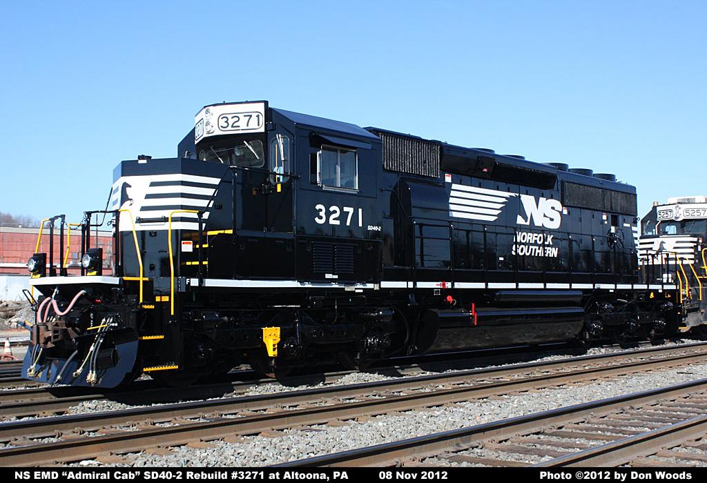
Associated with Southern and N&W. Considered more crashworthy than the low version. (It was also cheaper for a long time) These kept their high short hoods well into the NS era.
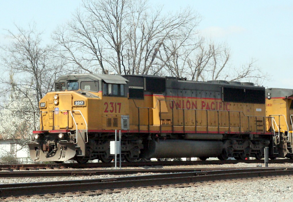
GE’s standard cabs had generally stubbier noses than their EMD counterparts.
There are probably more variations than shown here, but one so rarely encounters older GEs that I’ve never had a reason to try to learn more about it than this.
Early version, low nose
Characteristic of U-boats, Dash-7s. Short, “round but square” nose, rounded roof.
Transitional design used on early Dash-8s. The nose is more like the next version, but the round roof is still round. Notice the roof is lower than than body behind it.
Seen on Dash-8s and the small number of Dash-9s that were not built with wide cabs. The roof is angled instead of round, and matches the height of the overall body. The nose has sharper angles and is not as blunt as the Dash-7 version.
C40-9 with air “top hat” air conditioner (John Mueller)
All of these are museum pieces now, but relevant in the history of road-switcher design.
1st version
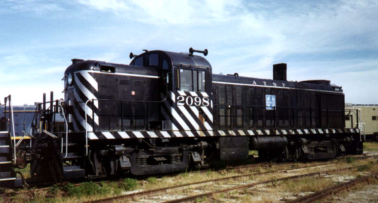
Used on RS-1, RS-2, RS-3, etc., all the way back to 1941. These were by far the most popular ALCO models, so this is the look usually associated with the builder. The short hood is the same height as the long hood, but the cab is notably taller than both.
No low-nose alternative was offered for these early ALCOs. But like their EMD counterparts, they ended up getting chopped every which way, resulting in a snoot almost like an SD40-2.
The length of the nose compared to its height is truly crocodilian, especially on the 6-axle RSD-15. The “Alligator” is disproportionately famous for a model that sold only in the double digits.
The Century Series featured a totally new look. They simplified the look of the nose, and angled the front windows. Most models had a very short GE-like nose. The C420 had a different, longer nose than the others.
The CF7 program to rebuild F-Units into a road-switcher involved an oddly proportioned parody of the standard EMD cab. Both rounded and angular roofs were used.
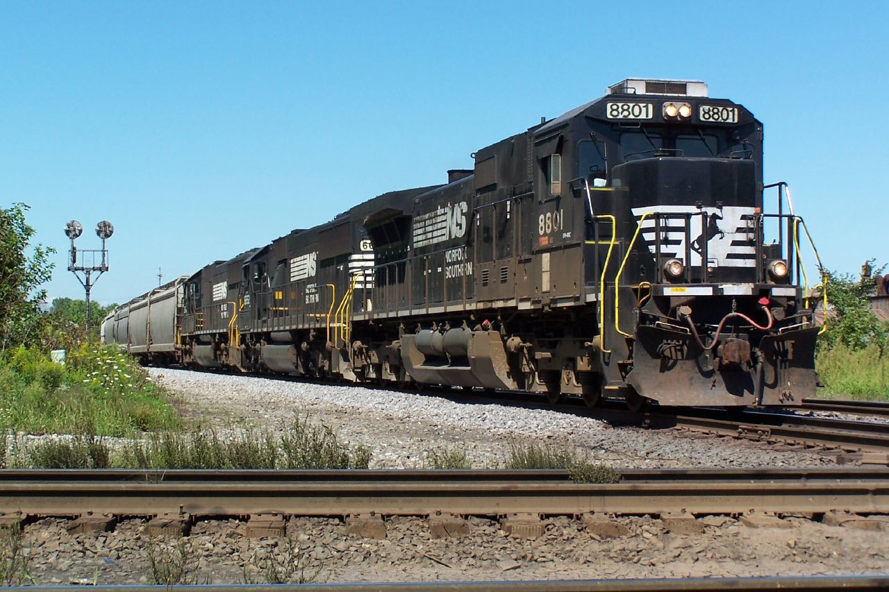
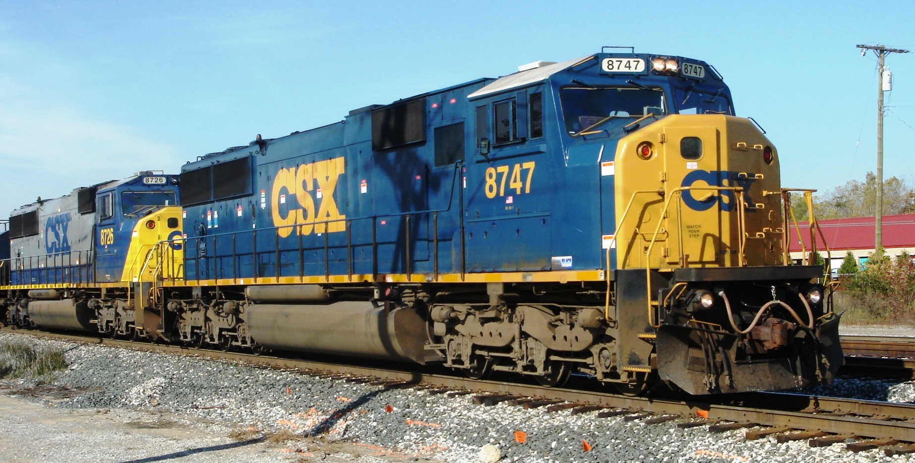
This is used by NS for some of their rebuilds. It is similar to the EMD standard cab, but with sharper edges, higher number boards (which go above the roof), and windows angled outwards (from bottom to top).
Similarities to the cab used on various NRE Genset models have been noted, but they are not so identical as to suggest that CSX simply bought the cabs from NRE.
There have been several flavors of wide-nose / wide-cab designs over the years. I have not seen a site that has pictures of all on one page. So here they are in rough chronological order.
This article covers only hood unit and cowl units. Carbodies and monocoque designs are a different subject altogether.
Early EMD
The earliest version from 1967 had no crash safety benefits over a standard cab, and was designed purely for aesthetic reasons. Created for the cowl units FP45 and F45, the same design was also used on the DDA40X hood unit.
This was similar to the first design, but lacked stairways and handrails. Used most notably on the ill-fated SDP40F of 1973, and F40C. All locomotives with this cab were cowl units.
The first ones built had a nose almost exactly like the FP45:
Unique and unmistakable for anything else, especially by EMD. The F40PH of 1975 featured a much simpler nose design than its older cousins, and became the face of Amtrak for the next 20 years.
GE, like EMD, produced wide-nosed cowl units for passenger service. Unlike the EMD counterparts, these appear to be one-offs, not part of the overall evolution of cab design. Not very many of these were ever built, and none survive.
The true “Canadian” Cab was created by CN in 1973. This was the first cab that was designed with crew safety in mind. All units with this design were originally sold in Canada but a number have been resold to US railroads and can be seen on shortlines and lease fleets.
For many years, US railfans tended to call almost any freight locomotive with a wide nose a “Canadian Cab”, as wide nose designs didn’t catch on down here until the early 90s.
The actual Canadian version can easily be distinguished by the four front window panes. Unlike the earlier (and most later) EMD designs, these windows are vertical rather than slanted back.
CN continued to order these from multiple manufacturers into the 90s, when they switched to the same 2-window models as US railroads.
EMD version
Used on GP38-2W, GP40-2LW, GP40-2W, SD40-2W, possibly others.
GP40-2LW (my own photo)
MLW version
Differs from the contemporaneous EMD design by the shape of the windows.
Unmistakable 3-window design. Otherwise very similar to the Canadian cab. Introduced circa 1988 and used for the SD40-2F, F59PH, and the earliest orders of SD60M. This can still be seen on mainline freights, but is rare and much sought after by railfans.
The most numerous EMD variation, starting in 1990. “North American” means the cab was sold in both the US and Canada, unlike earlier versions that were only for one country or the other.
Note superficial resemblance to the original 1967 design, particularly the shape of the windows. One visible, though small, difference is the nose on these is slightly tapered and the corners are more rounded.
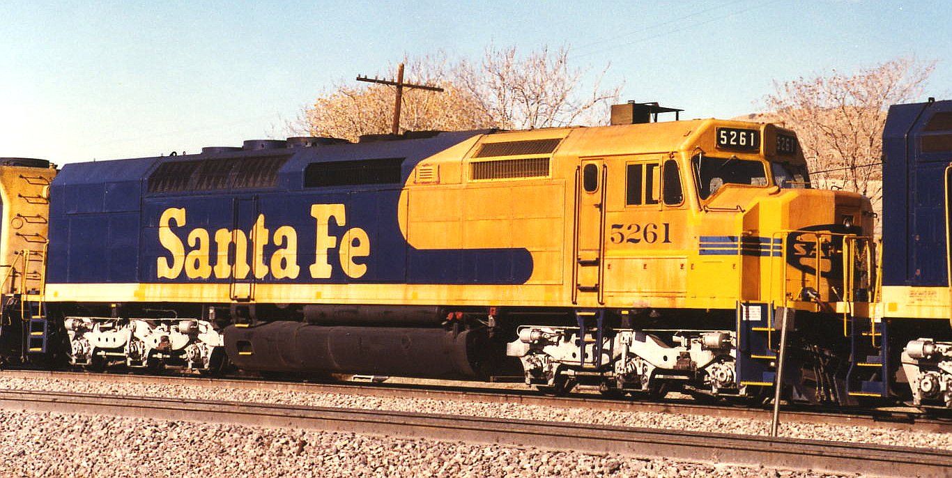
Designed by Sante Fe and used only for the GP60M. This design has a headlight that is not actually in the center of the nose but just to the right of center when facing the locomotive. Unlike the standard EMD wide cab, the nose is not tapered and looks more like the FP45 cab.
This looks nearly identical to the standard version, but was the first EMD cab isolated to reduce noise and vibration. A vertical seam is visible on the side of the nose. Used on SD60I, SD70I, SD80MAC, early SD90MAC.
Used on late examples of SD70M and SD70MAC. Nose has a slightly taller mid-section to accommodate full-height door, resulting in a somewhat “notched” appearance. The whole nose is less rounded and more angular than before, and no longer tapered.
Late SD90MAC-H (1999), SD70ACe (2004-2014), SD70M-2, and several others. The nose is deeply notched to improve visibility. The distinctive teardrop window shape of earlier designs is gone.
Unlike the constantly changing EMD, GE’s cab/nose design basically looks the same on nearly models since 1990. If it ain’t broke, don’t fix it.
There are thousands on the rails, the most likely thing to see leading any mainline train. Examples include Dash-8, Dash-9, AC4400CW, ES44AC, ES44DC, etc.
This seems to have been used in North America only on CN C44-9W’s, and on several GE models sold to the Australian market. Notice the EMD-like front windowpane shape.
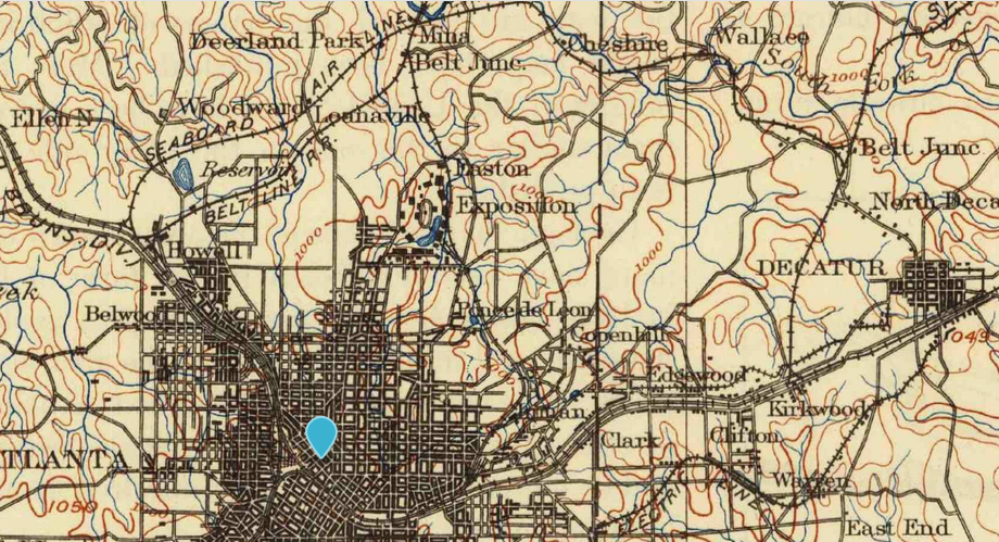
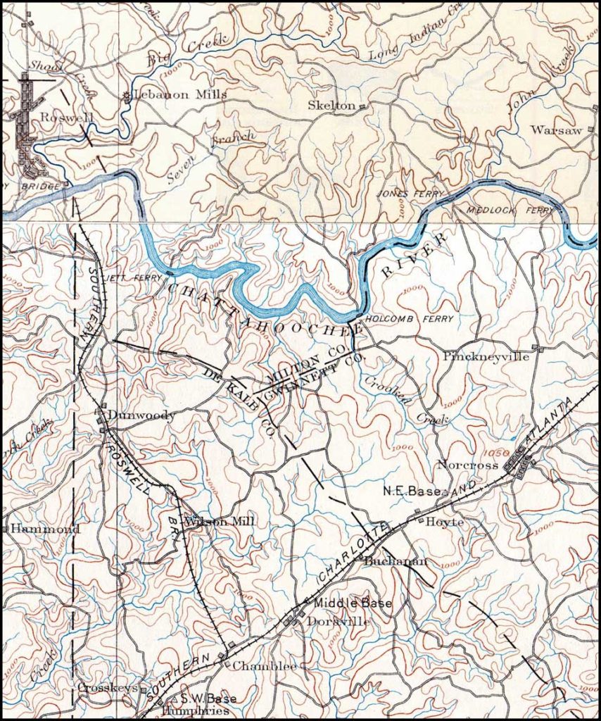
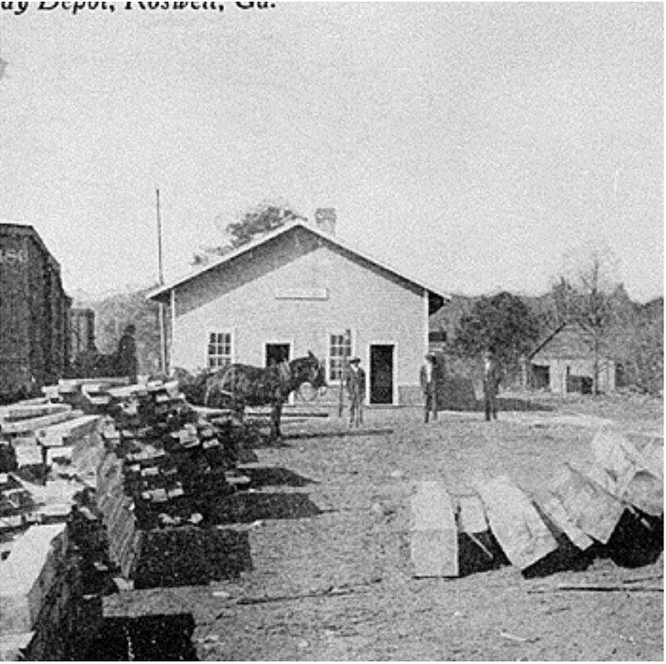
This post gathers the information I’ve been able to find about the Roswell Railroad, one of the almost-completely vanished and forgotten rail lines of the Atlanta area. This was branch of Southern Railway that operated between Chamblee and Roswell from 1881 to 1921.
The Roswell Railroad Company was incorporated in Georgia in 1879 as successor to the Atlanta & Roswell Railroad Company. It was controlled by the Atlanta & Charlotte Air-Line Railroad Company, which constructed the 10-mile, 3-foot gauge line and opened it for business on September 1, 1881. In the same year, the A&CAL was leased to the Richmond & Danville Railroad (which became Southern Railway in 1894).
The town of Chamblee was originally called “Roswell Junction”.
However, feeling the name of the settlement was too similar to nearby Roswell, they randomly selected Chamblee from a list of petitioners for the new post office name.
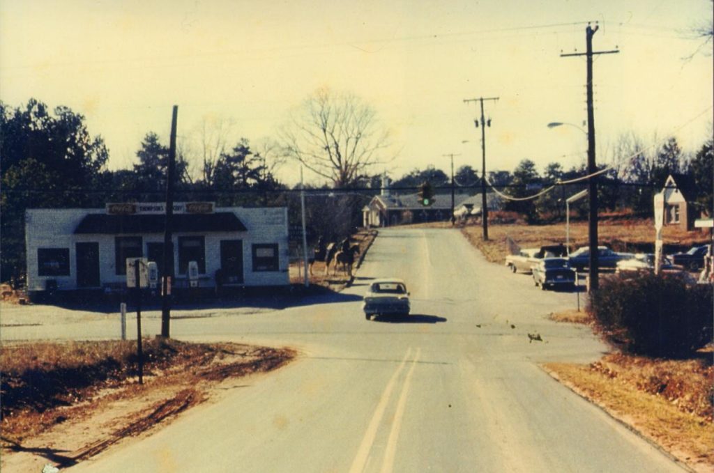
The railroad followed very roughly the present-day Chamblee-Dunwoody Road to the center of old-town Dunwoody, where the building located at 5518 Chamblee-Dunwoody Road was a section house.
The original Dunwoody depot was later moved and used as “Thompson’s Store”, but this building no longer remains.
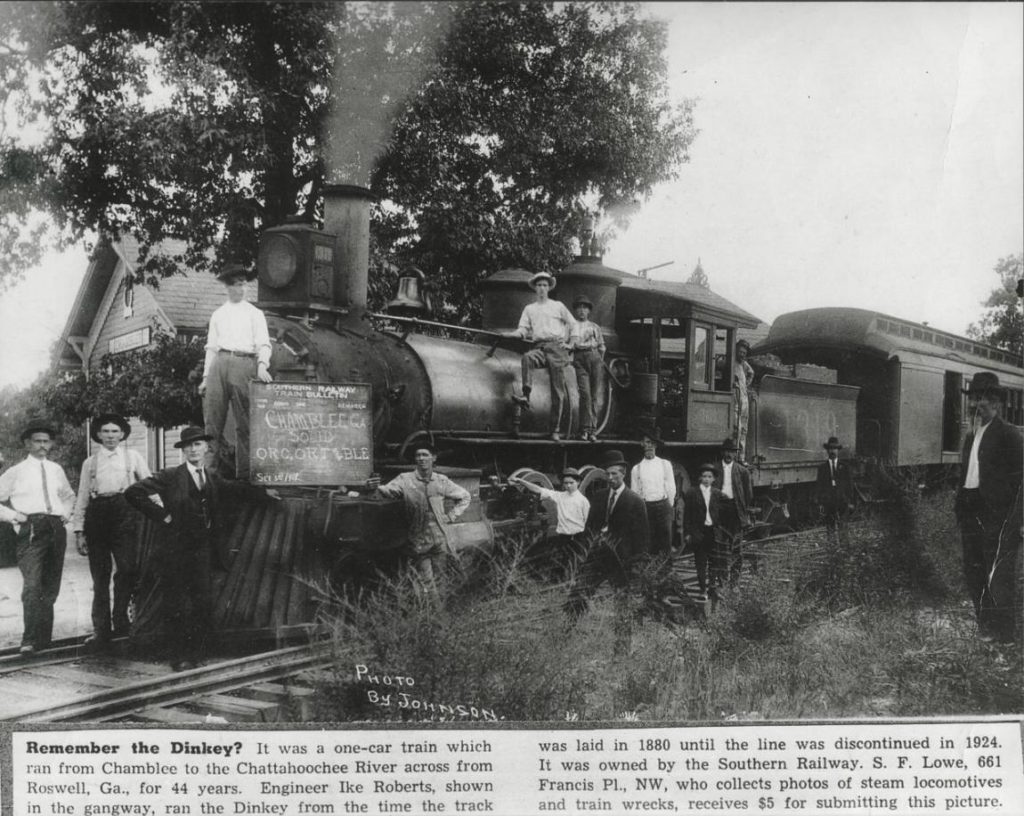
The line never actually reached Roswell, as the company was never able to build a bridge across the Chattahoochee. It ran along Roberts Drive and what is now Dunwoody Place, and ended near the present North River Tavern. This station was referred to as “Roswell” by the railroad. The engine house was “moved to by the river for use as a barn”.
Roberts Drive is named after Isaac “Ike” Roberts, the “only engineer of the Roswell Railroad”, whose house still stands at 9725 Roberts Drive.
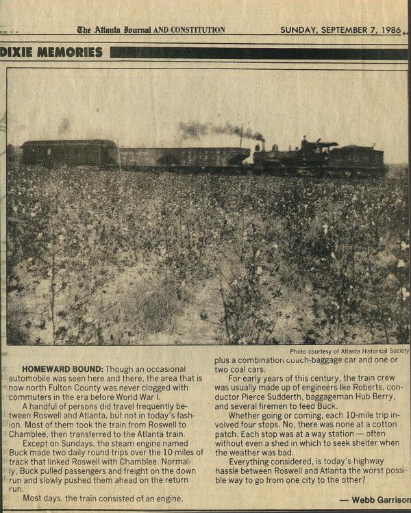
The final stop was Roswell Station, on the south bank of the Chattahoochee River, just east of the current Roswell Road. There was no means to turn the locomotive around, so it simply ran backwards on its return trip. The train was powered by 0-6-0-arranged Baldwin 1878 steam locomotive named “Buck.”
There was also a branch to the current location of Morgan Falls Dam.
The railroad famously was used by Teddy Roosevelt when he visited Bulloch Hall in 1905.
Theodore Roosevelt, who had begun his presidency on reasonably good terms for a half-northerner president, had infuriated the South by inviting Booker T. Washington to dine in the White House. Consequently, he waited a few years until the episode blew over and finally visited Bulloch Hall for the first time while touring the South in 1905. He was thought to be the first sitting President of the United States to visit the South since the end of the American Civil War, however this is incorrect as William McKinley had visited the South earlier while celebrating the victory of the Spanish–American War.
Here I reproduce information from the Norfolk Southern and CSX timetables. I have many times wished I had this to pull up on my iphone in a form other than the bulky PDFs this data is from.
Stations marked “not in timetable” represent signals that trains have been observed to call out (“Clear Doraville, NS 203 southbound”) over the scanner. NS generally does not list intermediate signals (between control points) in their timetables, but they may be shown on their track diagrams. Not sure about CSX.
Text in italics is additional commentary, not from timetable.
Norfolk Southern
First, a “British subway map” of these lines. Obviously not to scale.
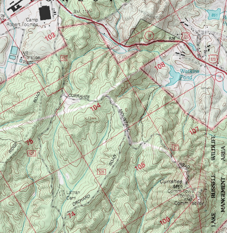
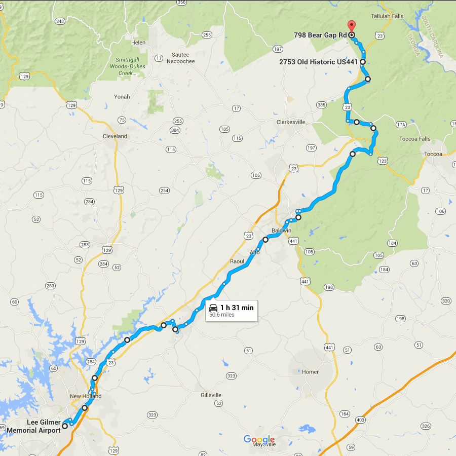
Picking up where the last one left off, this gets you out of the burbs and into the woods. At the northern end, it gets you into the mountains, even.
The route through Gainesville is rather arbitrary and I’m not sure how close it follows the divide.
You are pretty much running parallel to US 23 (when you are not actually on US 23) all the way.
The early parts of this route are very close to Lake Lanier.
From Lula through Mt. Airy, you are running directly beside the Norfolk Southern main line.
I have only been as far north on this route as Alto, so I can’t really say what the remainder of it looks like.
The end point here looks to be about as far as you can follow the ECD on public roads. From here, the ECD turns westward and generally forms the Habersham/Rabun county border until meeting the Tennessee Valley Divide at Young Lick. I don’t see any roads that directly follow this ridge, not even dirt Forest Service roads. From Young Lick, the ECD continues north on the Appalachian Trail. At that point, following the divide becomes more of a matter of hiking than driving.
Start on Aviation Blvd, continue east from last time
Right on GA 60
Left on West Ridge Rd
Right on Athens St
Left on East Ridge Rd
Left on Old Cornelia Highway
Right on US 129
Left on White Sulphur Rd
Left to stay on White Sulphur Rd
Left on Cagle Rd
Right on GA 52
Sharp left on GA 51
Continue onto Main Street (Lula)
Continue onto Gainsville Highway
Continue onto Old Cornelia Highway
Continue onto Willingham Ave
Continue onto Main Street (Cornelia)
Right on Highland Ave
Left to stay on Highland Ave
Continue on Chenocetha Dr
Right on Wyly St
Continue on Dicks Hill Pkwy
Left on Rock Rd
Left on Antioch Church Rd
Right on US 23/US 441
Right on John Wood Rd
Left on Tom Born Rd
Right on Old Historic US 441
Left on The Orchard Rd
Right on Bear Gap Rd


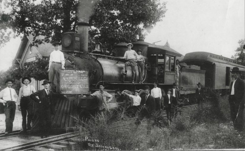

 The final stop was Roswell Station, on the south bank of the Chattahoochee River, just east of the current Roswell Road. There was no means to turn the locomotive around, so it simply ran backwards on its return trip. The train was powered by 0-6-0-arranged Baldwin 1878 steam locomotive named “Buck.”
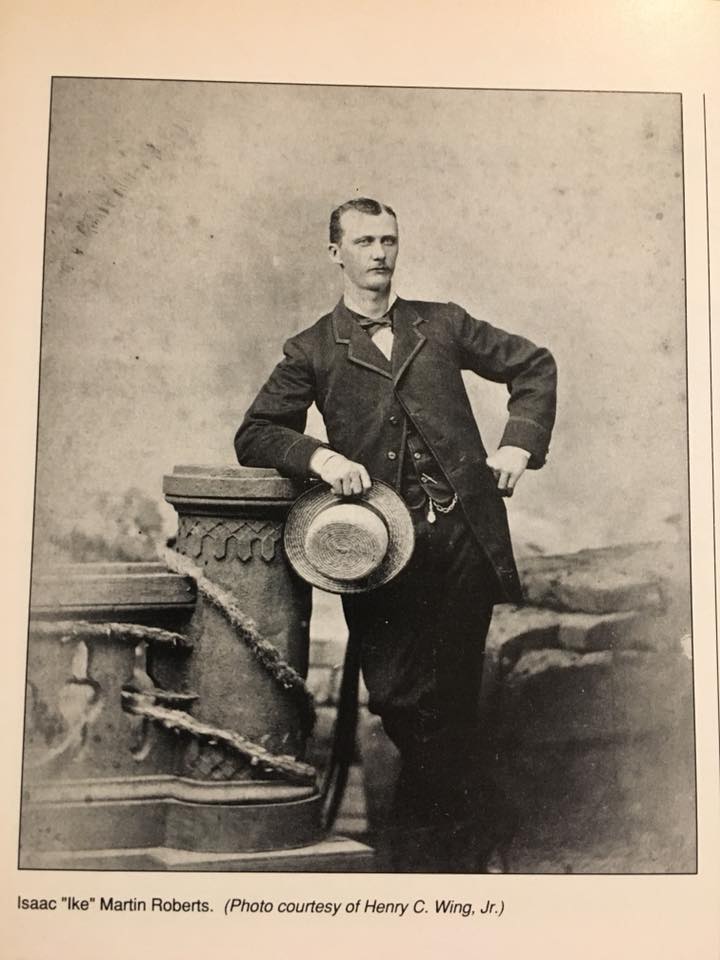


.jpg)
_Rutherford_Yard,_Harrisburg,_PA_on_May_10,_1970_(21829140763).jpg)
.jpg)
_Autotrain,_Sanford,_FL_(22737450251).jpg)
.jpg)