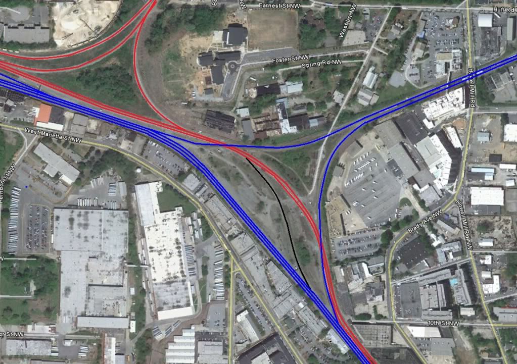
Legend (from original): “CSX lines are red, NS lines are blue, interchange lines are black”
Legend (from original): “CSX lines are red, NS lines are blue, interchange lines are black”
Mr. Plow is a loser and I think he is a boozer, so you better make that call to the Plow King.
King Plow refers both to the King Plow Arts Center and to the NS control point located next to it.
The parking lots of the arts center are ok places to watch trains from, particularly the most northwestern one because it is the only one that is free to park in. I don’t have any photos to post from these parking lots because the fence ruins them, mostly.
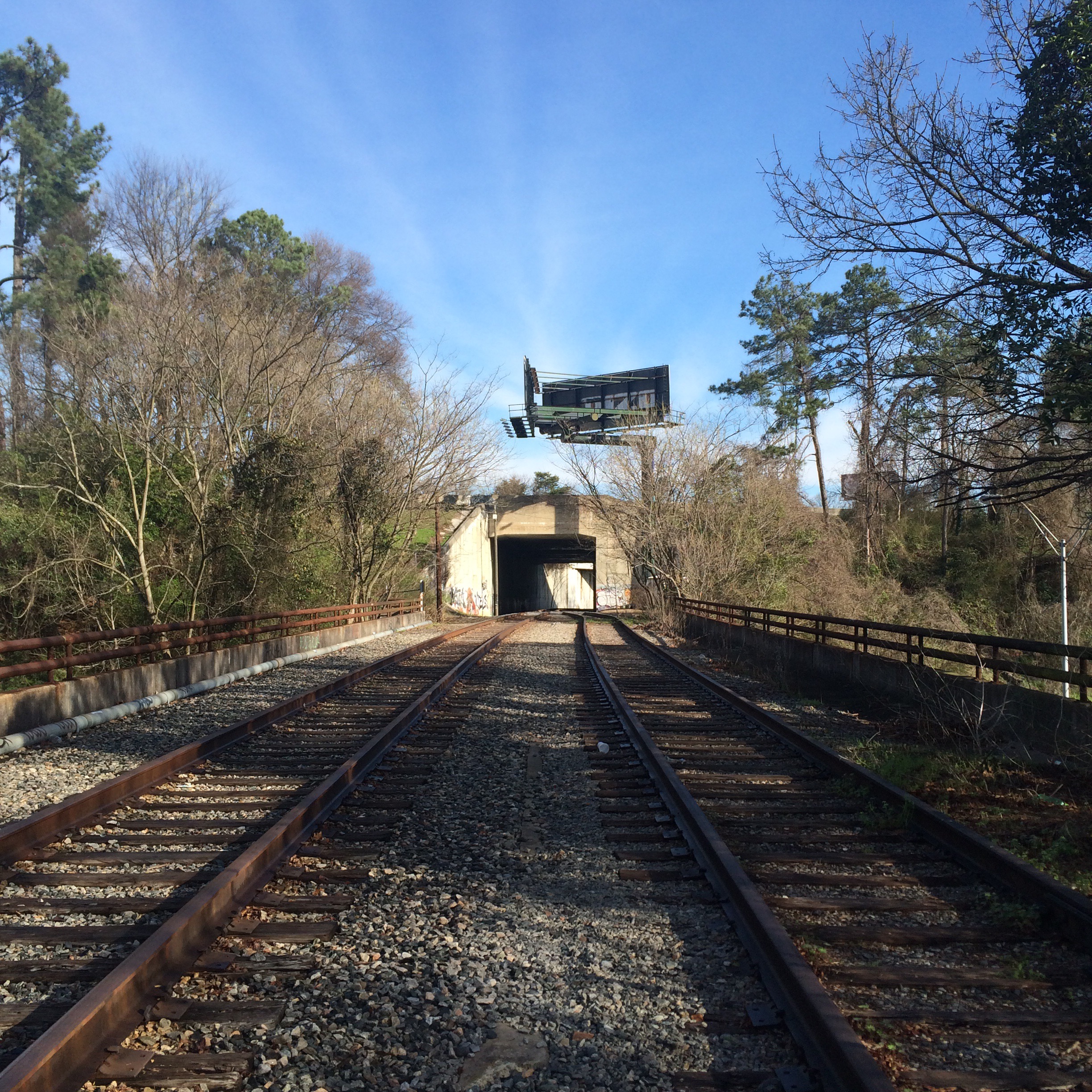
If you feel like getting out your car and walking around you will get much better views from the Marietta Street overpass.
I suggest getting there in the morning if you want to snag a parking space on the street near the bridge. This is a very busy part of town now that it is gentrified.
When looking north, you are looking at part of the large confusing interchange of NS and CSX tracks that is Howell Junction. You can’t see all of it from here. There is no one place to see all of it from. You can see different sides from the aforementioned parking lot, and from the end of Foster Street near the Goat Farm.
(At Foster Street you will be tempted to drive into the middle of the tracks and just park and wait for trains to go by. I have done this without incident, but not particularly lately. I’ve read it is a good way to run afoul of the railroad police. I wash my hands of the matter)
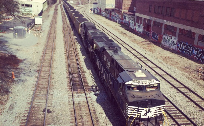
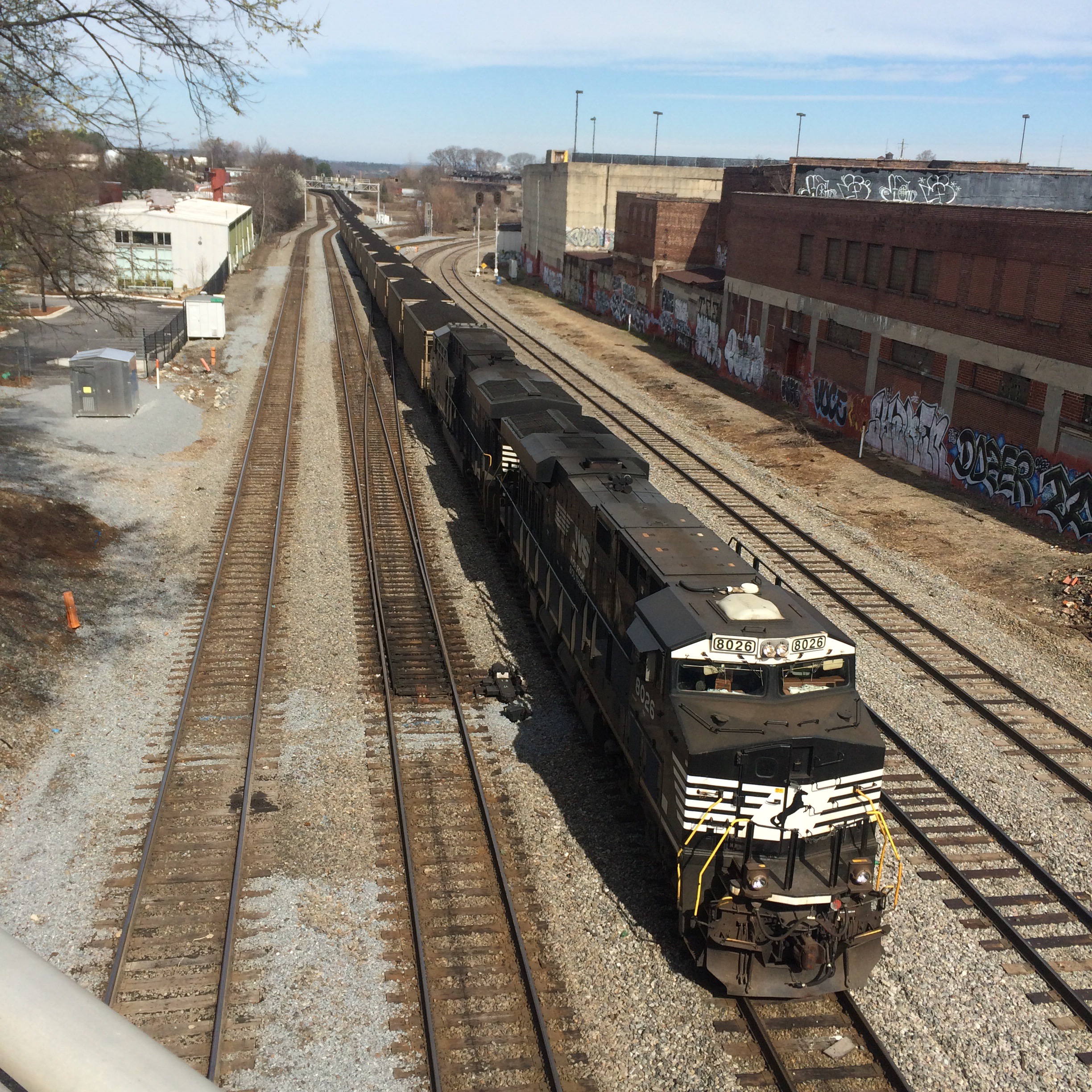
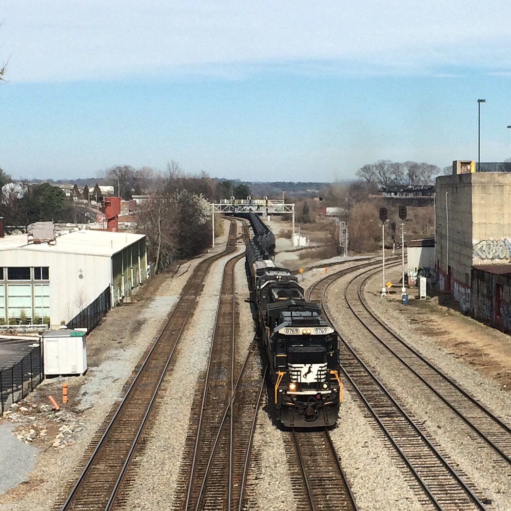
Here are a couple of southbound trains seen from the overpass. One of the two tiny buildings to the left of the tracks bears the actual green “King Plow” sign. Can you see it?
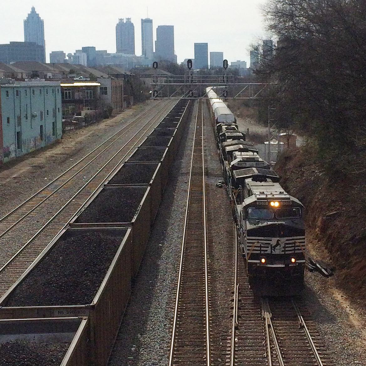
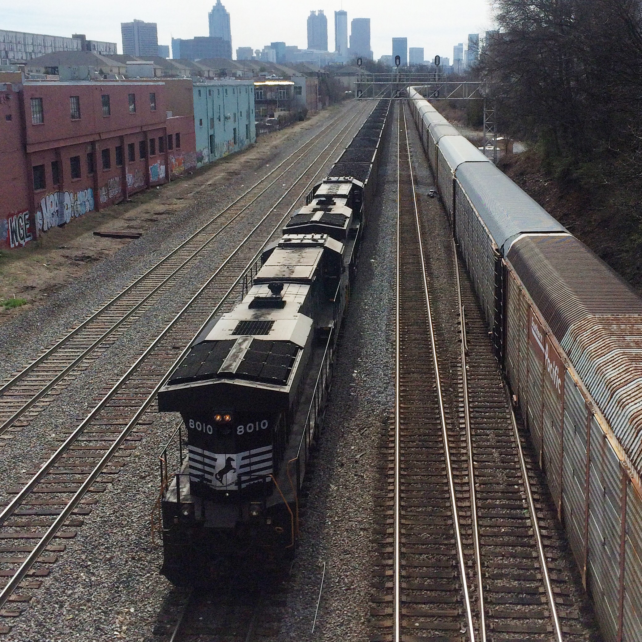
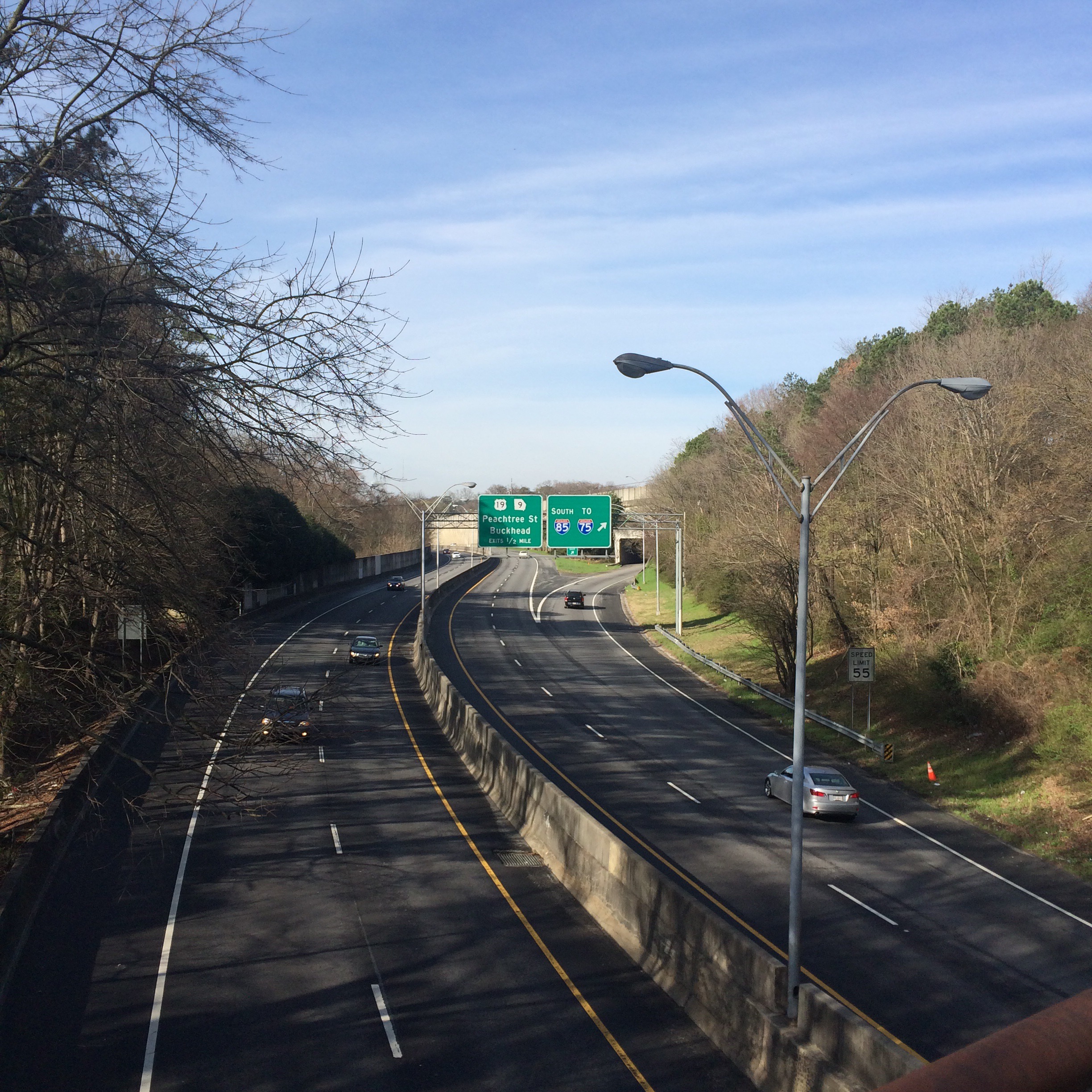
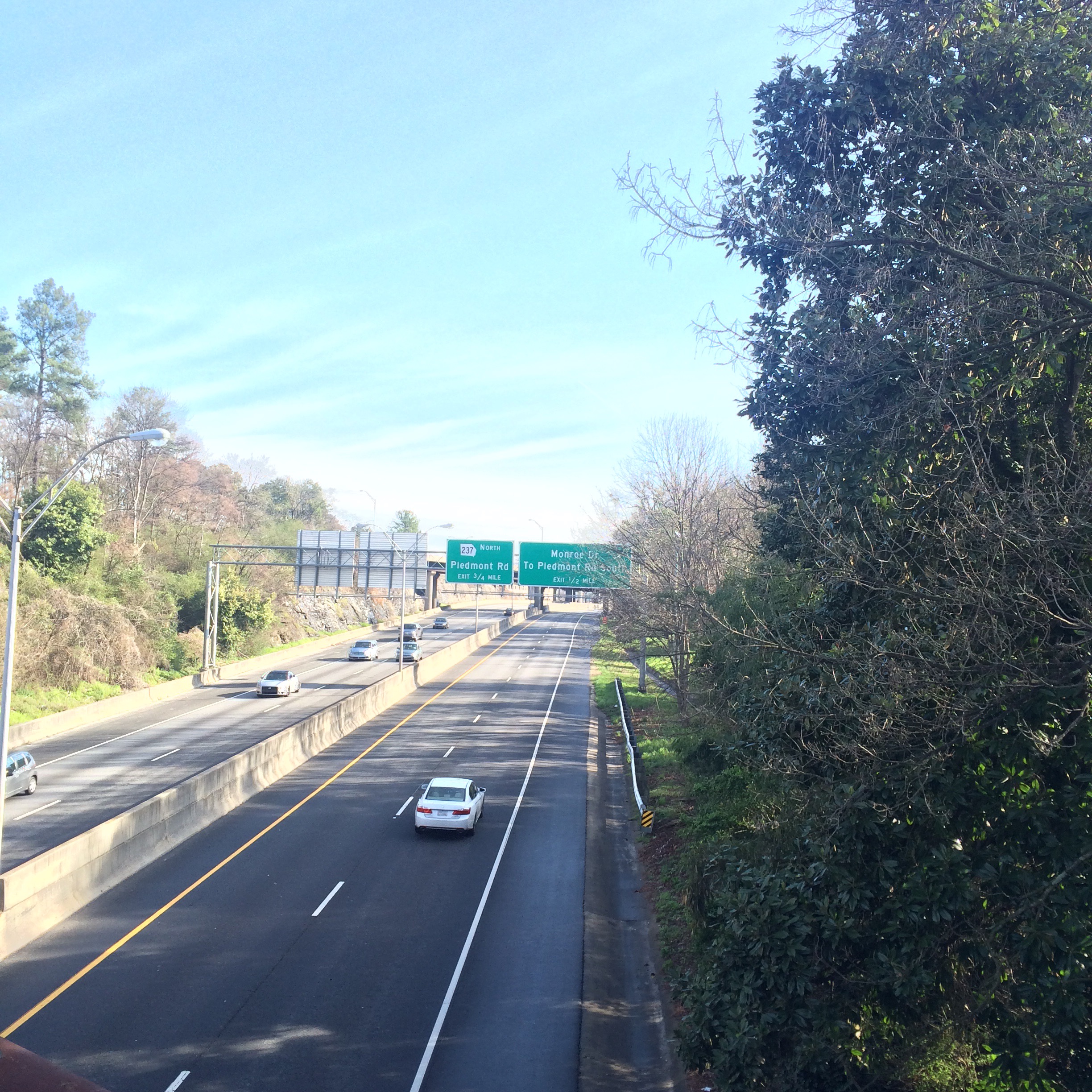
Looking south from here, trains have the downtown Atlanta skyline behind them:
This morning I took a walk on the BeltLine trail from the Ansley Mall access point northward. The northern part of the eastside trail is supposed to be completed in 2015. I figured I had better check out the “default” state of the old railroad before it is fully trailified. Better late than never right?
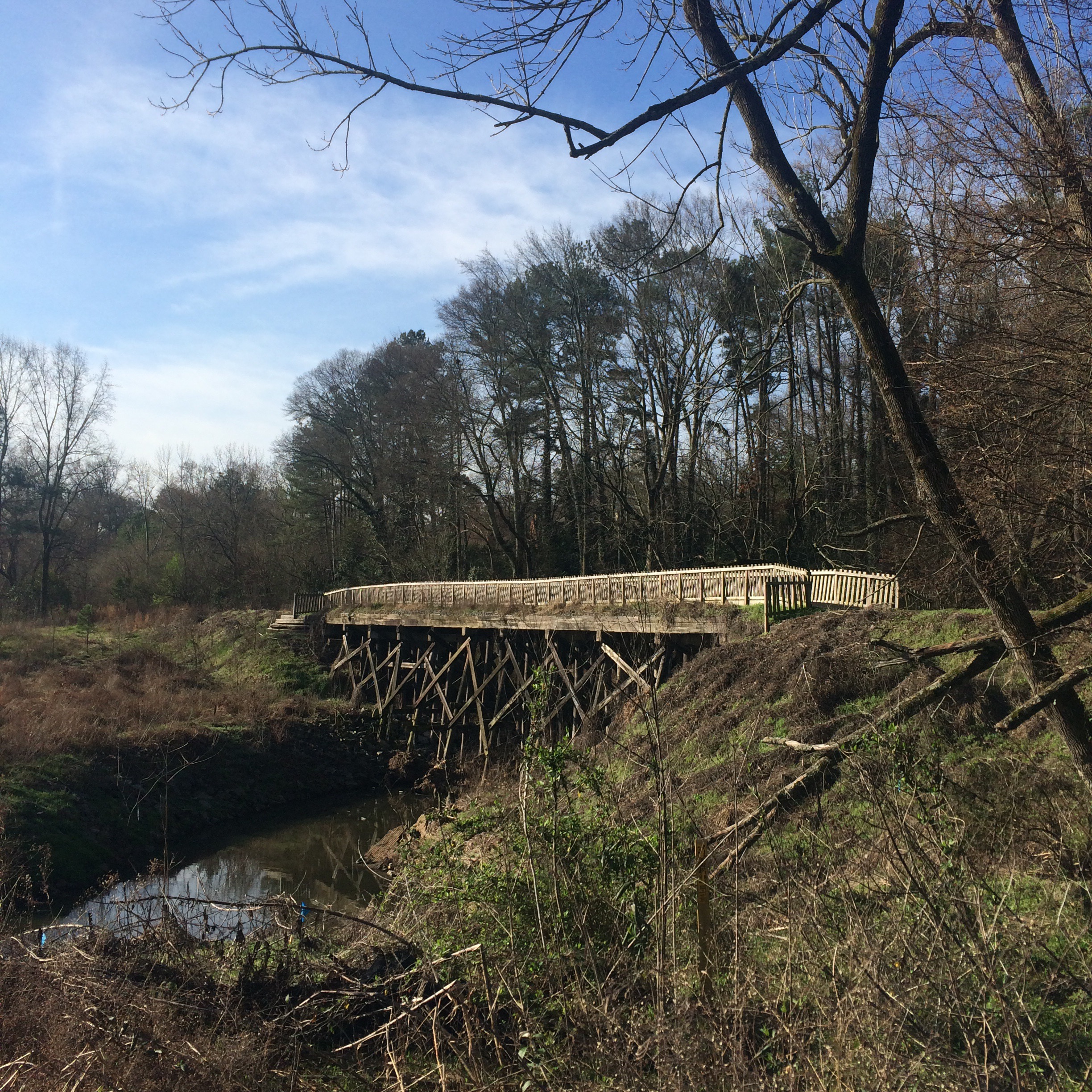
I started at the Publix parking lot, next to this old trestle bridge:
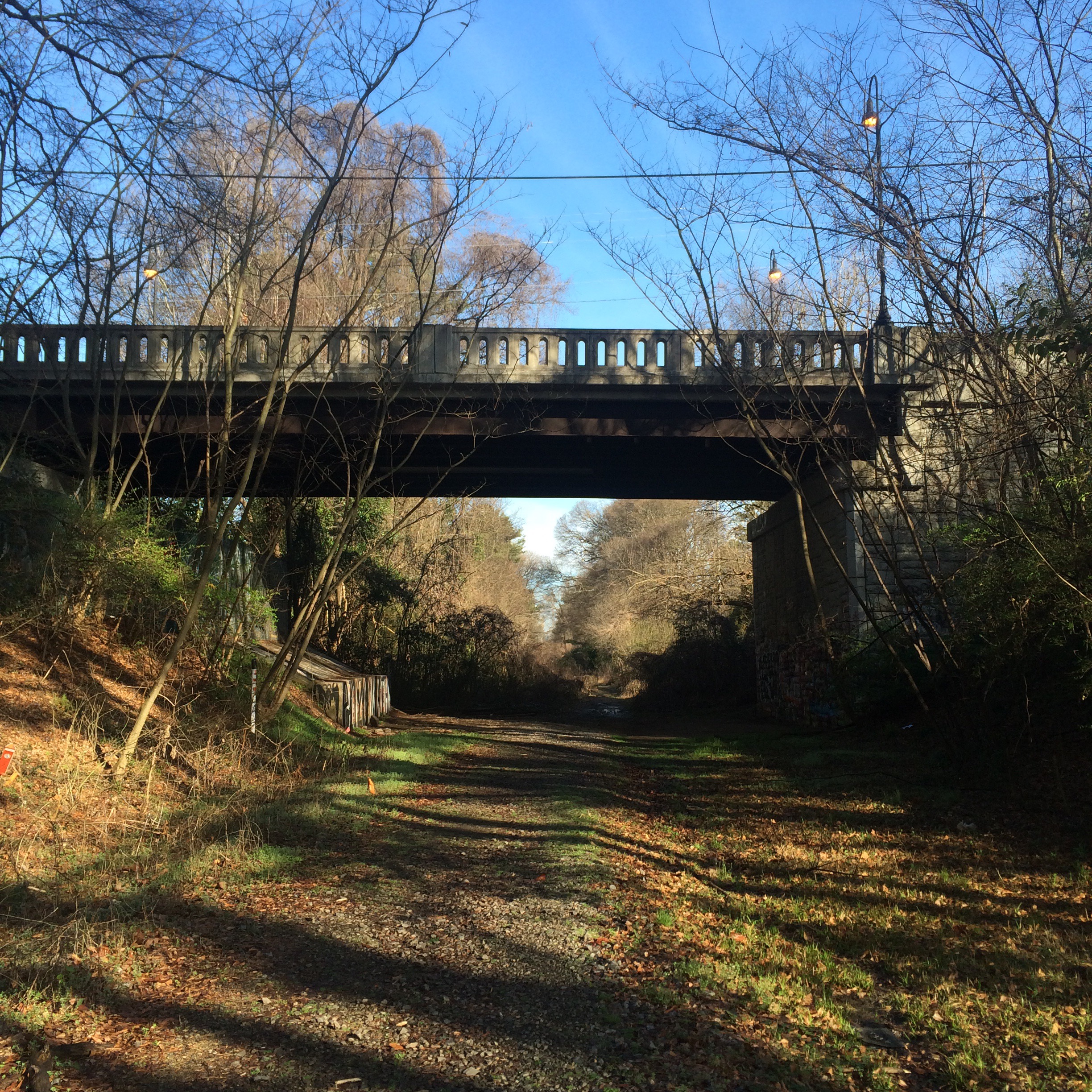
The Montgomery Ferry Rd overpass is pretty much the end of trail-as-such. This is where most of the people biking/running turn around and go back.
Past this point things briefly get muddy. But then you find yourself walking on a railroad.
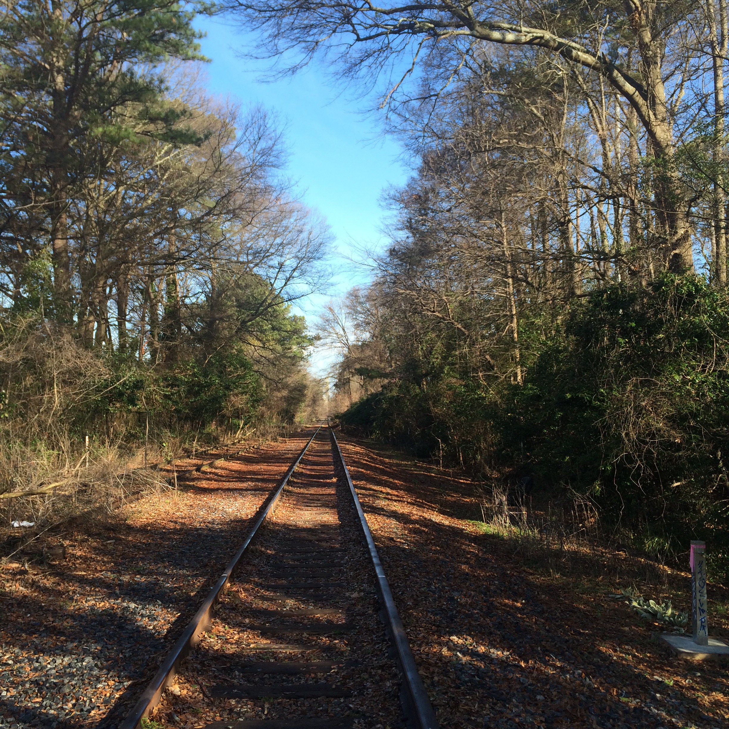
The right hand track (walking north) actually looks semi usable by trains. The other one.. Not so much.
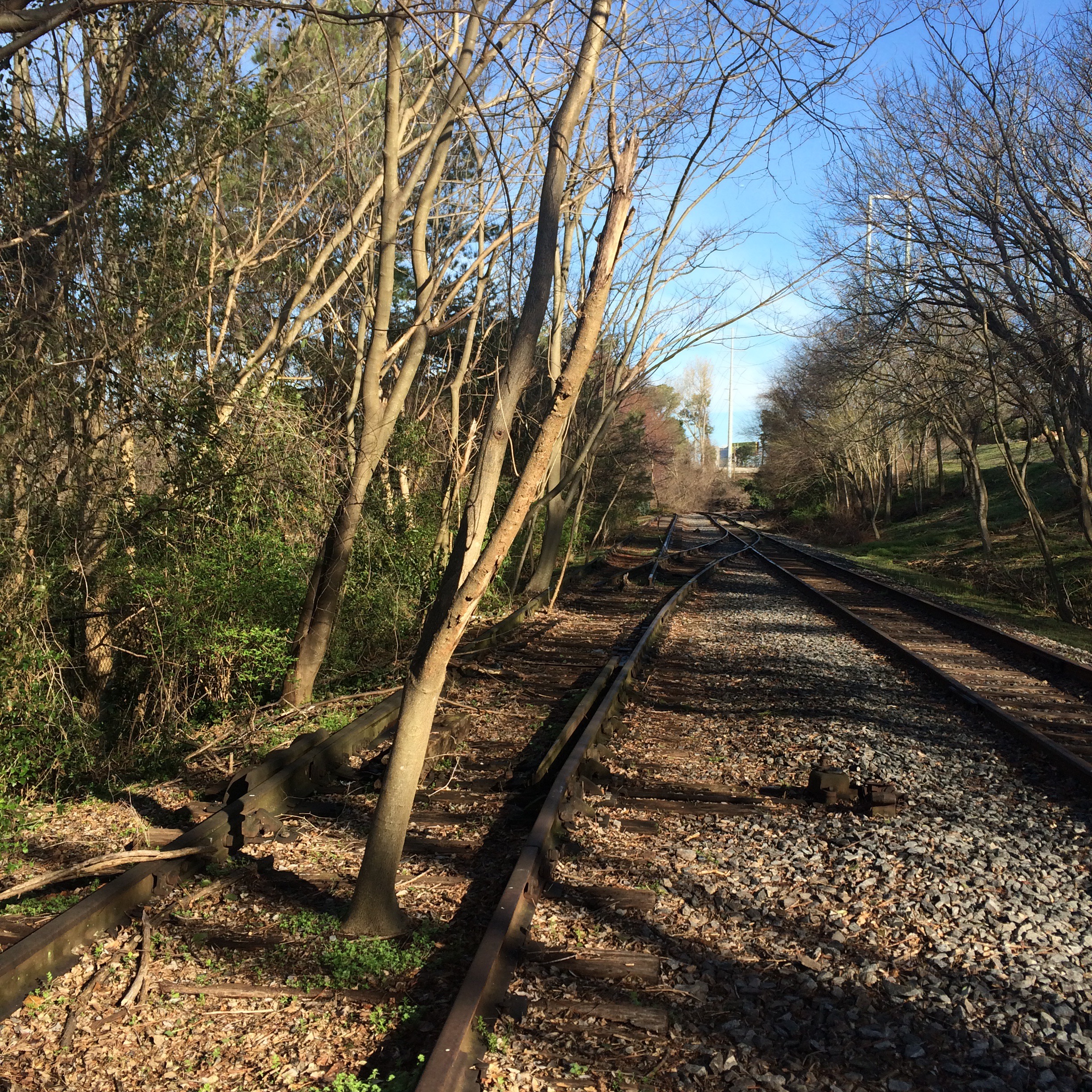
I have no idea if it is the railroad (Norfolk Southern) or the BeltLine organization that keeps this corridor clear of weeds.
The rest of the way north the rail line goes over GA-13, under I-85, and under the MARTA tracks before reaching the NS main line at Armour Yard.


The Bankhead avenue bridge once carried US 78 over the railroad tracks. Now it stops abruptly in mid air.
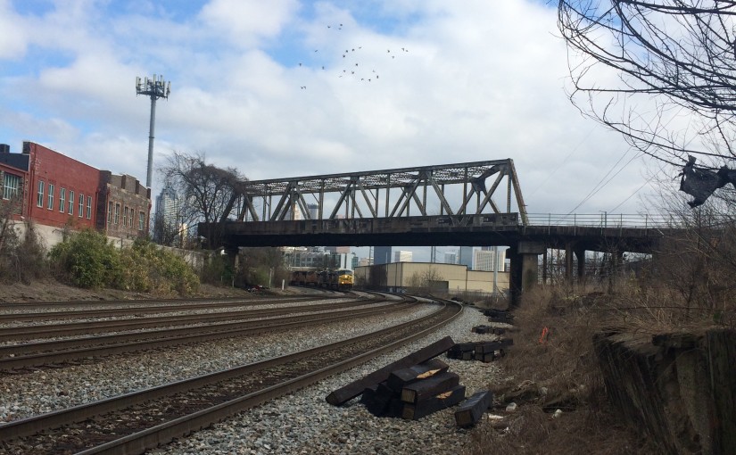
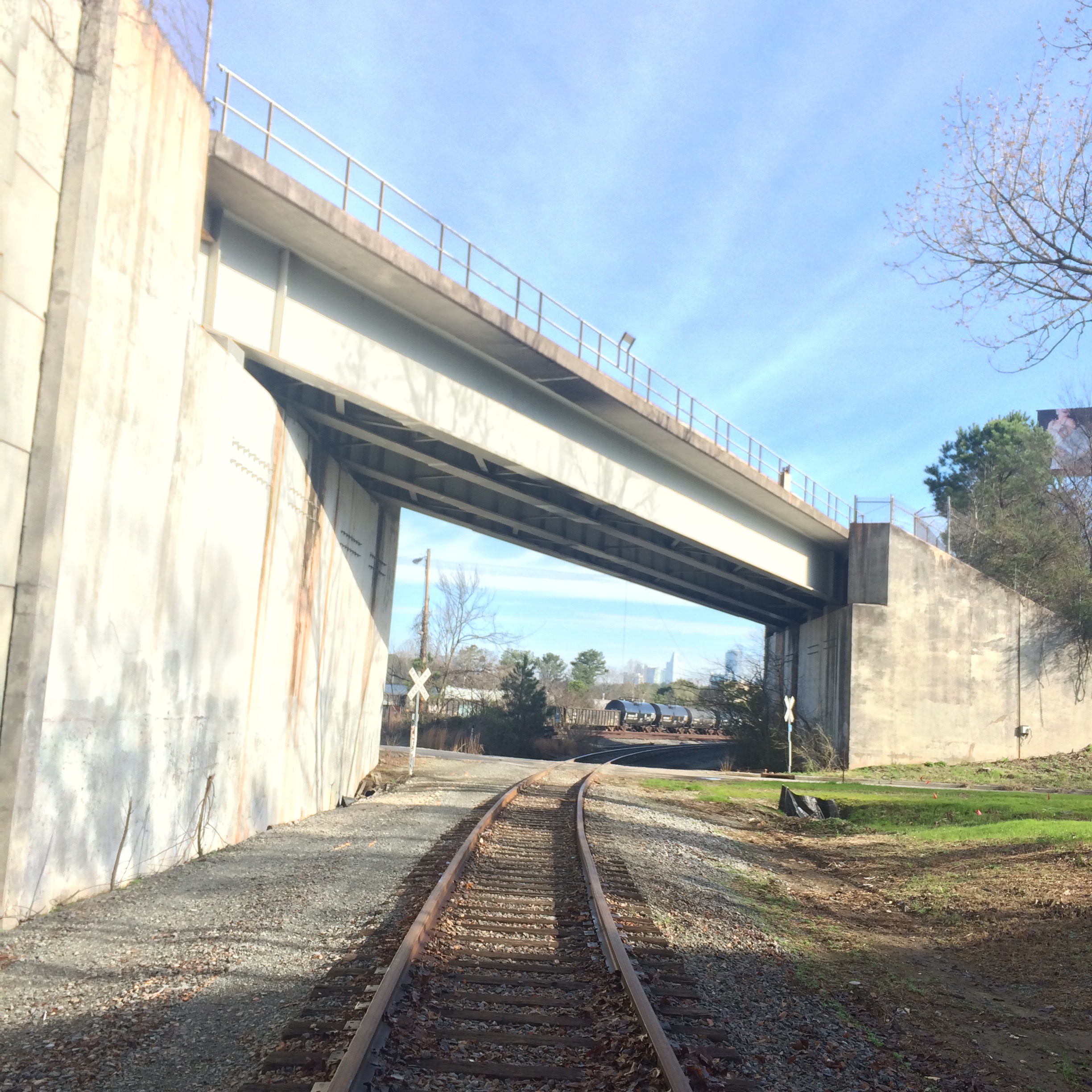
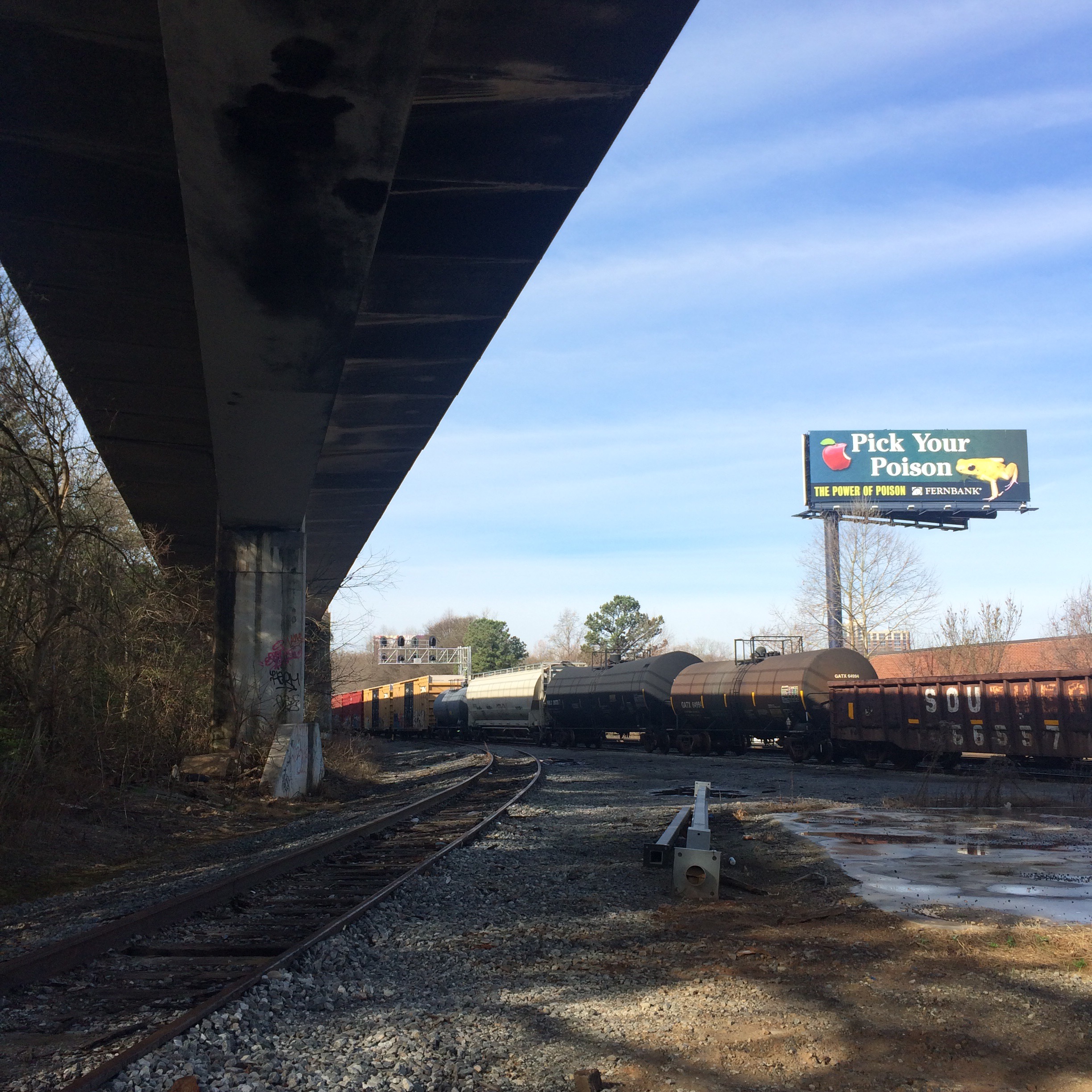
Both NS and CSX pass under here. This set of tracks running parallel to Marietta street between about the King Plow center and the Georgia World Congress Center is a major funnel of train activity, and certainly was already in 1912 when this bridge was built. You can see why they would want to put a bridge over it.
Here are some photos taken on the approach to and on the bridge itself. These were taken a few weeks ago.
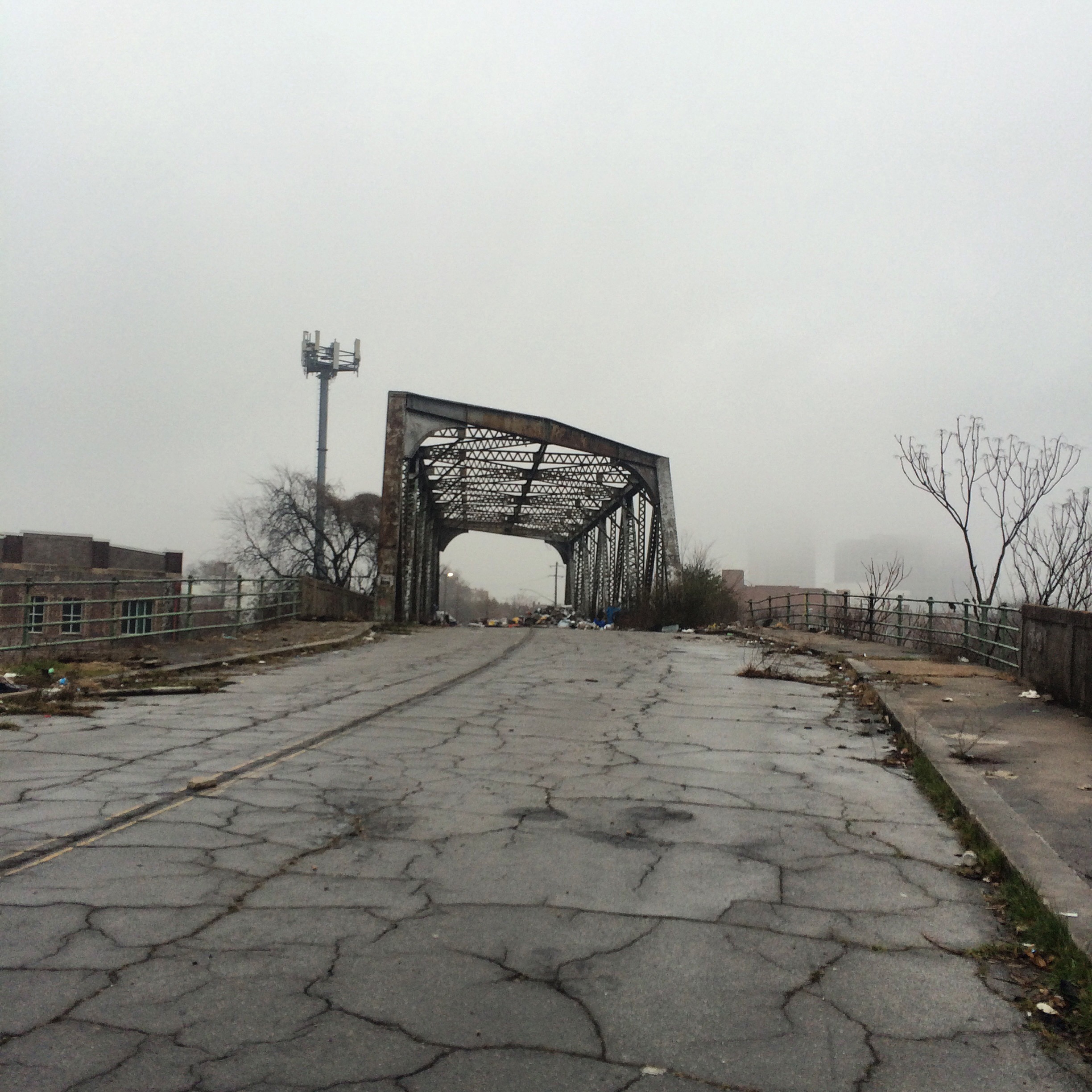

This is an older photo of the end of the bridge, clearly taken at a different time of year. As you can see, it just kind of.. stops. There is nothing to prevent you from just walking off the end of it.
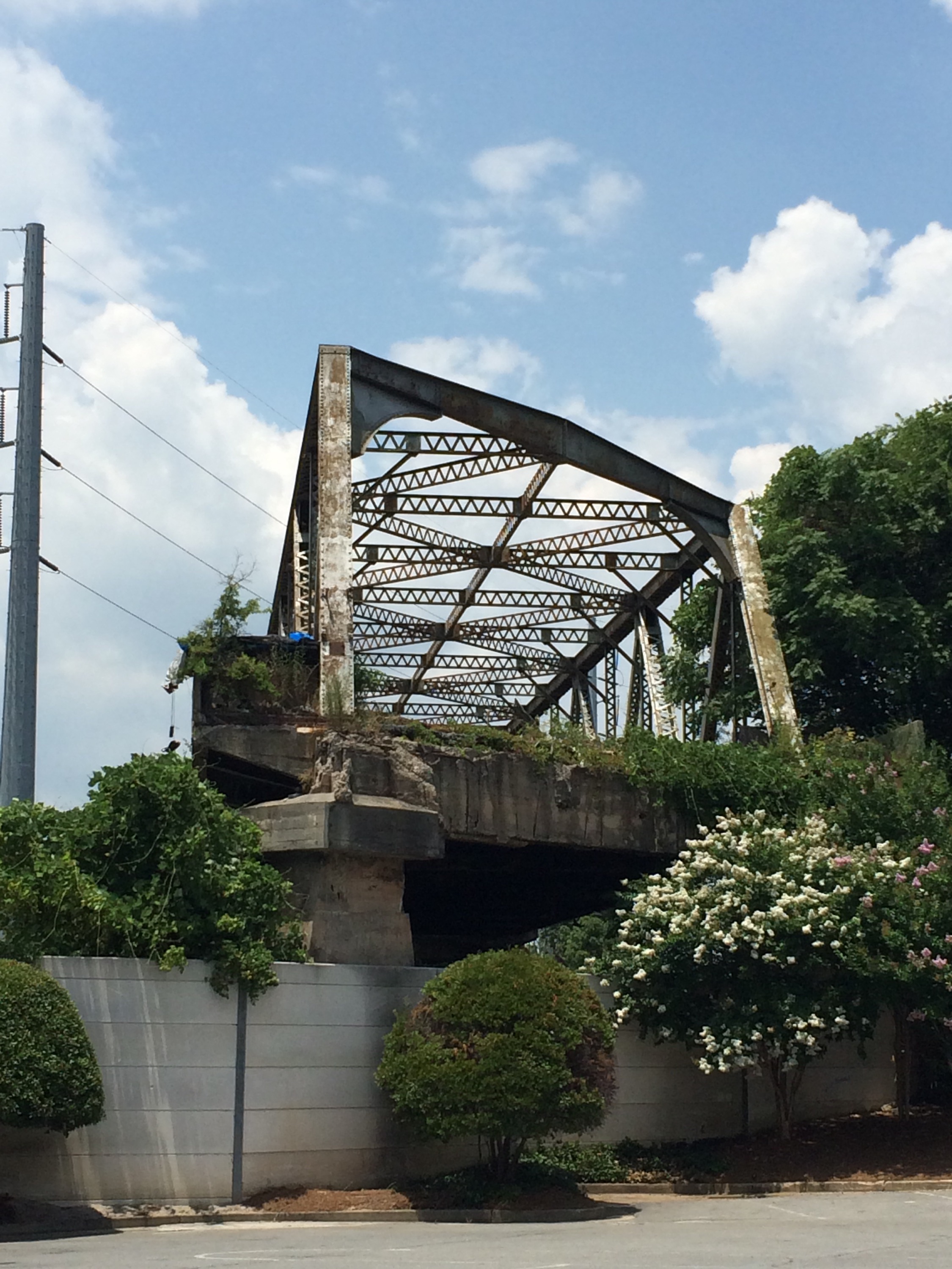
I’m surprised you never see news stories about homeless people falling off of it.
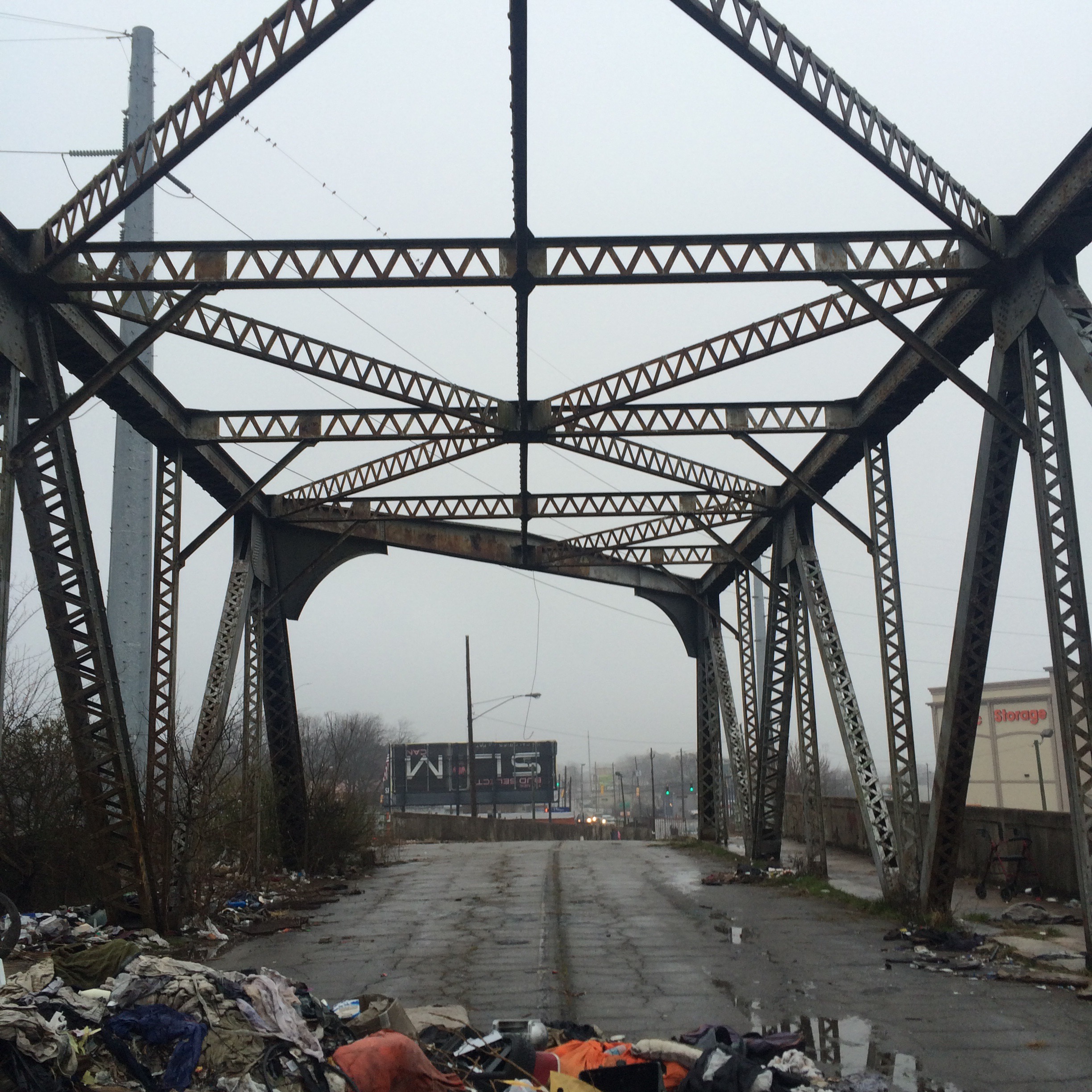
The bridge and tracks under it can easily be observed from the Northside Drive bridge slightly to the north. This is not a bad place to stand waiting for trains, if you can find a place to park. I actually went to the bakery cafe at the corner of Northside and Marietta and bought something so I wouldn’t feel guilty about parking there.

I also went down under the thing to trackside level, to get pictures of trains going under it.
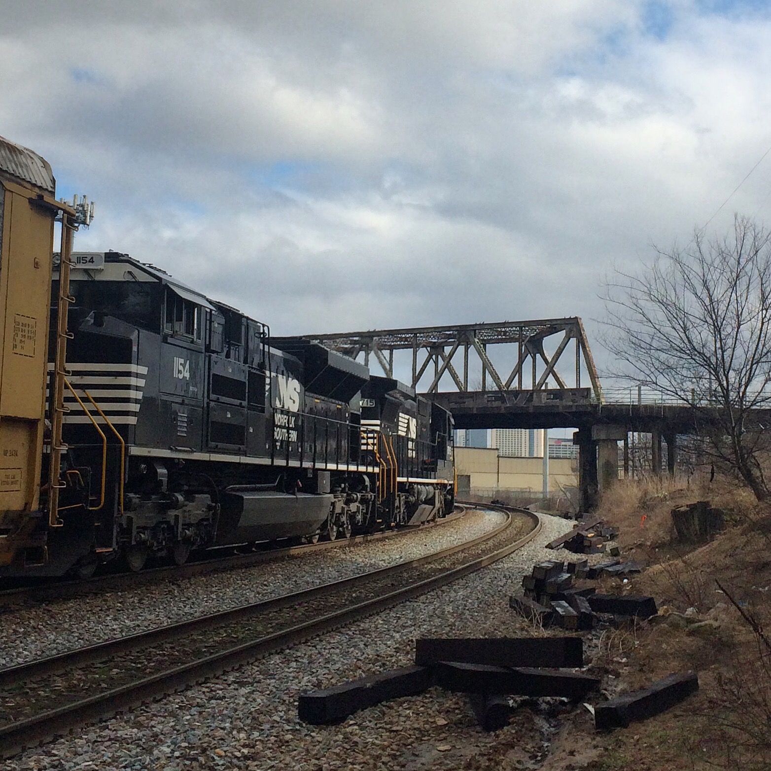
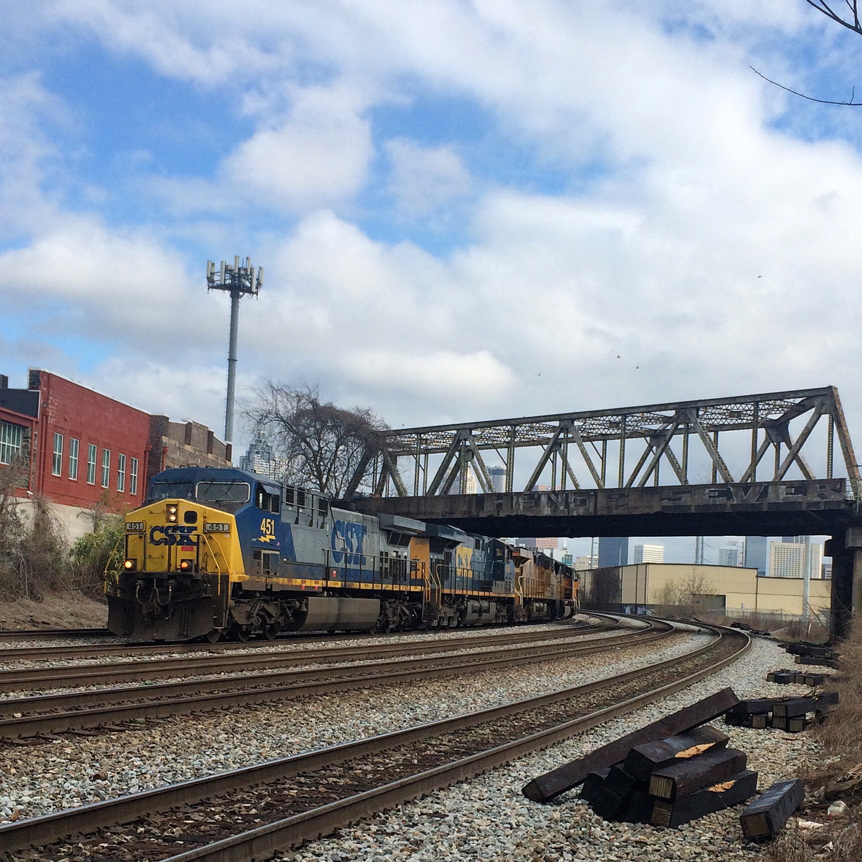
Just to give an idea of train frequency here. The three trains shown were 10 and 5 minutes apart. It had been about 30 minutes since the previous train which was leaving just as I arrived. I would expect this pattern to hold at most times of day.
Atlanta was not built at a natural seaport (like Savannah) or at the head of navigation of a major river (like Macon and Augusta). Atlanta is near the Chattahoochee river, but is not actually centered on it, and is also much too far upstream for steamship navigation.
No, Atlanta was built as a railroad junction. You probably knew that. But what you may not know is that some of the oldest railroad lines, and some of the oldest roads, were built on top of the Eastern Continental Divide. This is the boundary that divides the rivers that drain to the Gulf of Mexico from those that drain eastward to the Atlantic.
There are good reasons why roads and railroads would be built on top of a natural watershed boundary. They avoid they need for bridges over streams, since by definitions the boundary lies between all the streams. They avoid low, swampy areas where early roads would get bogged down. The ridge can provide a relatively consistent elevation at the expense of being a bit twisty. “Ridgeways” have been in use worldwide for a long time. There is a trail in England called The Ridgeway which is over 5000 years old.
The ECD is not much remarked upon in Atlanta, mostly because it is a very gentle boundary. Atlanta is not mountainous. The ECD twists around through gently rolling hills. Because so many roads were built near it, you can drive through the city on it, and you get no sense of being on top of any kind of ridge. So most people don’t actually know it even exists, much less where it runs.
It is supposed to be a common belief that Peachtree Street runs along the ECD, but this is only true of a short section which was formerly called Whitehall Street. The main portion of Peachtree Street has little to do with the ECD.
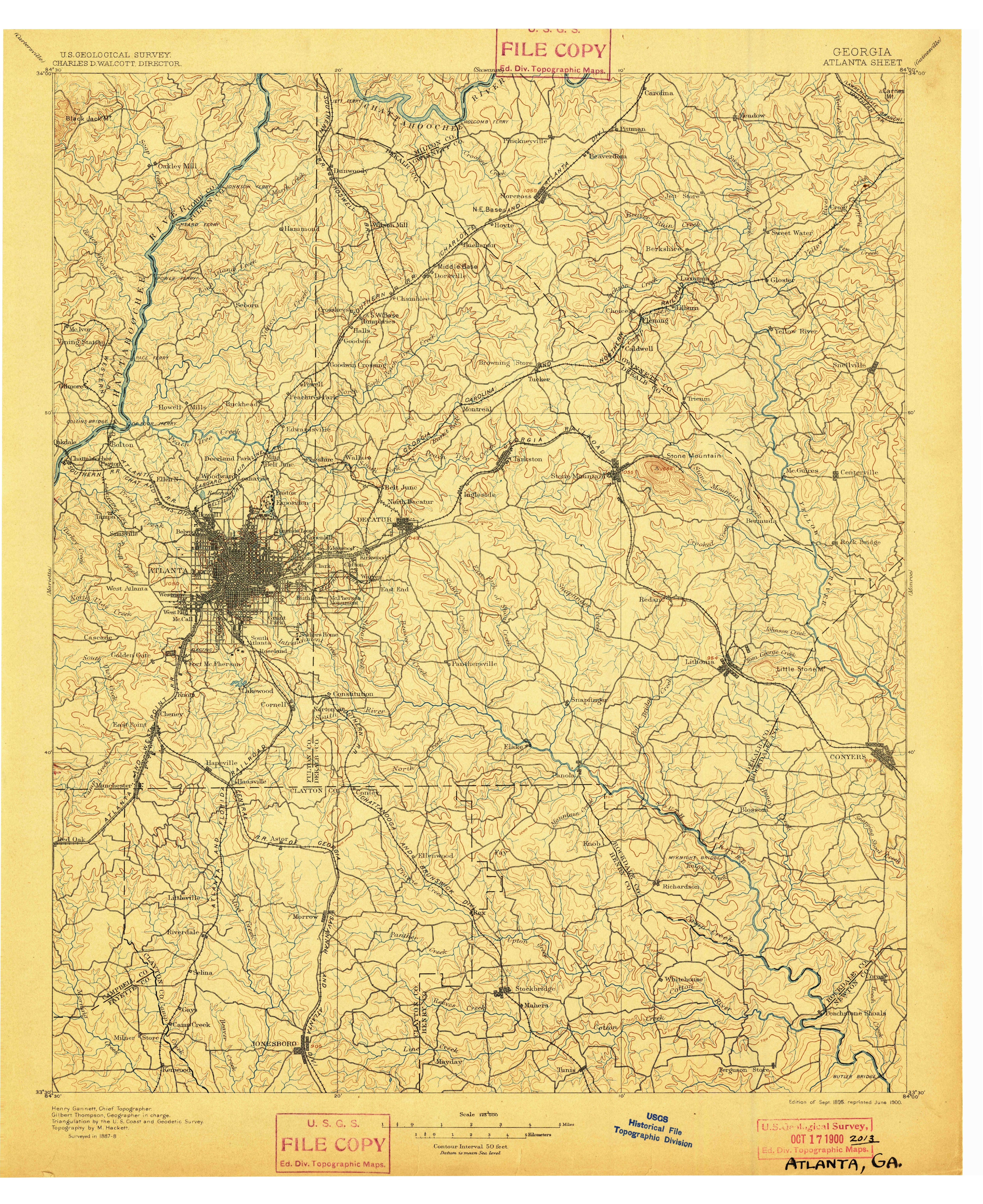
I could not resist taking the 1895 topo map and adding a red line that vaguely approximates the ECD. The map gives a mostly unobstructed view of the contours and streams, so the divide almost jumps out on its own. Click on this thumbnail to get the whole map.
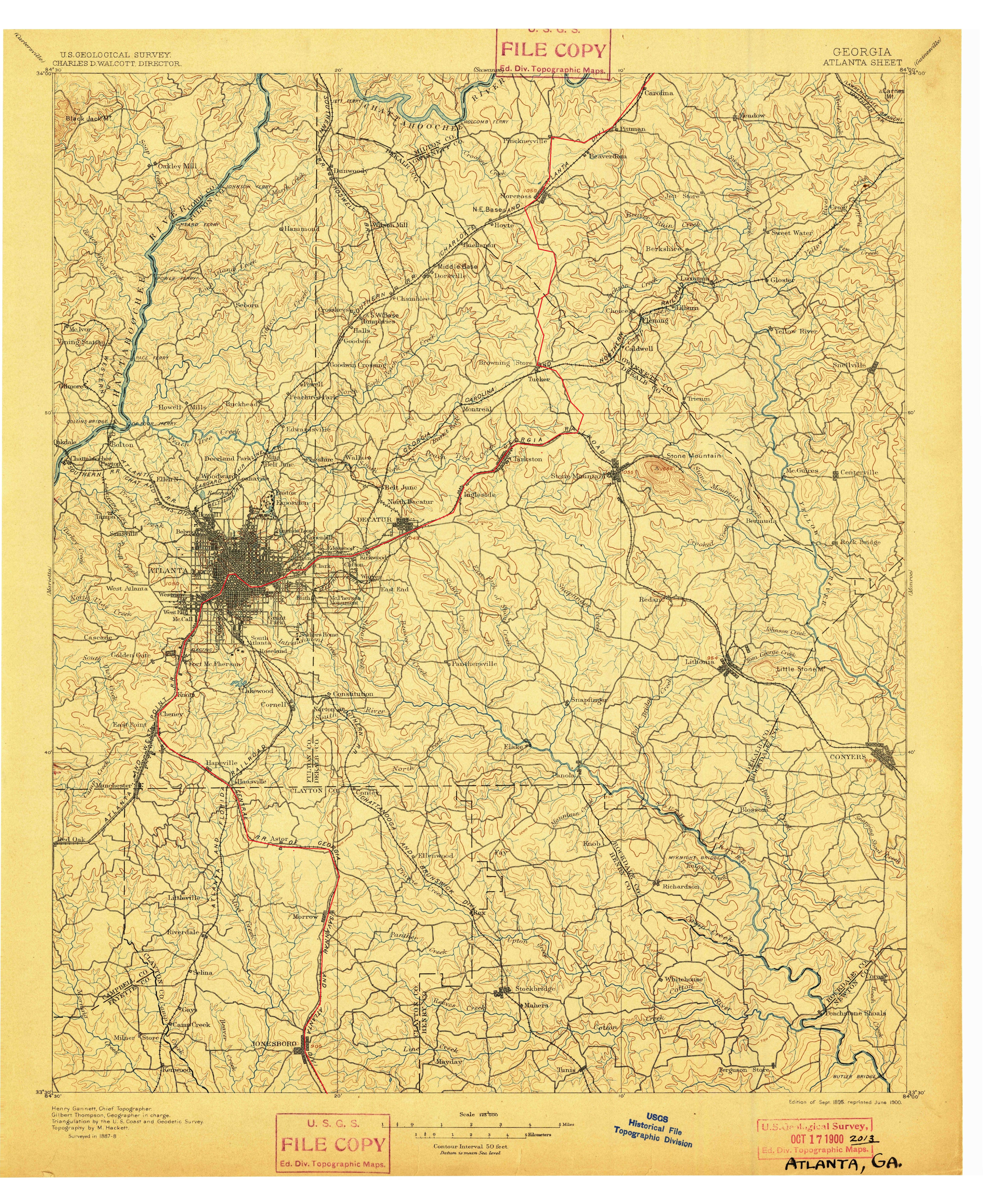
So many towns are centered on this invisible line. Jonesboro, Morrow, Hapeville, East Point, Atlanta, Decatur, Clarkston, Tucker, Norcross.
As you can see on the full map, the divide is actually not that far from the Chattahoochee. In fact you can see all the way from one side of the Chattahoochee’s drainage area to the other on this map.
This image from Wikipedia shows the entire Chattahoochee, Flint, and Apalachicola river system. The yellow area is that drained by these rivers.
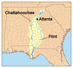
Notice how narrow this drainage area is upstream from Atlanta. That is our water supply. All of the city’s (and several surrounding counties’) water comes from rain that falls on that small yellow area. This is why Atlanta’s water supply is threatened by drought every few years.
This is the Suwanee quadrangle which includes Roswell, Alpharetta, Cumming, Duluth, etc. This is the companion to the Atlanta quad posted earlier.
Click the thumbnail to expand.
Lake Lanier, a portion of which should be present here, was not impounded until 1956.
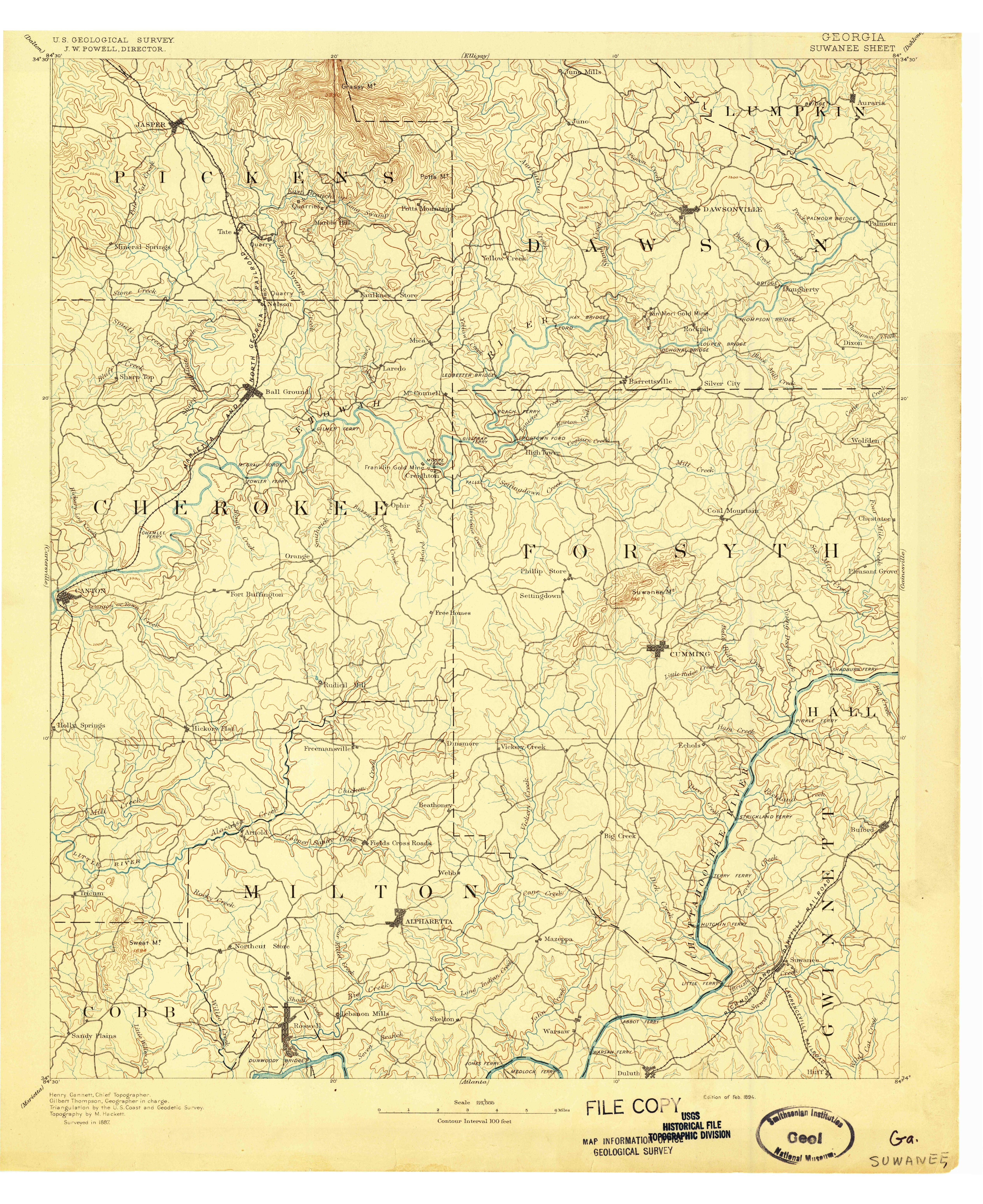
Another gem from the USGS store.
This thumbnail shows the long-abandoned Roswell Branch of the Southern Railway where it joins the main line in Chamblee. Click to get a much larger map covering a much larger area.
Notice that most of the Chattahoochee are still ferries on this map, rather than bridges. Holcomb Ferry is located more or less where Holcomb Bridge road is now, and so are the others.
The Eastern Continental Divide is rather easier to see on this map than on a modern map, if you know where to look.
Screenshot of part of a PDF downloaded from the USGS map store. Click to enlarge.
Notice an additional rail line crossing the L&N, that I forgot to include on my map that I made with MS paint. This was the electric street railway. I have since edited that map to show it.

I know they all connect into a single system, I mean is there one city or area that is directly served by all seven of them.
Looking at their route maps on all their wikipedia pages (and also using this), I actually don’t think there is. The closest you get is Chicago which has every railroad except KCS (the closest it gets is Springfield), and New Orleans which has everything except Canadian Pacific (which doesn’t come any further south than Kansas City).
So the answer to the question is no, they don’t.
But a drive around the Midwest would probably allow you to see all seven in one day. Hmm…
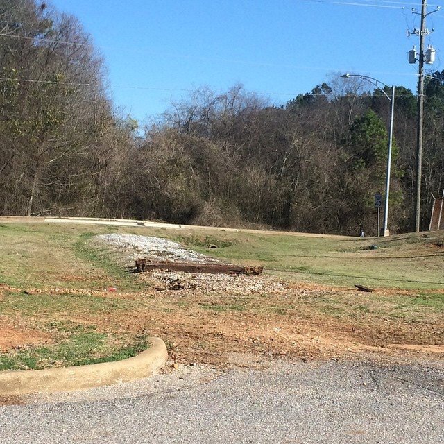
The explanation I tried to give about the abandoned tracks in Tuscaloosa in my last post probably makes more sense if you look at this map. Click the map to enlarge it.
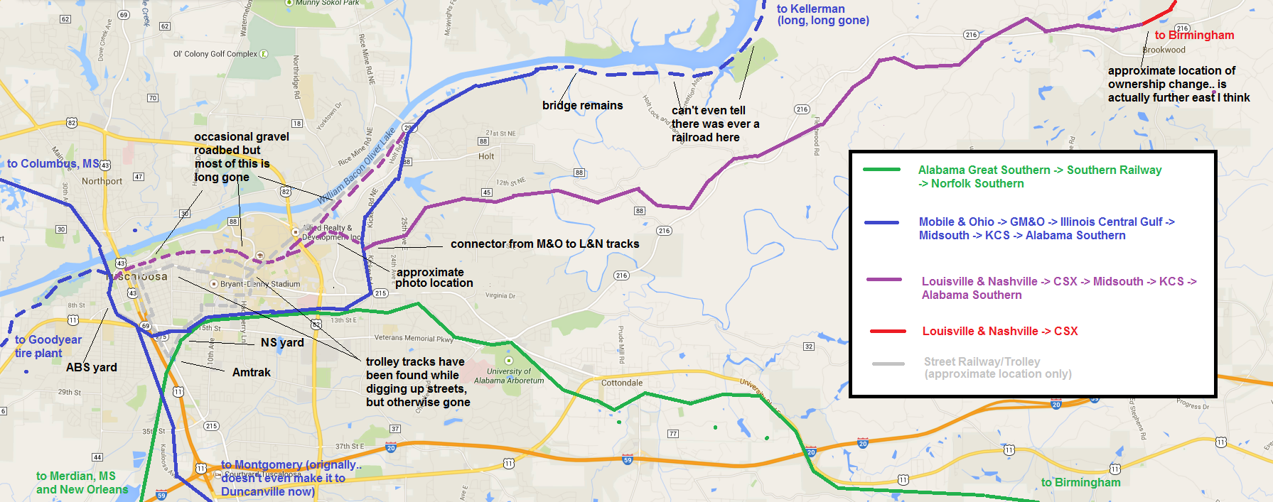
For reference, this is the photo of the “approximate photo location”:
The main reference for the location of the street railway is here.