More Birmingham

When I said “it’s almost like it was designed by a railfan”, that may or may not literally be the case, but the downtown street grid was planned around a “railroad reservation”, as Birmingham was laid out in the 1870s at the height of railroad importance.

As the “Birmingham Wiki” says:

The Railroad Reservation is a plot of land, 1000 feet wide by 4,780 feet long in the center of Birmingham‘s street grid, set aside in William Barker‘s original plat of the city for use by the railroads and related industries.

The tracks within the railroad reservation remain active today, giving people in Birmingham a rare opportunity to engage in trainspotting or benching in the midst of the downtown core.

This “bird’s eye view” drawing from 1885 shows the area around Sloss Furnace. Just look at those happy little trains. The railroad lines are recognizable. The train nearest the top of the picture is on what would now be the CSX, the middle train is on the NS, and the bottom train is on a segment of track that no longer exists but is continuous with the extant Alabama and Tennessee River. Most of the land is still empty, but the street grid is already laid out.

That image is from Birmingham Rails, which has a lot of interesting maps and other images if you follow the links.

What follows is a smattering of pictures taken at various places around the city.

NS SD40-2 on the north side of town with an obviously ex-BN green one with spraypainted change of ownership:

IMG_5219

(null)

The tail end of a CSX train passing over Graces Gap, which is where northbound trains cross over Red Mountain into Birmingham proper. This train has already passed the CSX control point called “Grace’s”, which is slightly south.

(null)

Caught the lead ES44AC of another train from the same overpass:

(null)

I managed to beat that train downtown, and catch it again from the parking lot of Carrigan’s Public House.

IMG_5264.JPG

A different CSX train, this one showing the contrast between the “Bright Future” and “Dark Future” (fan nickname) paint schemes:

(null)

UP power on NS, taken down under the Richard Arrington Blvd bridge.

(null)

Downtown Birmingham Railfanning

Downtown Birmingham is not only better-preserved than downtown Atlanta, it is also much easier to watch trains. It’s almost like they let a railfan design the place.

bham

Viaducts

Birmingham has its own equivalent of Atlanta’s “gulch”, sort of. NS and CSX run right beside each other through the very center of town. Both railroads are double-track, and there are additional sidings and such, so a fairly wide path through downtown is devoted to rail.

Birmingham’s downtown street grid is (as in Atlanta) grade-separated from the railroads, except that in Birmingham many of the surface streets go under the tracks rather than uniformly over. The freeways and a few surface roads go over the tracks on viaducts that provide a good view of the trains below.

Birmingham has not built any structures completely over the top of the tracks, as Atlanta has. Therefore the view from the viaducts relatively unobstructed.

The bridges on 22nd street and Richard Arrington Blvd (which occupies the place of “21st” street in the grid) have curbside parking spaces on the bridge, so you can pull your car over right in the middle and stand next to it waiting for trains to come by.

You shouldn’t have to wait long, because these viaducts span main lines of both NS and CSX. (Birmingham’s other Class 1, BNSF, is a topic for another day)

The 24th street viaduct provides no such parking, and the sidewalk is only on one side of the road, so it is not as good as the others.

This is a view looking southwest from the Arrington Avenue viaduct. To the right of the tracks in the distance you can see the platforms of the Amtrak station. These two photos show two trains that went by in rapid succession, you can see the end of the first train still in the second picture.

IMG_5072.JPG

IMG_5089

This is looking northeast from the same place (and same train). Mountains loom ominously on the horizon.

IMG_5091

Some blatantly “instagrammed” pictures of the same trains. You can see the Sloss Furnaces pretty clearly in the background of these.

IMG_5092

IMG_5075

Sloss Furnaces

Speaking of which, before getting back to the rail pictures, let’s throw in a few of the Sloss site itself. If you don’t look at these and say “I want to go to there“, then I don’t really understand how you like trains either.

IMG_5103

IMG_5099

IMG_5096

IMG_5097

27th Street Interlocking

As shown on the map above, this is a major intersection of NS and CSX lines. In spite of its name, it not directly viewable from 27th Street. I got a good view of it from the extreme western end of the Sloss property.

The shortline Alabama and Tennessee River also comes into play here, but I saw no sign of their trains.

“Emergency release instructions” for both roads :

IMG_5169

An NS train is about to cross the double CSX tracks, with the downtown skyline in the background.

IMG_5119

A train approaches on the CSX with a BNSF unit in the lead:

IMG_5141

The Crescent train 19:

IMG_5166

Anoether NS train waits under the 1st Avenue North viaduct before proceeding. The viaduct itself might have provided a good overhead view of all this stuff, had I managed to find a place to park near its approach.

IMG_5168

Railroad Park

At the other end (southwest) of the downtown corridor shared by NS and CSX, lies Railroad Park. It is a nice park, but I think if you are really out just to see trains rather, then you will get a better view from the viaducts.

IMG_5181

IMG_5182

 Easy Livin’ in Irondale

These last were not taken in downtown Birmingham at all, but out in the suburb of Irondale where the NS tracks enter Norris Yard. Here these is a covered wooden platform beside the tracks with benches and picnic tables, so you can just sit in the shade and relax as the trains roll by.

I did drive around Norris as much as possible without entering obvious NS property, but I didn’t really feel like stopping anywhere to take pictures, so these are all taken from the platform. The sun was pretty low by this point, as can be seen in these pictures.

IMG_5200 IMG_5204  IMG_5209 IMG_5210


The free railroad map website you probably don’t know about

Courtesy of the Federal Railroad Administration:

http://fragis.frasafety.net/GISFRASafety/

Found by David Kudrav.

You can zoom and search and do all the stuff you are used to being able to do with an online map. You can see main lines (color coded by railroad), mileposts, station names, Amtrak, and even individual markers for each railroad crossing.

It mostly doesn’t bother to show sidings, branch lines, etc.

The station names are a bit.. off. Just in my area, almost all of them are  at slightly different mileposts than the railroads’ timetables have, and some of the ones on the map appear to have been derived from a source other than the current timetable. I’m guessing the database they are pulling these from is not particularly up to date, and the railroads have moved them around and renamed them? Either that or they’ve just got bad data.We have found both situations where a line is shown without its mileposts, and also situations where the mileposts appear without the actual line they are on. (Mobile, AL has a notable case of the latter)But still, it’s the only free online thing I’ve seen that shows railroad mileposts on a reasonably accurate map.

More on the Nelson Street Bridge

According to bridge hunter, the bridge was built in 1906 has been closed to traffic because it is “structurally deficient”.

The west side of this bridge connects with the Castleberry Hill neighborhood. An earlier wooden bridge in the same spot may have been the first such overpass in the city, predating the massive number of viaducts and buildings over the tracks that since defined downtown Atlanta.

A bit of reading of local news articles suggests that the city intended to tear this bridge down after completing renovations/rebuilding of the nearby Mitchell Street. But that was finished in 2012, and here we are three years later and the old bridge is still standing, in use by pedestrians if not by vehicles.

The elephant in the room when discussing the future of this part of Atlanta is whether or not the Multi-Modal Passenger Terminal will ever be built as planned. If the MMPT happens, say goodbye to this whole area as depicted in these photos. These bridges would all be replaced by street-level parks and plazas completely burying the railroad tracks, making it that much harder to watch trains. (If there was a political action committee to promote railfan-friendly architecture and urban planning, I’d give money to it..)

Of course having a big fancy new train station would be fun too, but.. whether or not it’s ever going to happen is a big “if”.

Amtrak doesn’t want to have to run their trains down there because it’s not actually on their route. The freight railroads don’t want passenger trains running down there because they have enough trains already. Considering that commuter rail has been “coming” for the entire 15 years I’ve been in Atlanta, I don’t see any of this happening any time soon, so we may have the urban decay aesthetic to enjoy a while longer.


Atlanta railfanning locations, part 1: Spring

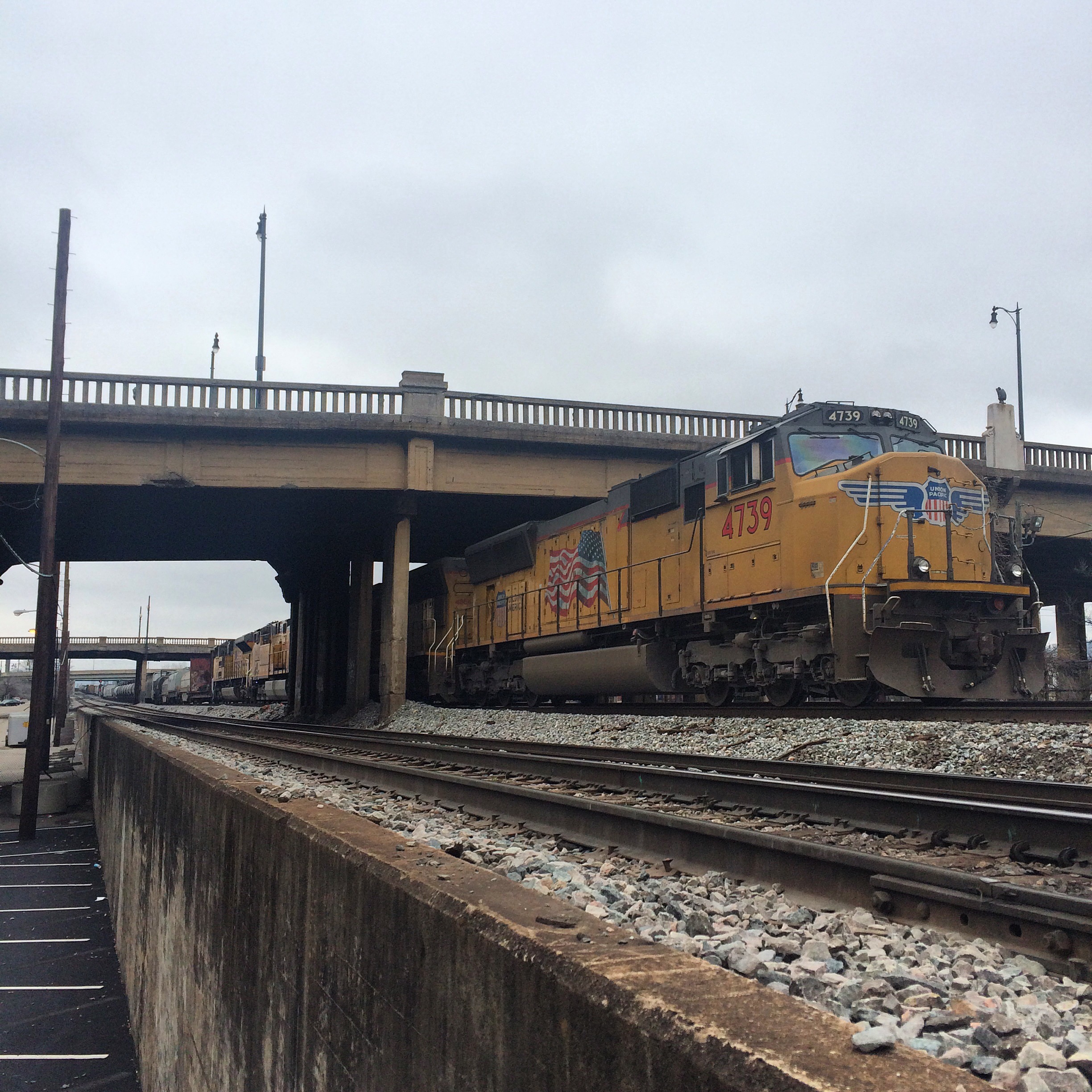
Those of you who remember me as a foamer in college would be surprised at this, but I’ve been quite lax in the train watching hobby for a while. The last time, until recently, that I regularly out with a scanner looking for trains was in the early 2000s when I worked in midtown. With basically no economic development west of the Connector back then to create traffic, I would use my lunch break to zip over to Inman and Tilford yards, Howell junction, the Marietta artery, sometimes all the way downtown. Or all the way west to the Chattahoochee.

I moved locations, I got busy with other stuff, I gave my last scanner away to some wacky college kids (ahem).

Only in 2014, when I started to make the trek to public outdoor shooting ranges (a subject for a different post) and subsequently started exploring the lesser known rural highways of Georgia did I feel the rails calling again.

So in 2015 I have purchased a new scanner and am refamiliarizing myself with where one can get close to the tracks. This is not always easy in a city that grows as rapidly as Atlanta.

Locations where you can get a good view of trains, with nearby parking, and without having to trespass (much) are not as common as one would like. So this is a series of posts describing places to see trains.

If anything below is incorrect, please someone point it out.

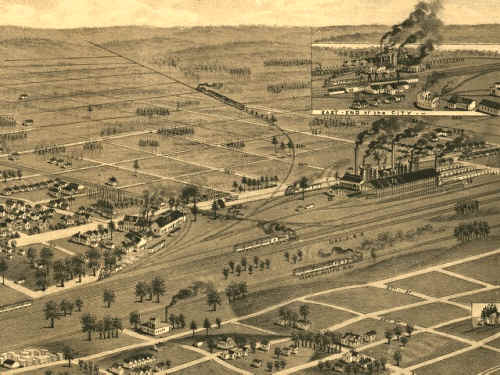
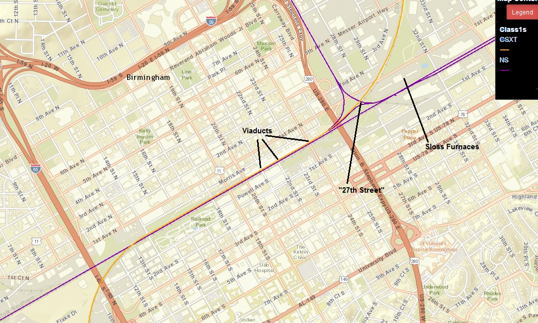
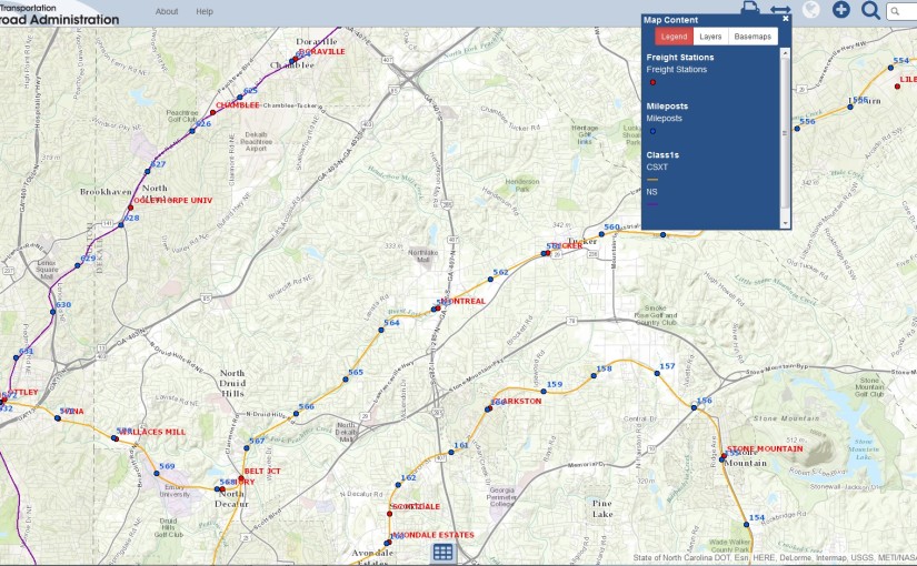
Before beginning, here is a general overview of the Atlanta area so I don’t have to write one myself.


Spring Street Norfolk Southern Building and surroundings

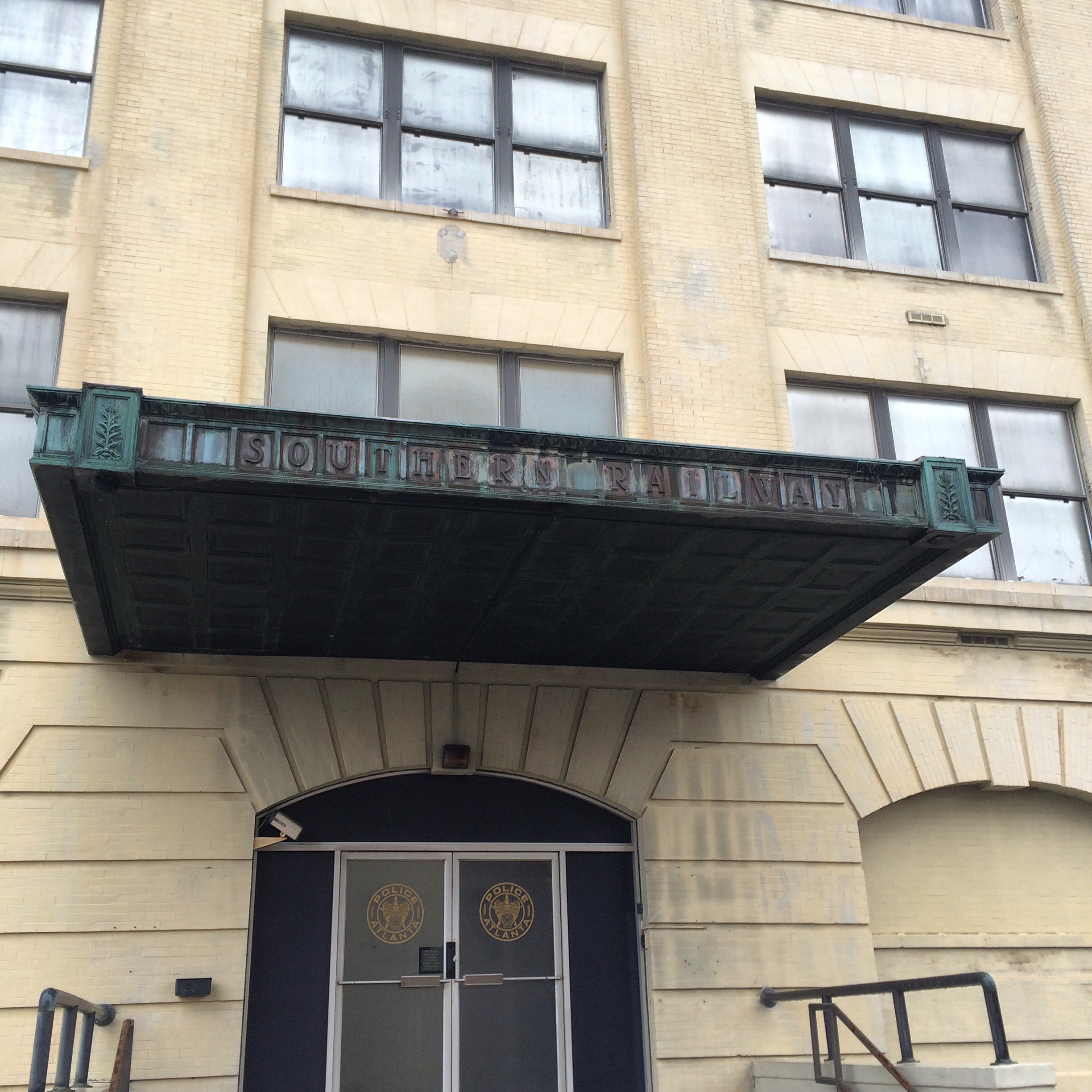
The former Southern Railway building (actually collection of interconnected buildings) downtown on Spring Street has been vacated since the mid-2000s, when Norfolk Southern moved their Atlanta offices to midtown on Peachtree Street. As far as I am aware it has not been sold and is still owned by the railroad, although one of the entrances I saw has the Atlanta police logo on it, I do not believe it is actually owned by the city.

The building has been used as a filming location for The Walking Dead. The bridge that crosses the tracks here is the bridge that Rick rode over on horseback in the first (or a very early) episode. The roof of one of the buildings was the setting for some important scenes early in the first season. I have not watched the show past the 2nd season so I do not know if they returned here or not. There is a nearby tour bus business called “Atlanta movie tours” that I think is focused on TWD fandom.

The nominal location for at least one NS building is “125 Spring Street Southwest, 30303“.

There are parking spaces in front of the building itself, but they bear prominent “you gonna get towed” signs. I am not sure how long you could get away with ignoring them. There is pay parking across Spring Street,  but it is probably not worth it.

Nelson Street passes through the buildings, and crosses the railroad tracks behind on an elevated overpass. This overpass has been relegated to pedestrian only traffic, and when you walk on it you will immediately see why, the pavement is in bad shape and there are cracks that you can see through all the way down. You should probably be able to find free on-street parking on the other side of the bridge.. unless there is a major event going on at Phillips Arena or the Georgia Dome, in which case you are just screwed for parking and you should go watch trains someplace else.

A good location to plug into Apple/Google mapping apps to get directions to a street you might actually be able park on is Smoke Ring BBQ, at 309 Nelson St SW, 30313.

Three MARTA stations are nearby, as seen on the map. The Garnett Station formerly announced “Norfolk Southern” was one of the destinations at that stop.

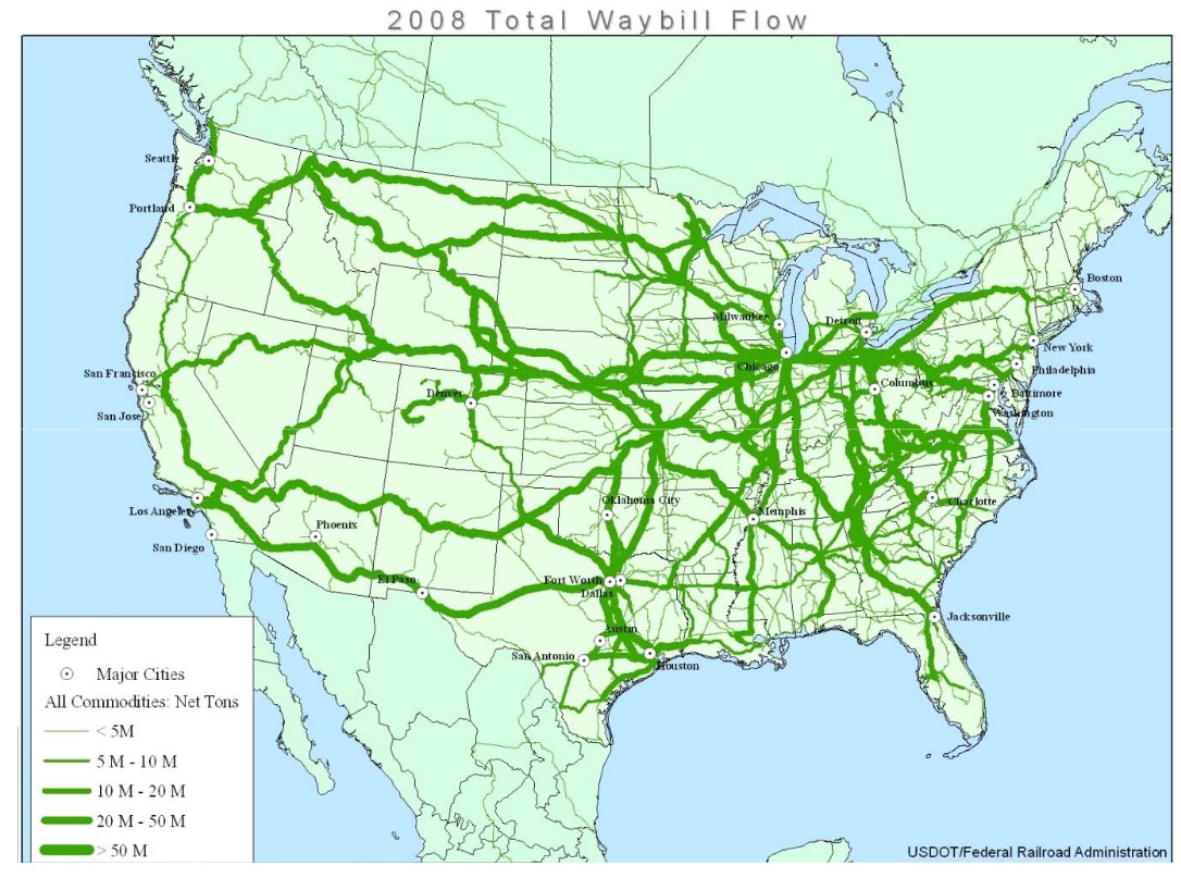
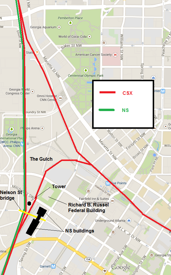
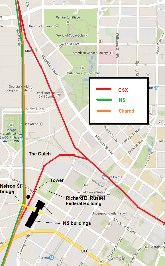
Both NS and CSX trains pass by here. This location is marked as “Spring” in both the NS and CSX employee timetables. Atlanta is too complex to have a single bottleneck point for all trains, but this spot sees a lot of them. Here is a sloppily annotated and somewhat inaccurate map that I made showing the major rail lines in the immediate vicinity:


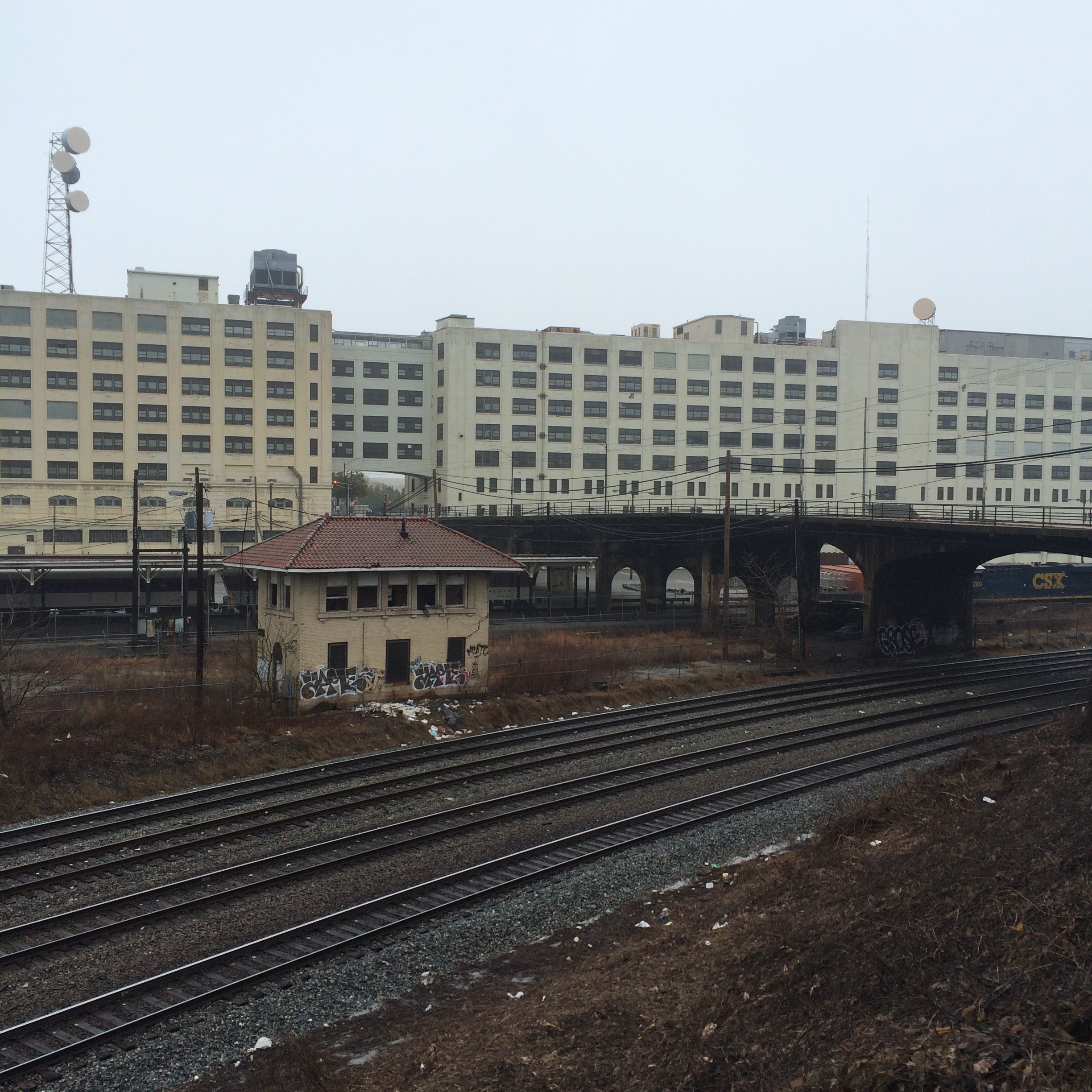
The first photo here is a view of the “back” of the building from across the railroad tracks. The bridge shown is the pedestrian Nelson Street.

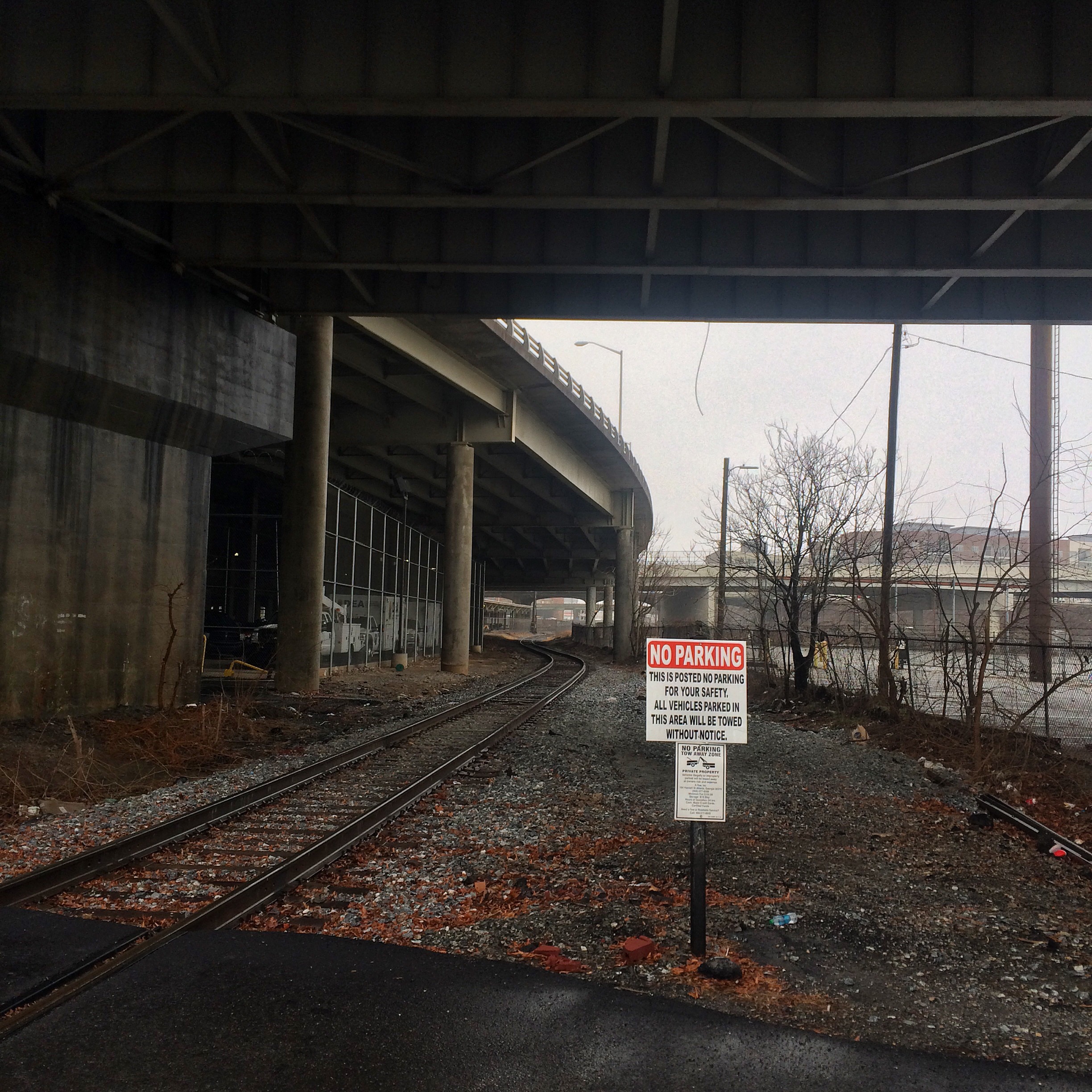
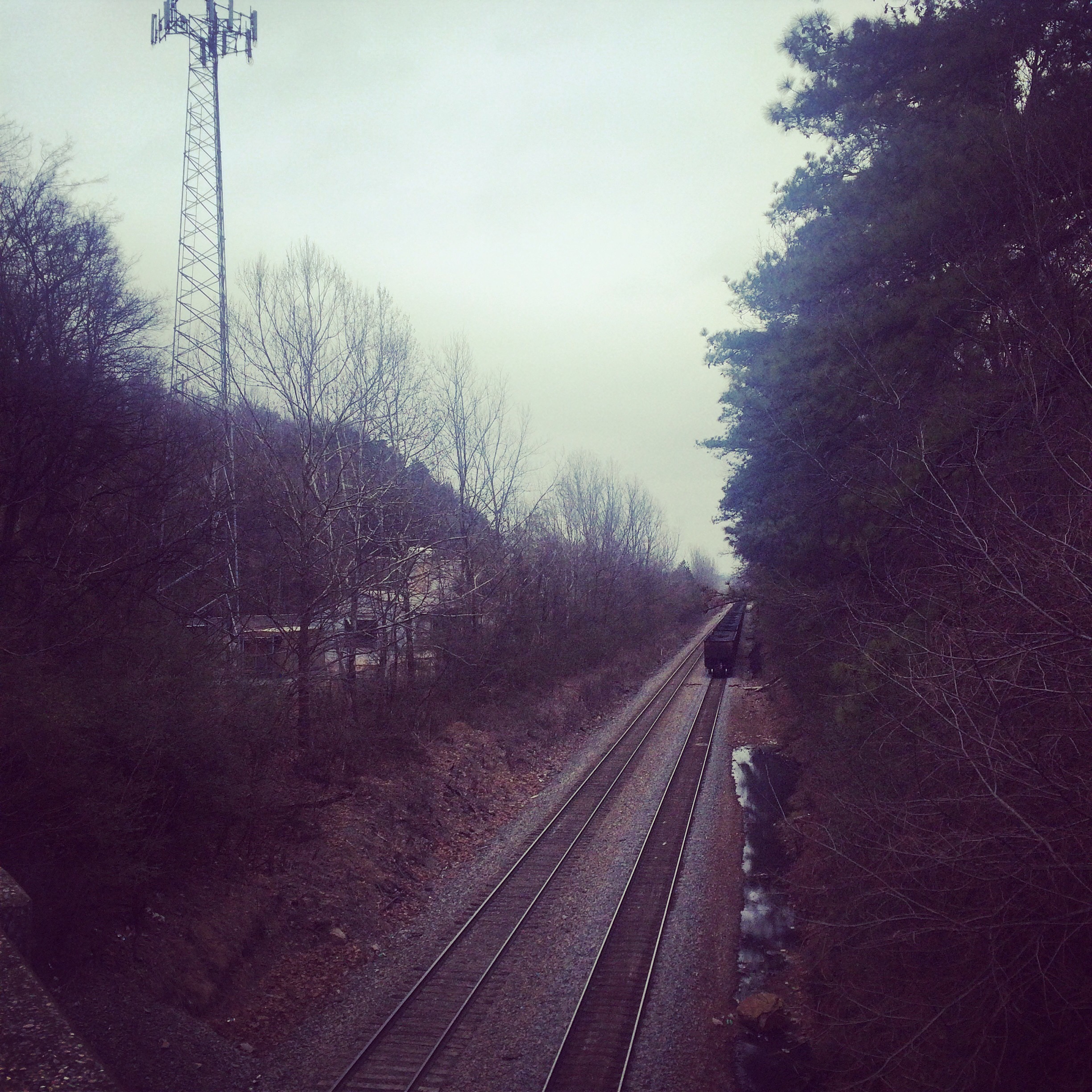
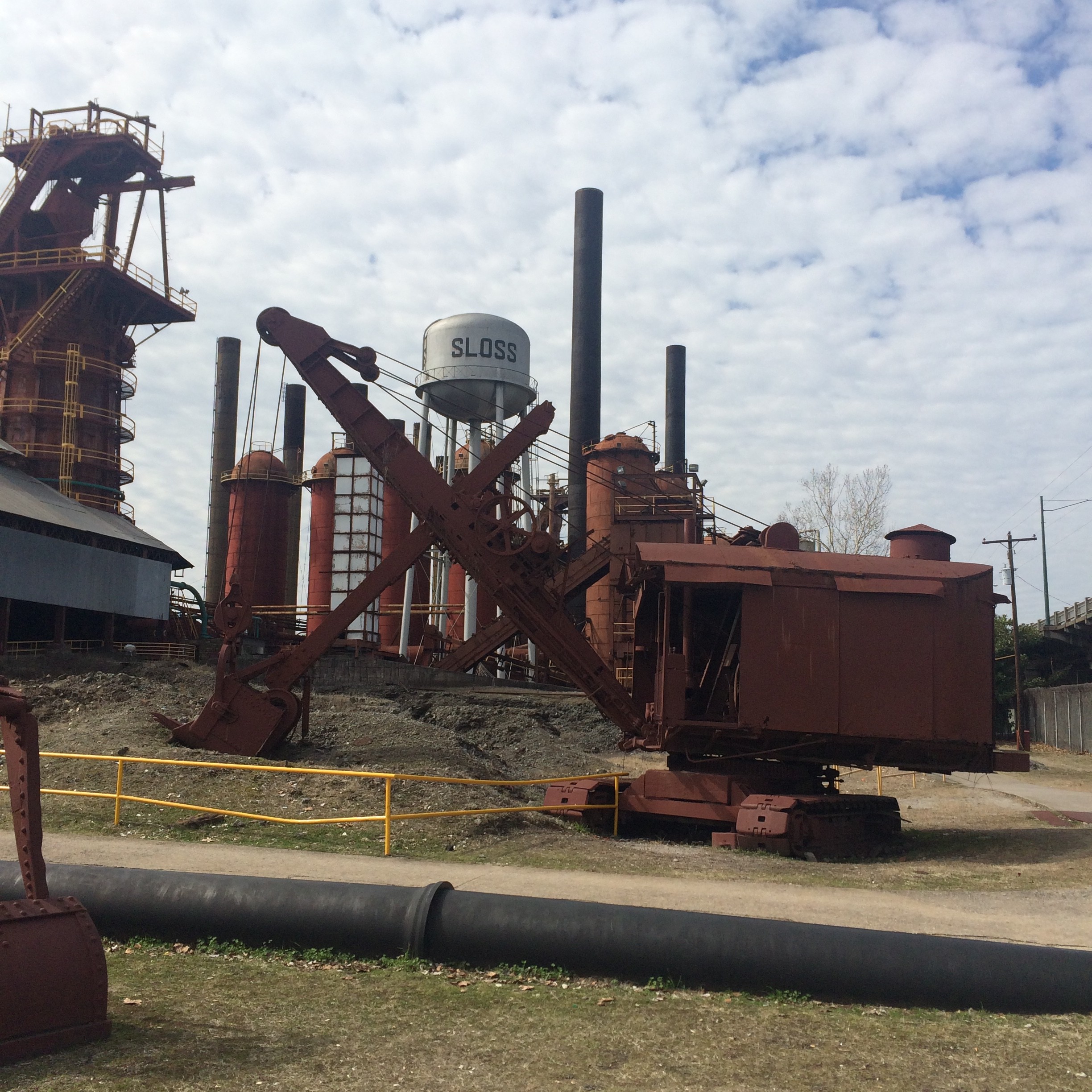
The area between is the southernmost extremity of Atlanta’s infamous Railroad Gulch. The portion shown here may be the only part of the gulch that is not paved, the rest being mostly parking lots. (There will be a post in the near future focusing on the gulch and Underground Atlanta area from a rail perspective)

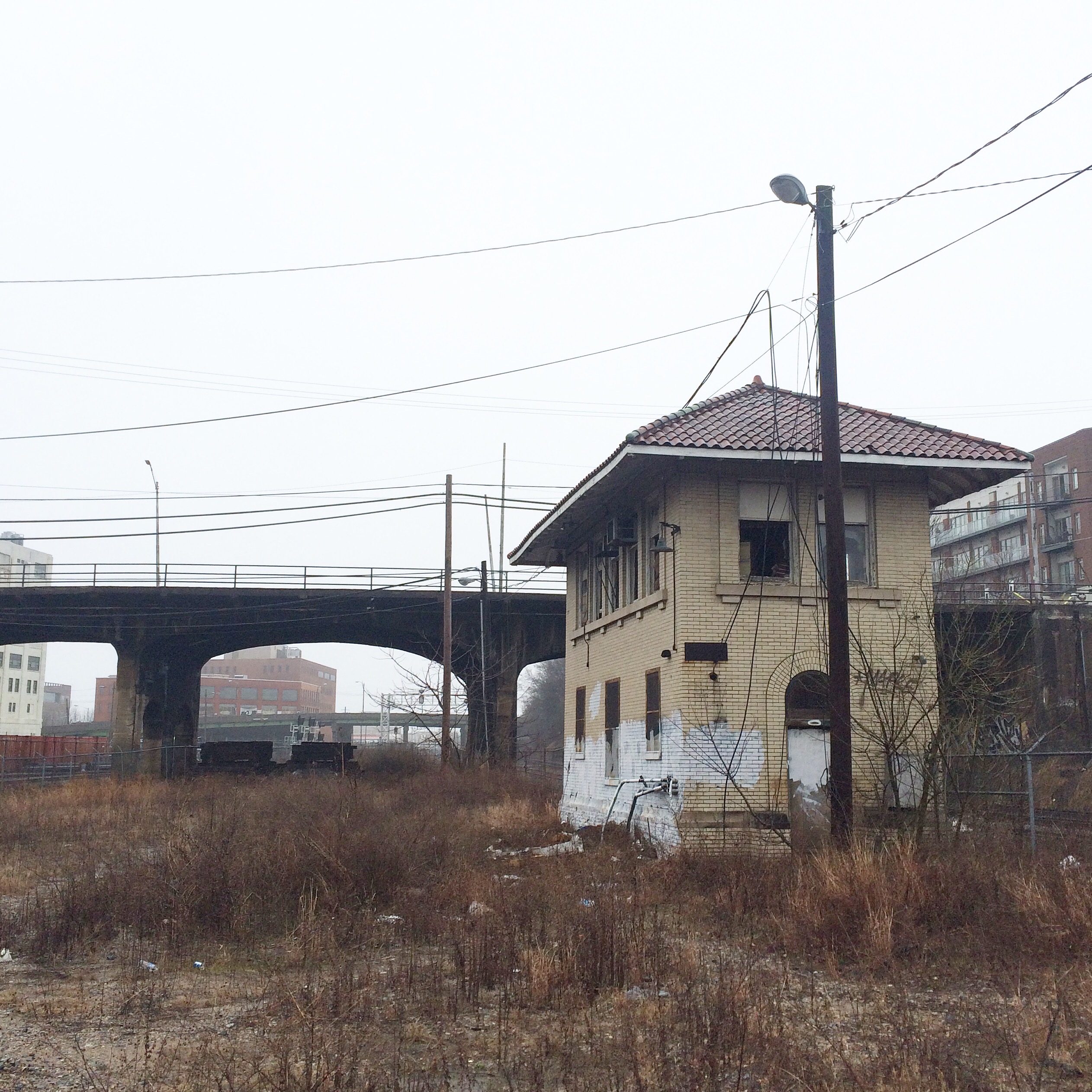
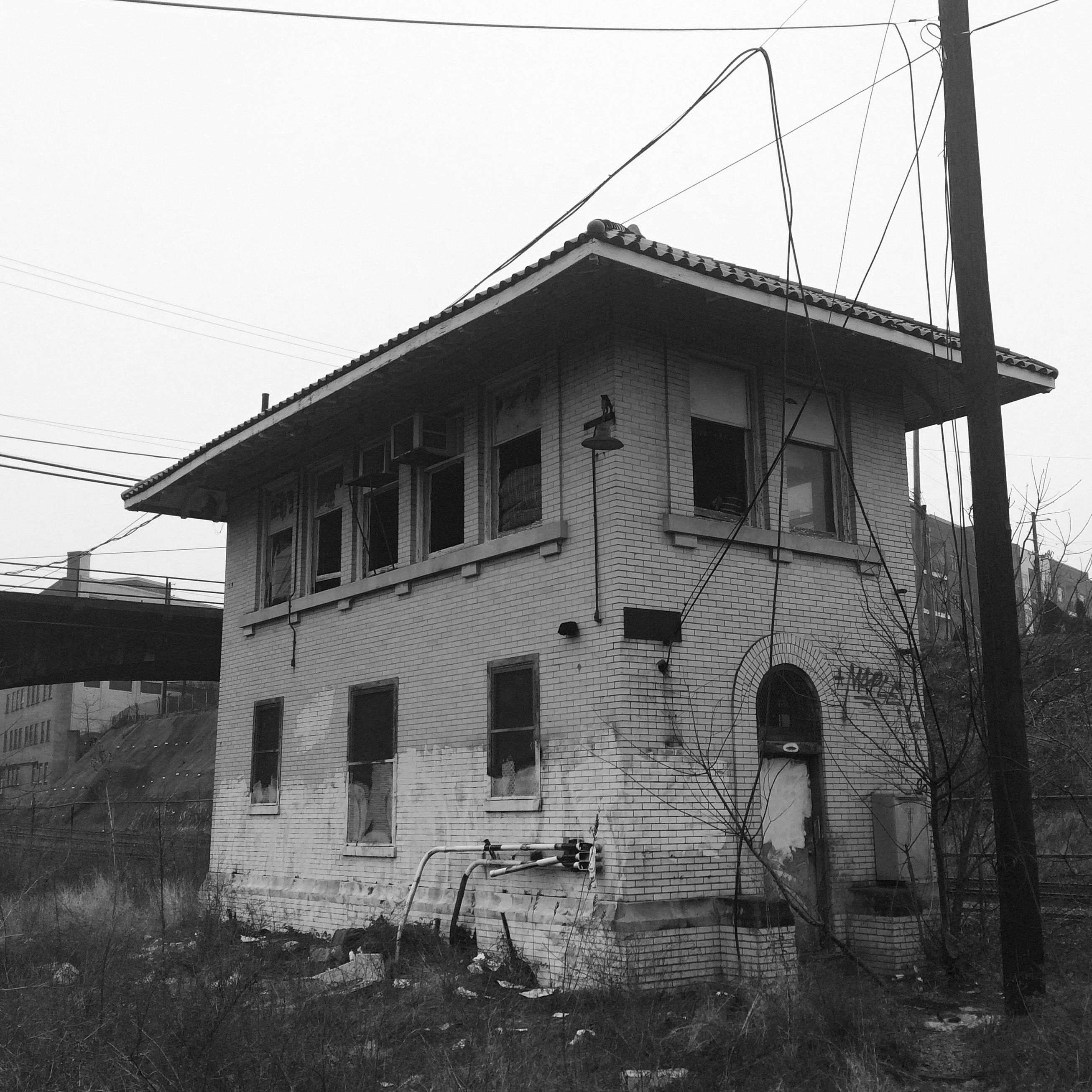
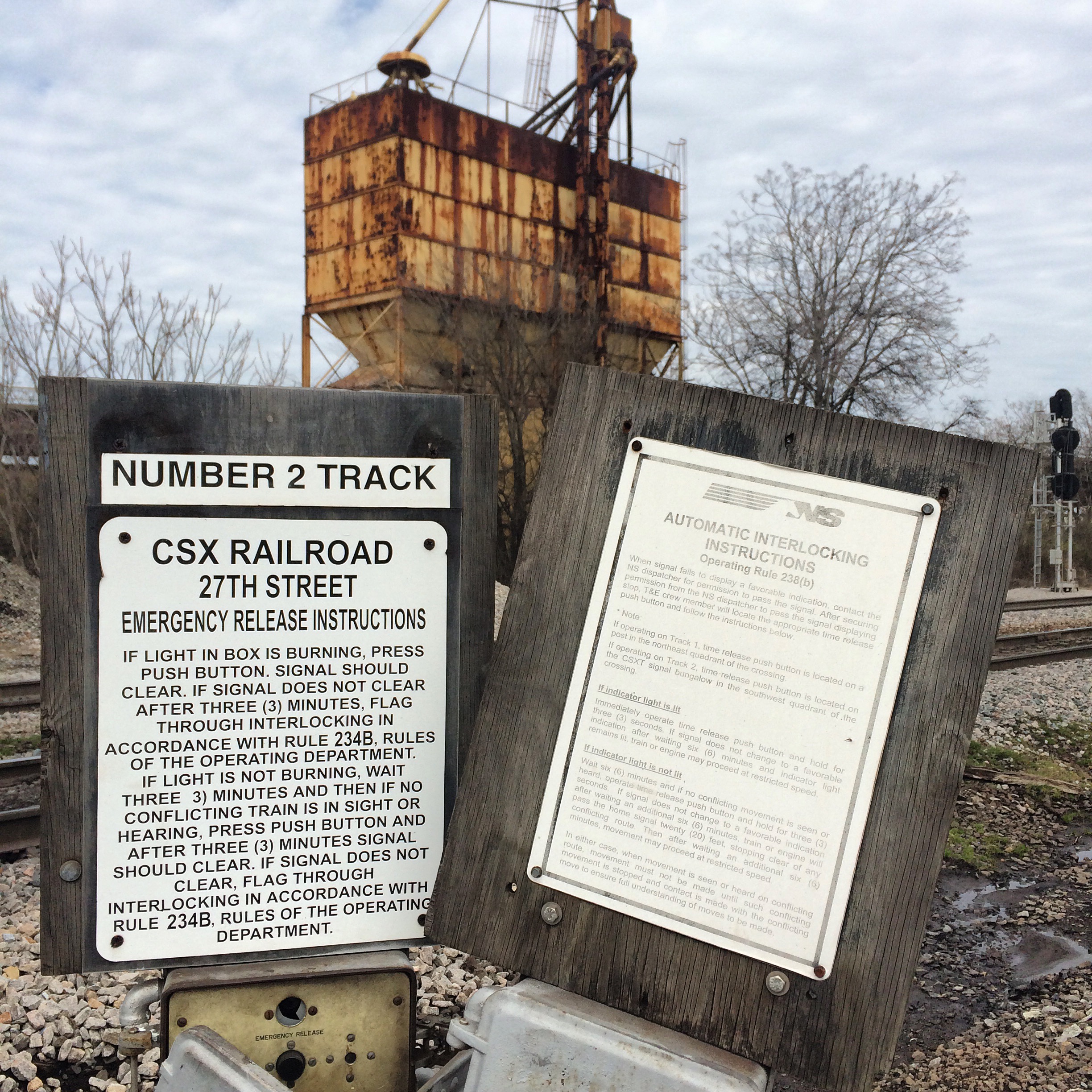
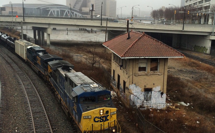
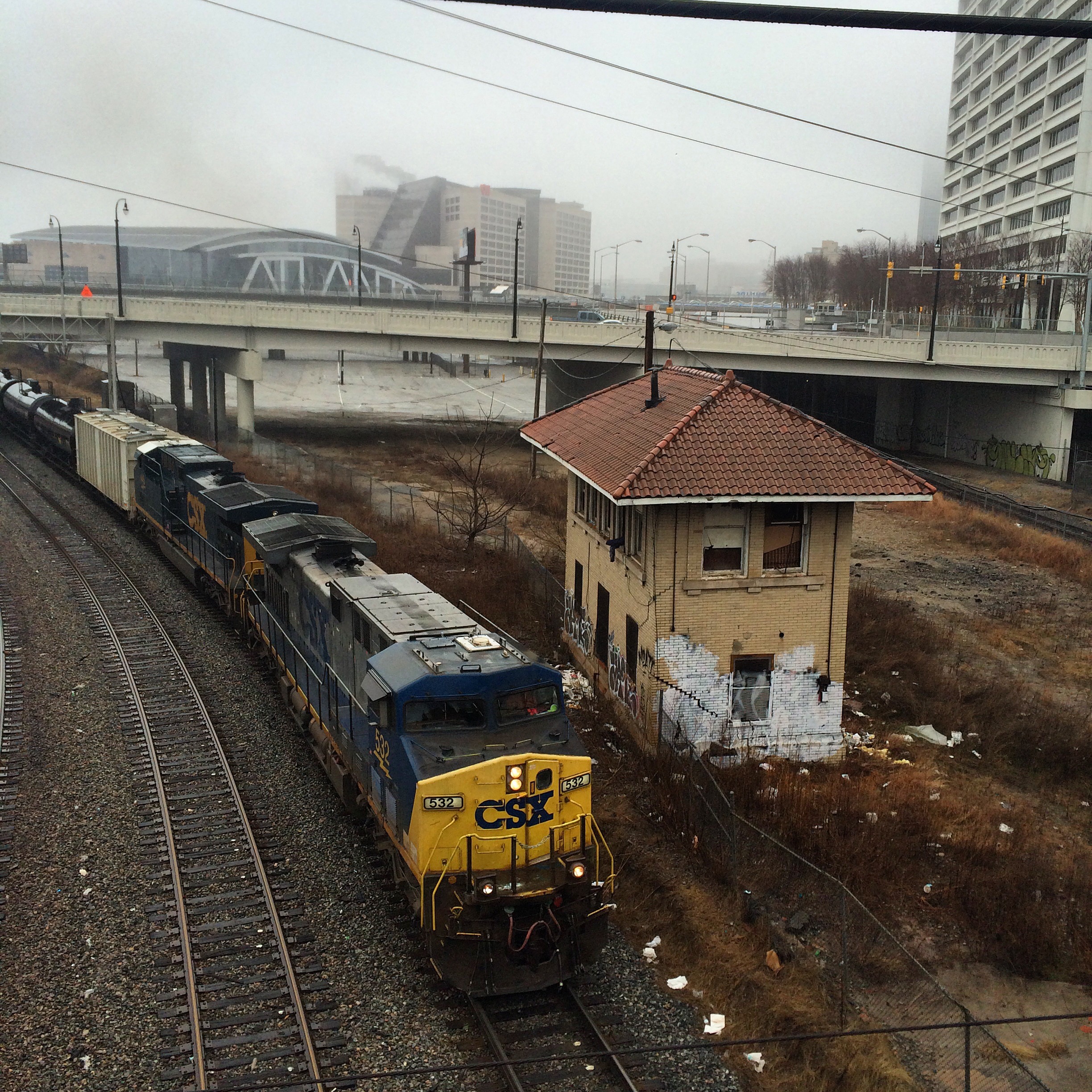
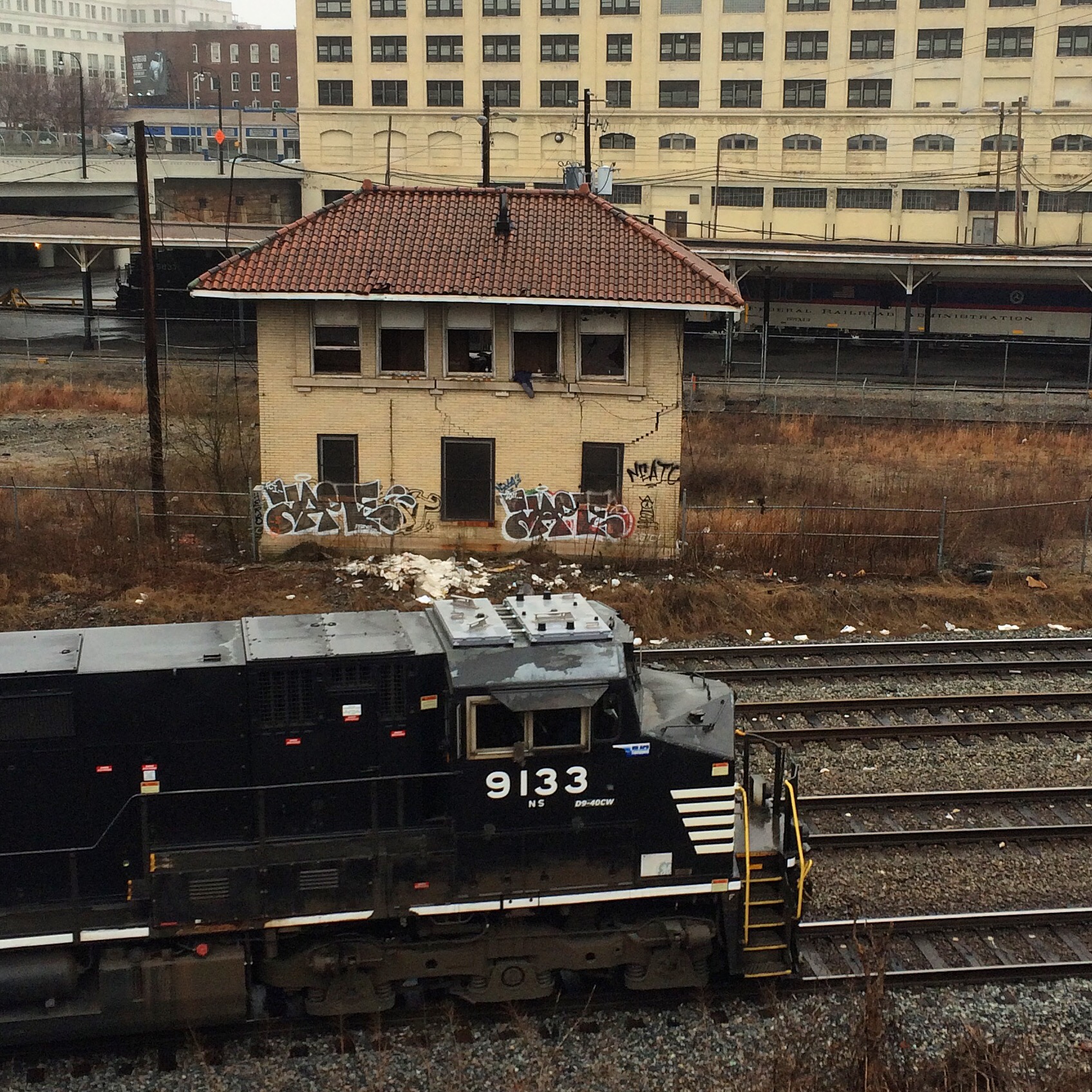
The small building down in the gulch next to the tracks is the Spring Interlocking Tower. This is one of very few remaining such towers anywhere, and almost certainly the only one in the metro area.

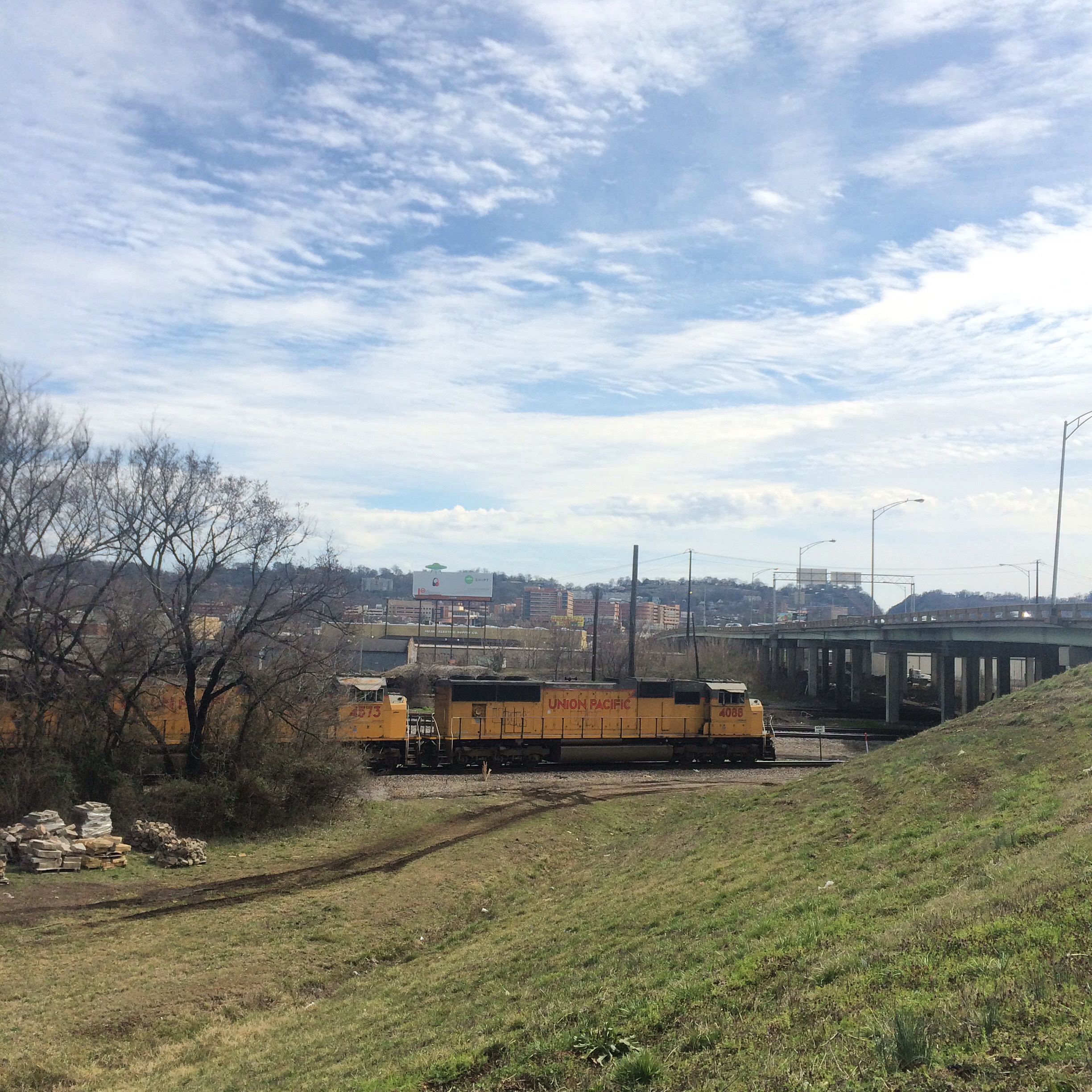
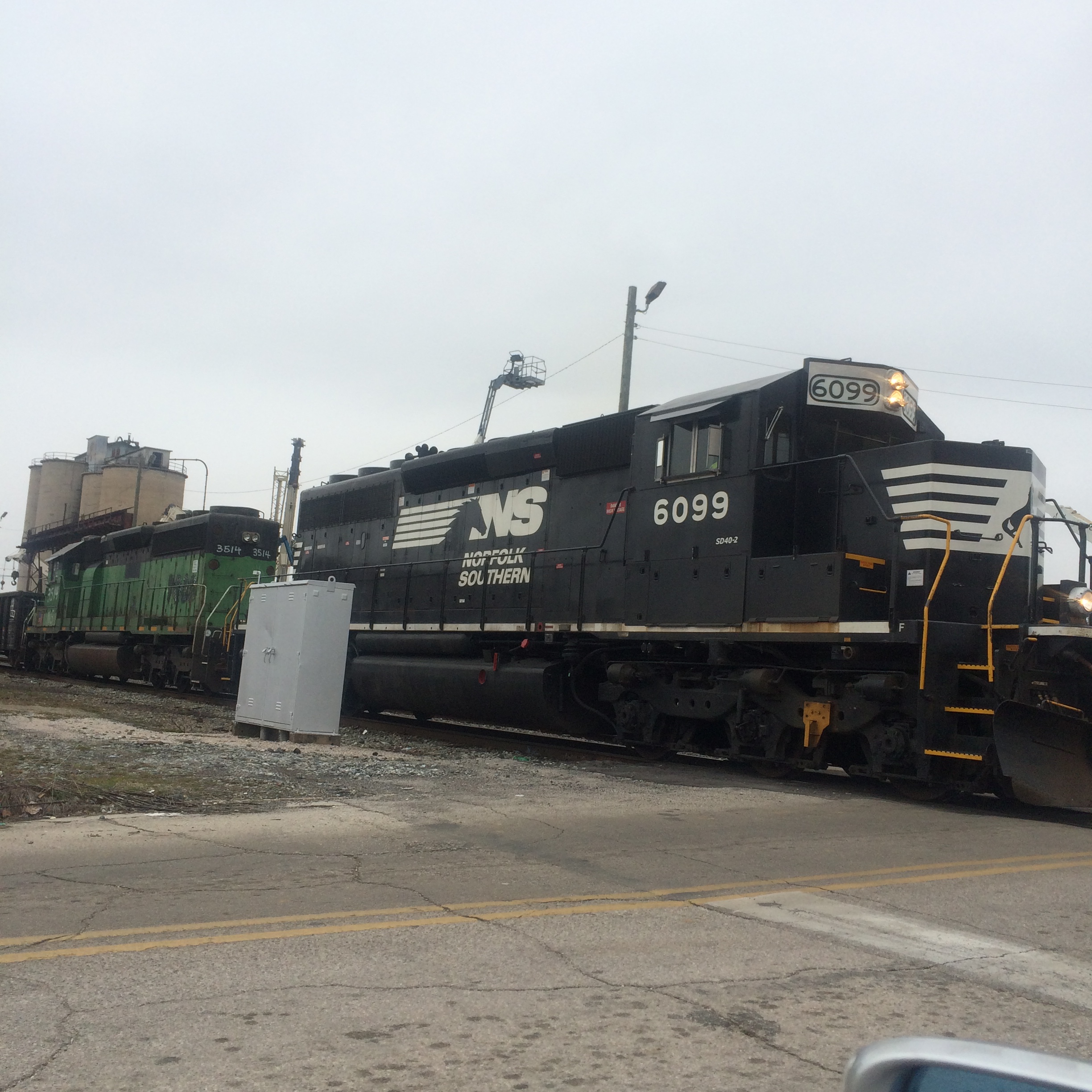
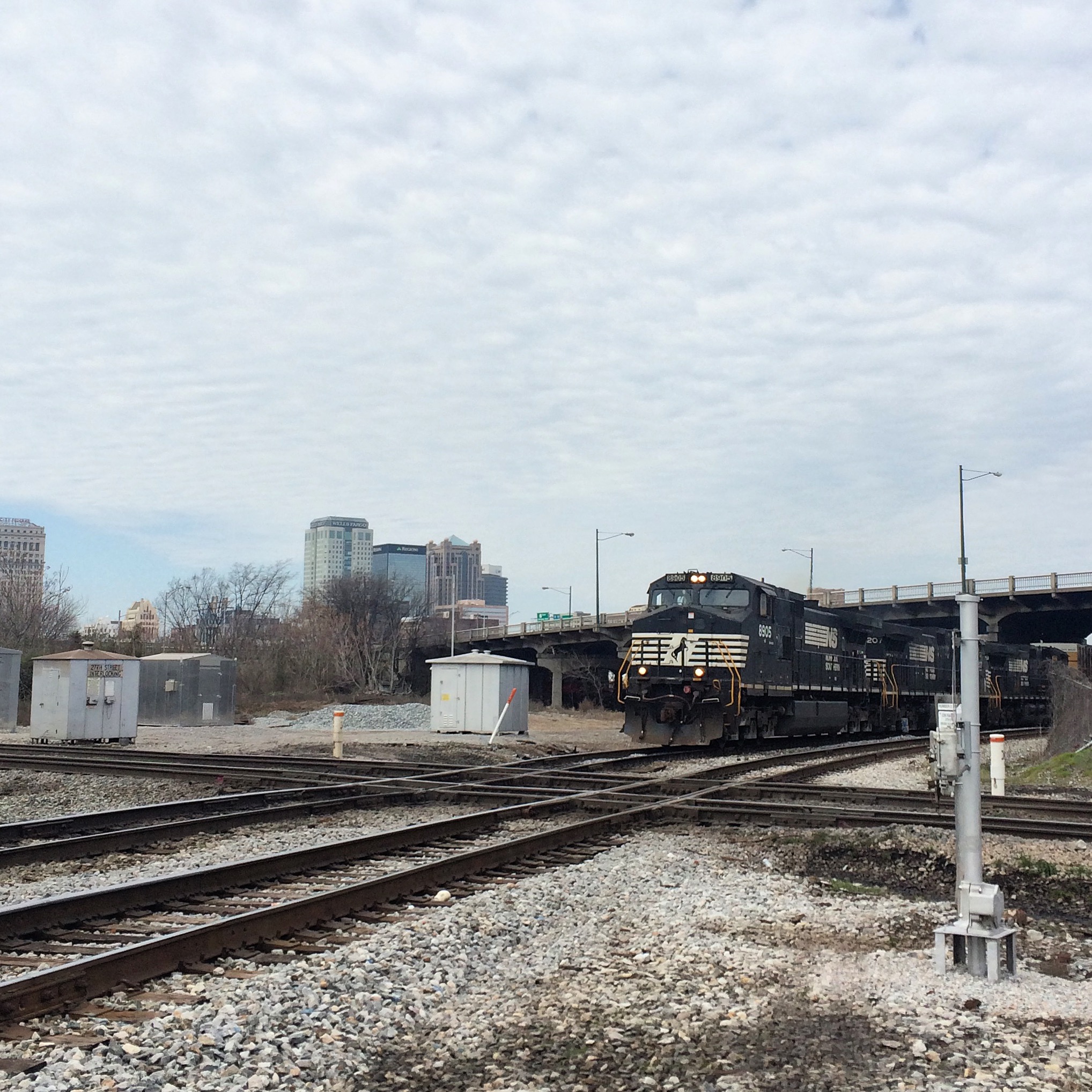
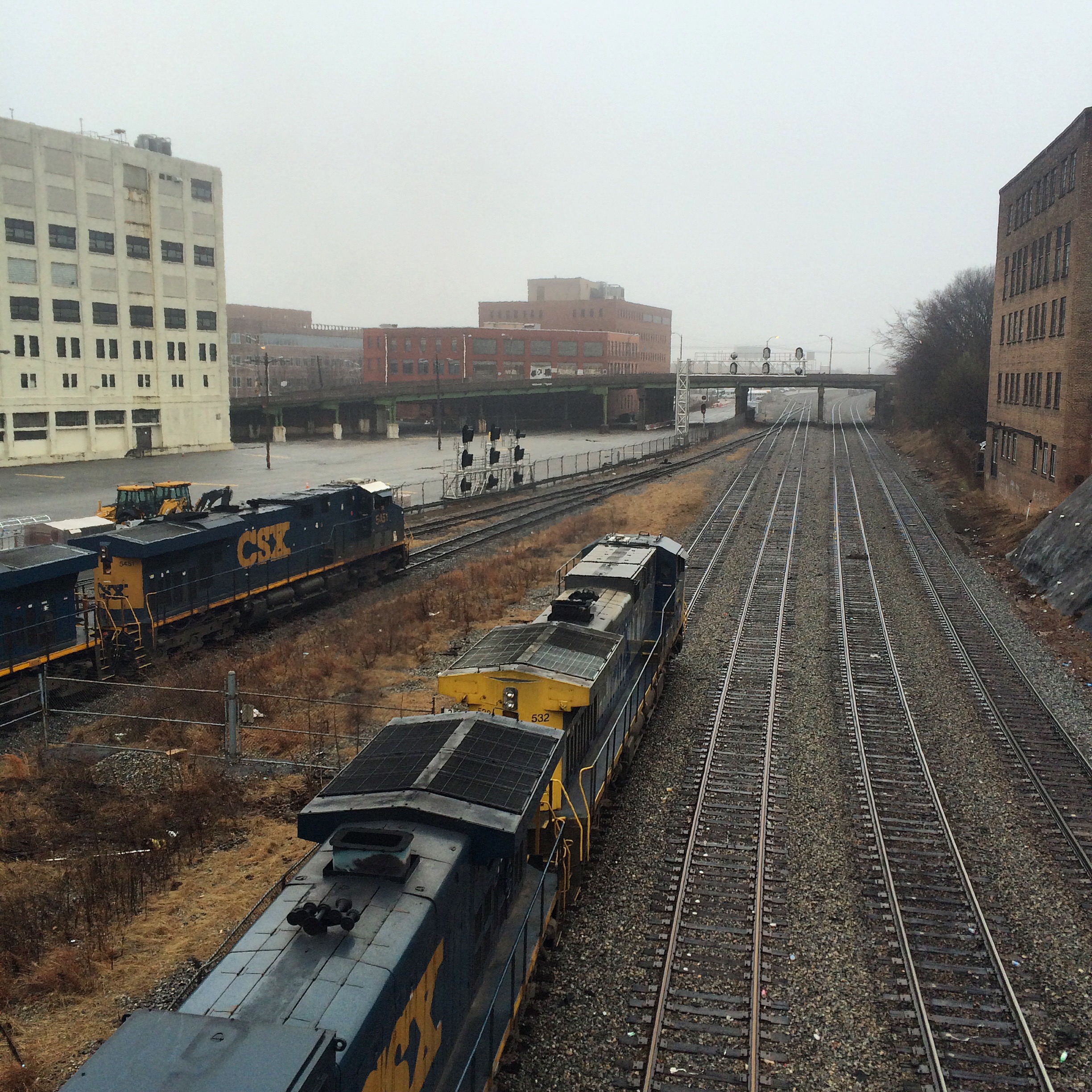
I think the two tracks nearest the camera here are Norfolk Southern and two beyond are used by both NS and CSX (I believe owned by NS).

(null)


This is the front entrance to 125 Spring Street, showing both the “Southern Railway” name and the aforementioned “Atlanta Police”.

(null)


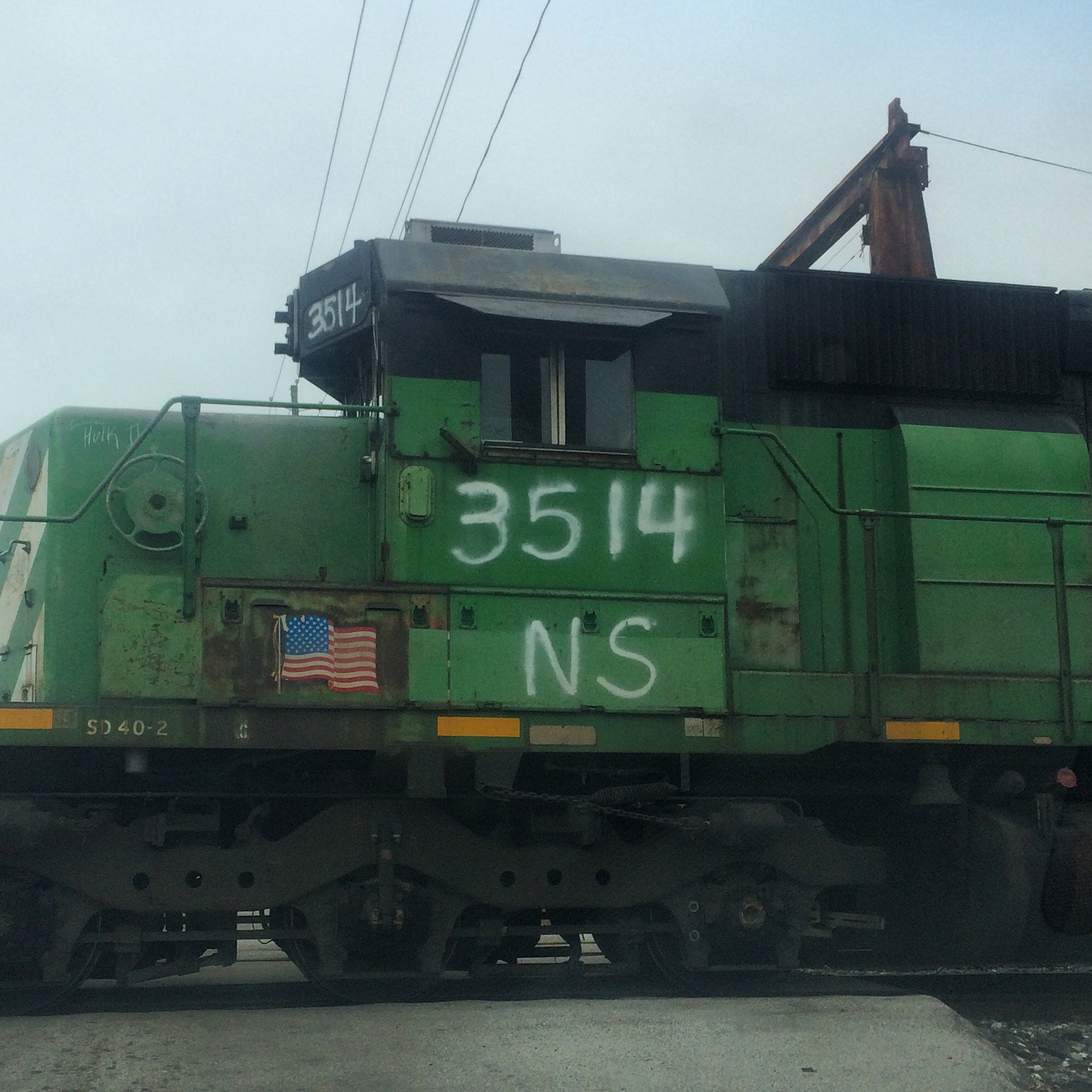
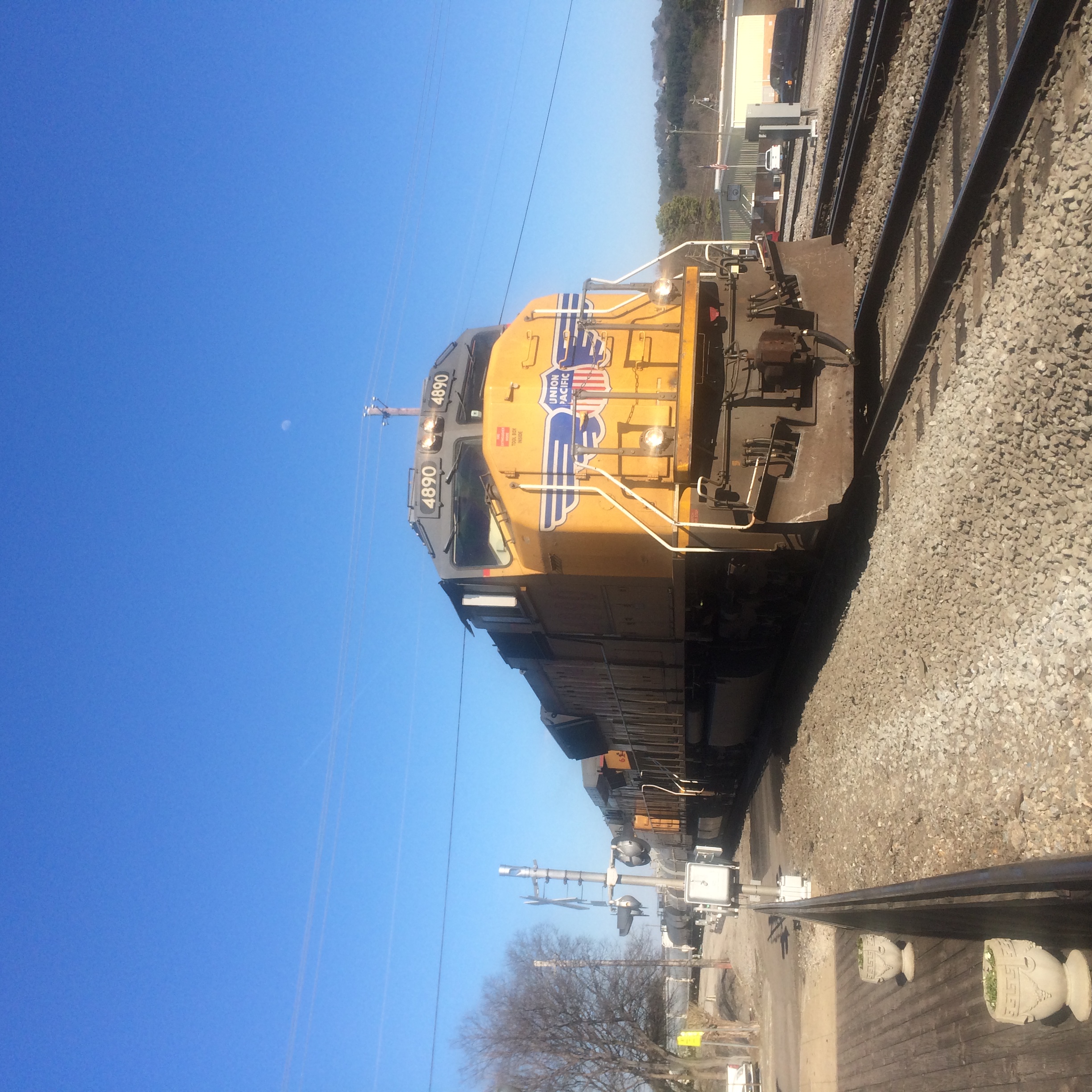
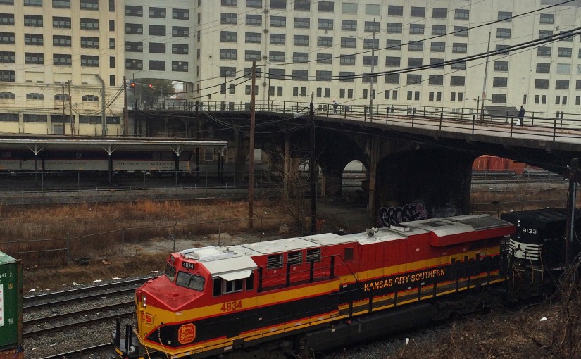
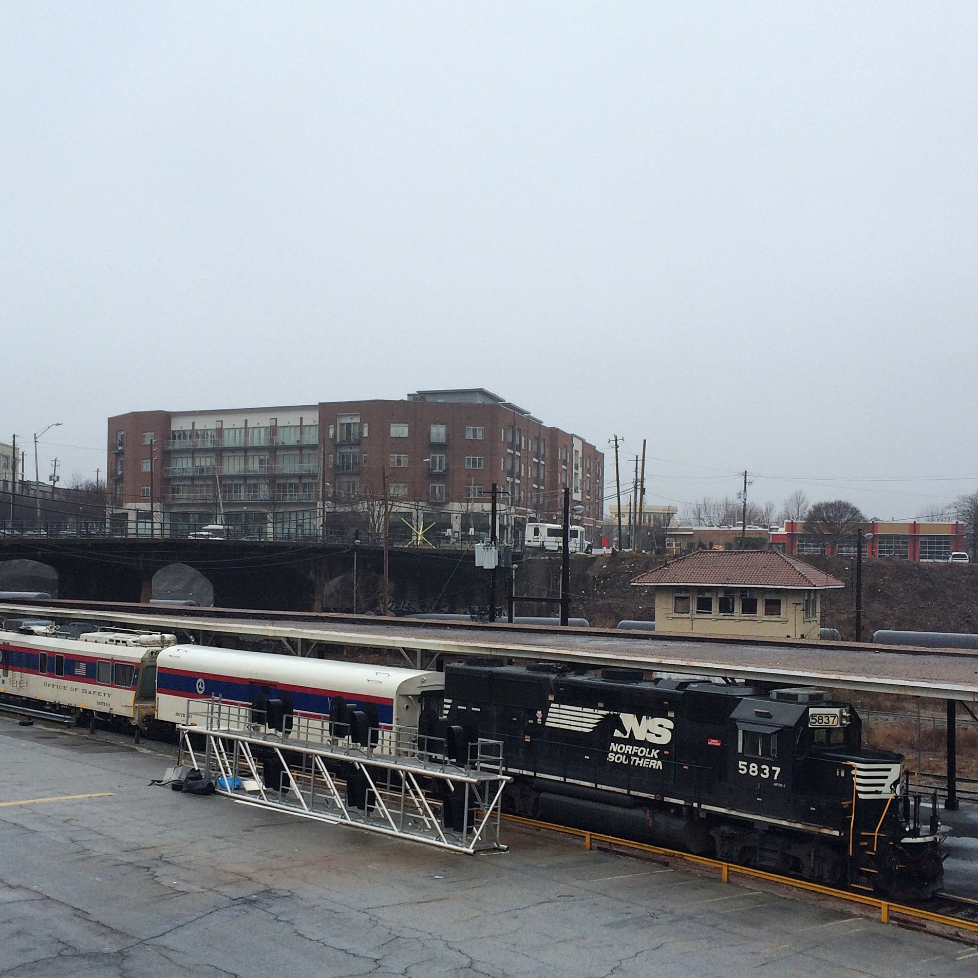
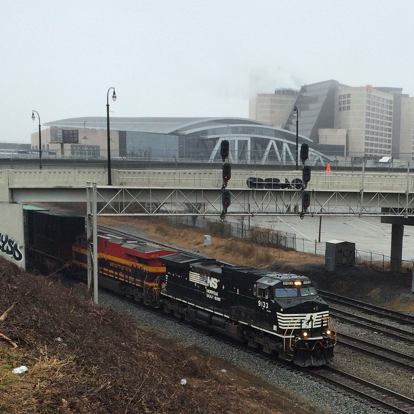
This is taken from the Mitchell Street bridge which runs just north of the complex, which unlike Nelson is open to vehicular traffic. This train was idling here the entire time I was there. The cars are from the Federal Railway Agency.

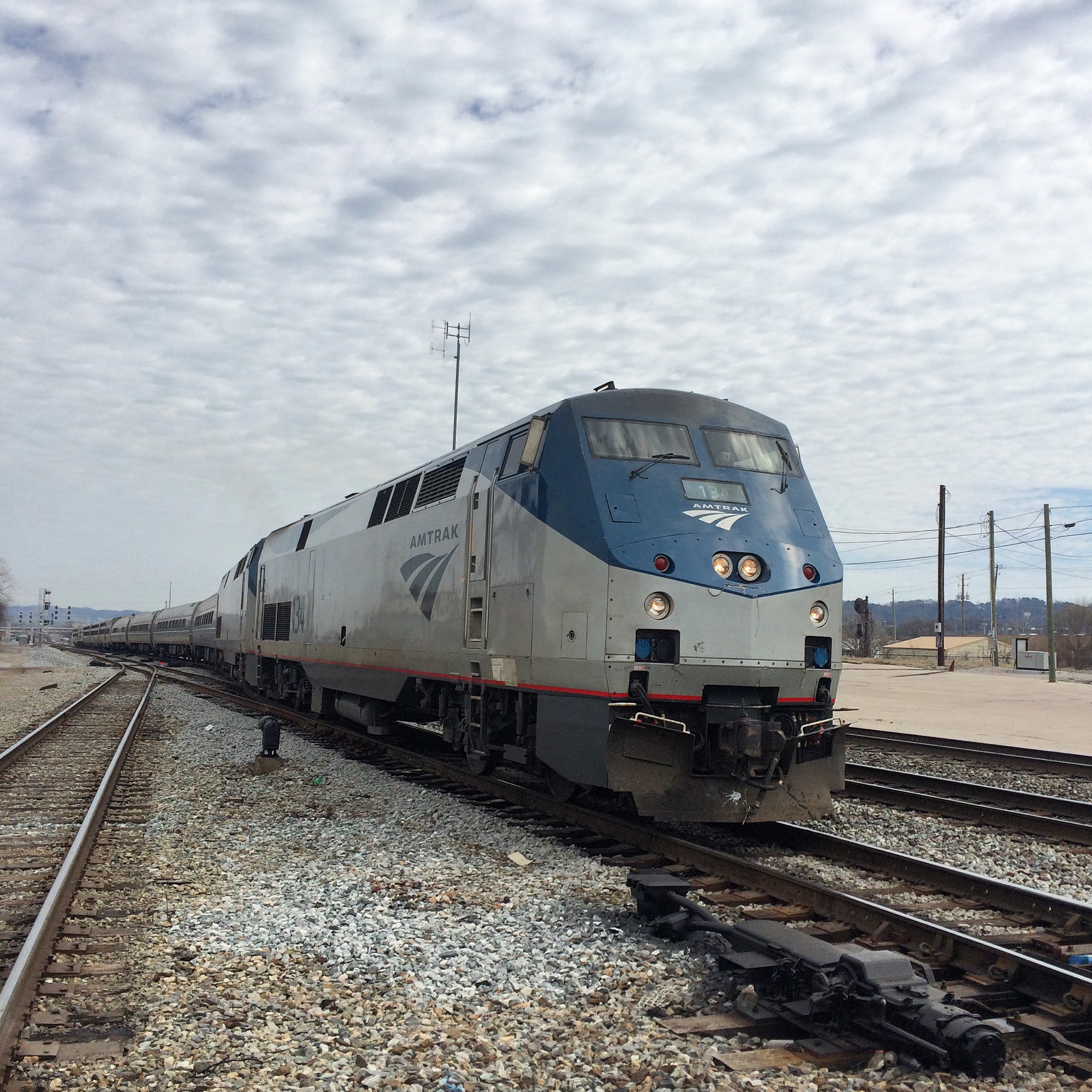
The structure behind the train that looks like a passenger platform is exactly that, a reminder of the long-demolished Terminal Station. Here, not the current Amtrak station on Peachtree, is where Southern operated its intercity passenger trains.

(null)


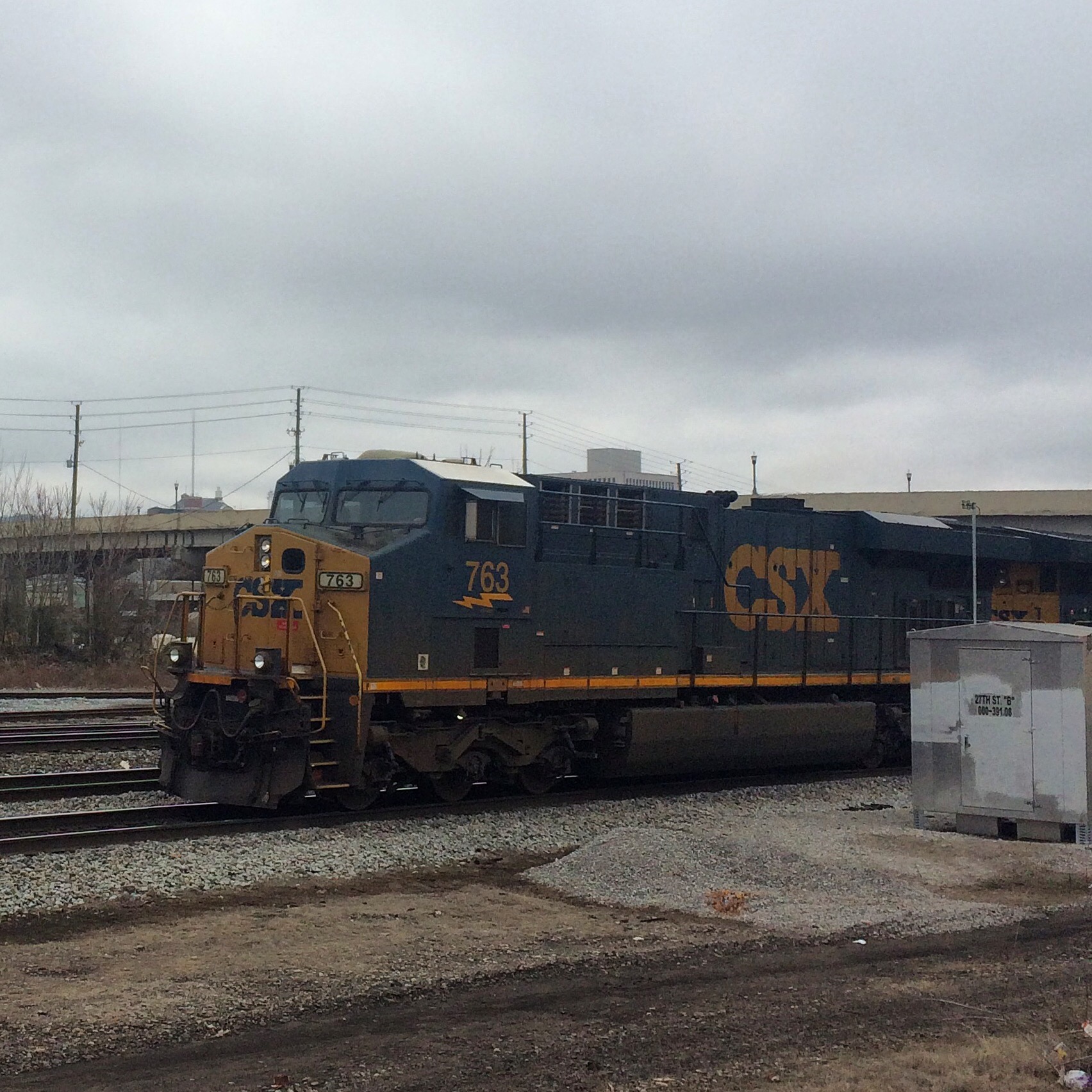
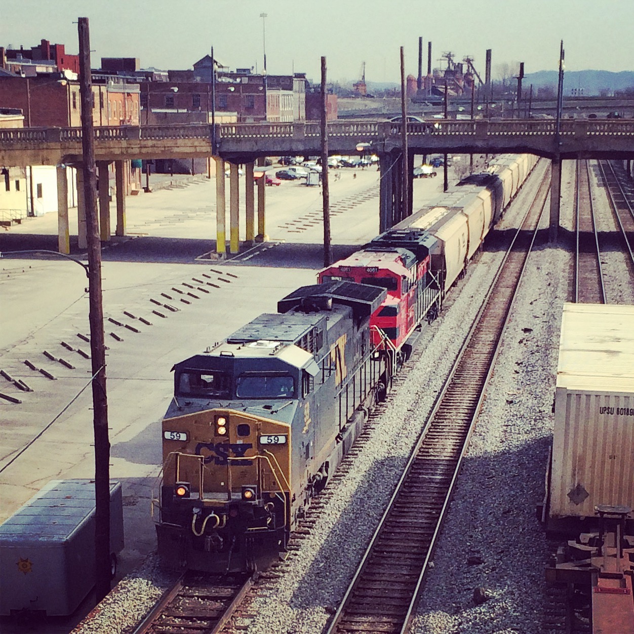
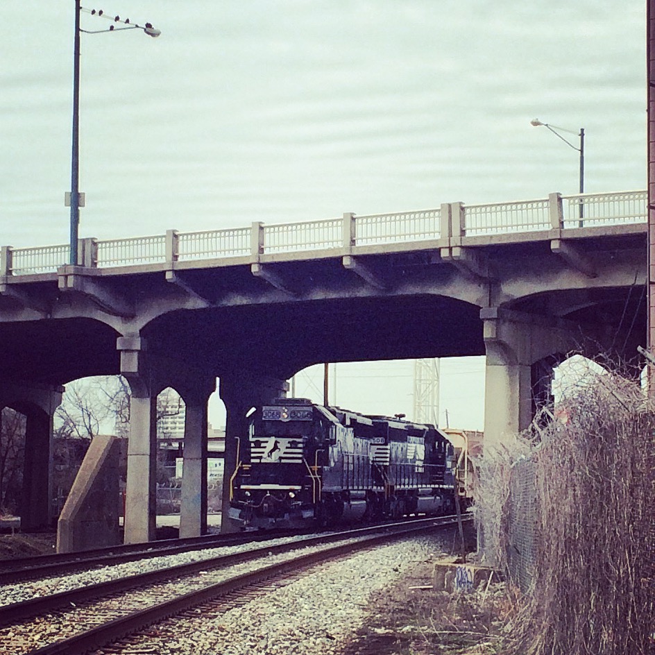
This was a CSX power move of two locos that came down from the direction of Hulsey Yard (the bridge it is emerging from under is Mitchell Street) and then sat idling the rest of the time I was there.

The tall white building on the right is the Richard B. Russell Federal Building. In the parking deck under it there are spaces marked “FBI Parking Only”, and a scary number of vehicles labelled with various other three-letter government agencies.

(null)

(null)


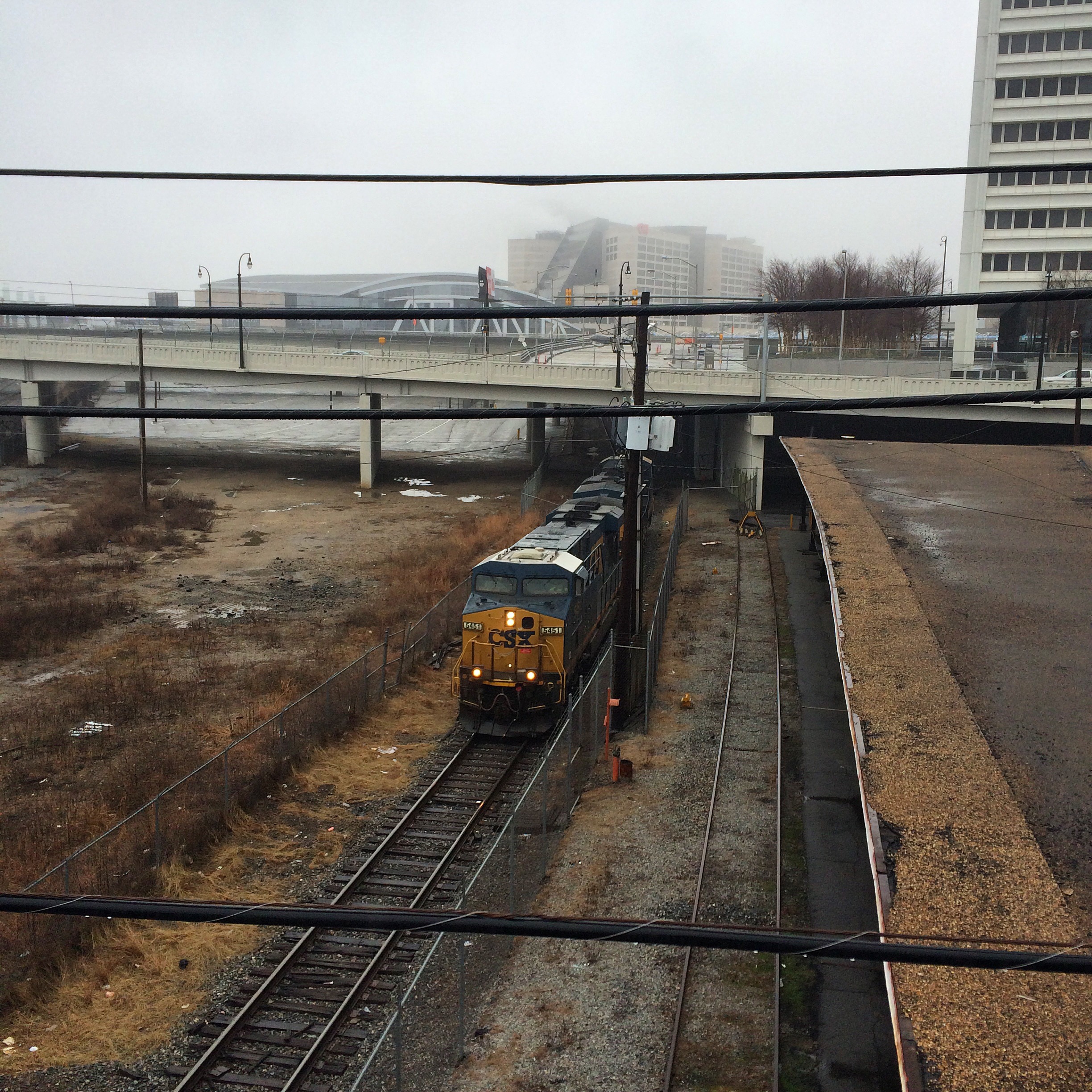
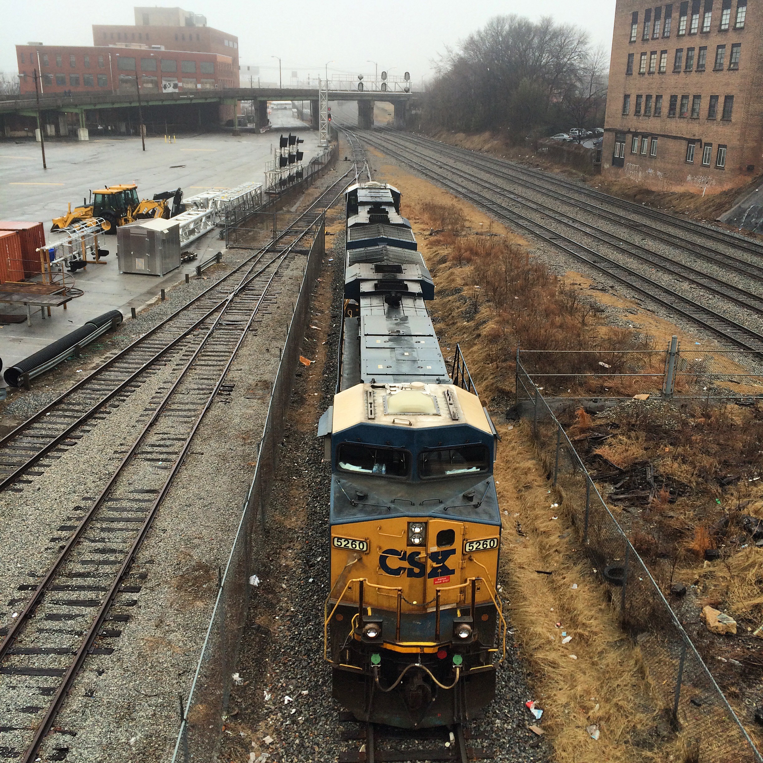
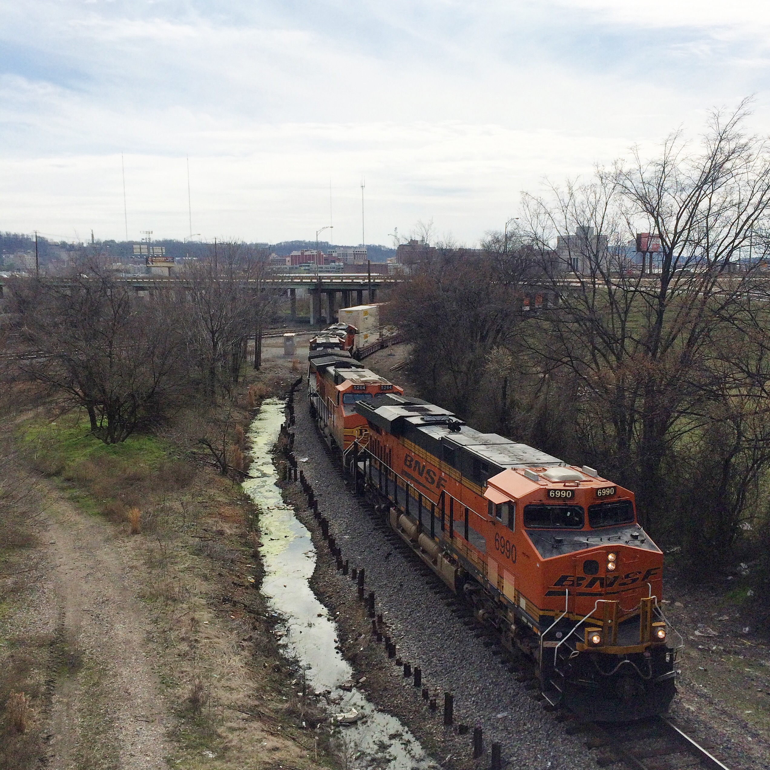
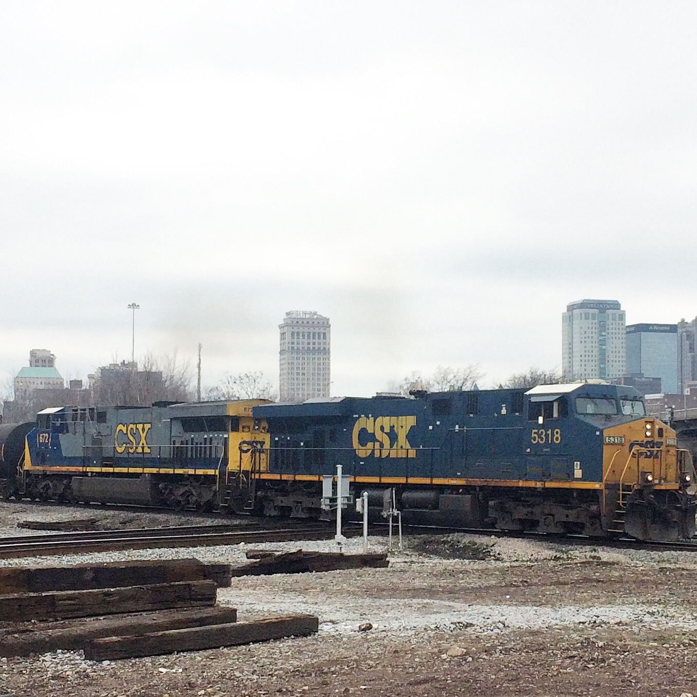
These photos show a soundbound CSX train as it passes under the Nelson Street bridge. The first is looking north, the second looking south. Note the two locos sitting to the right in the 2nd photo.

(null)

(null)


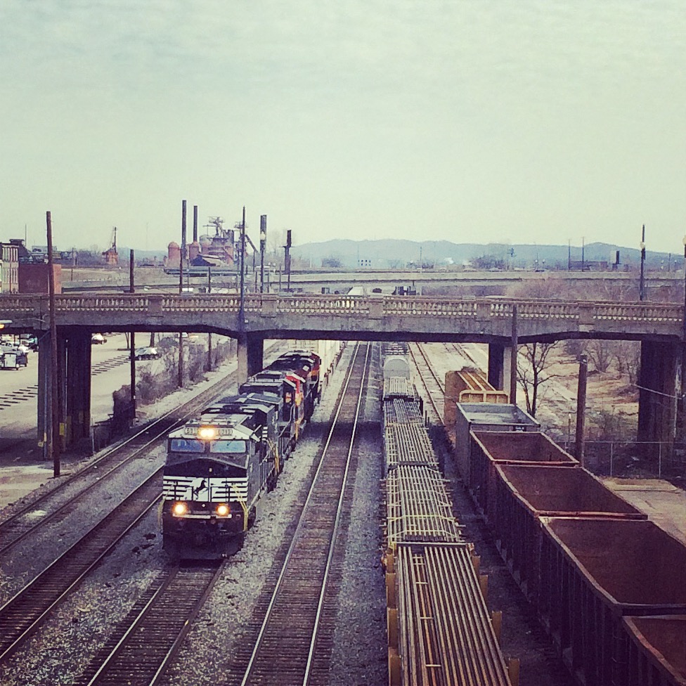
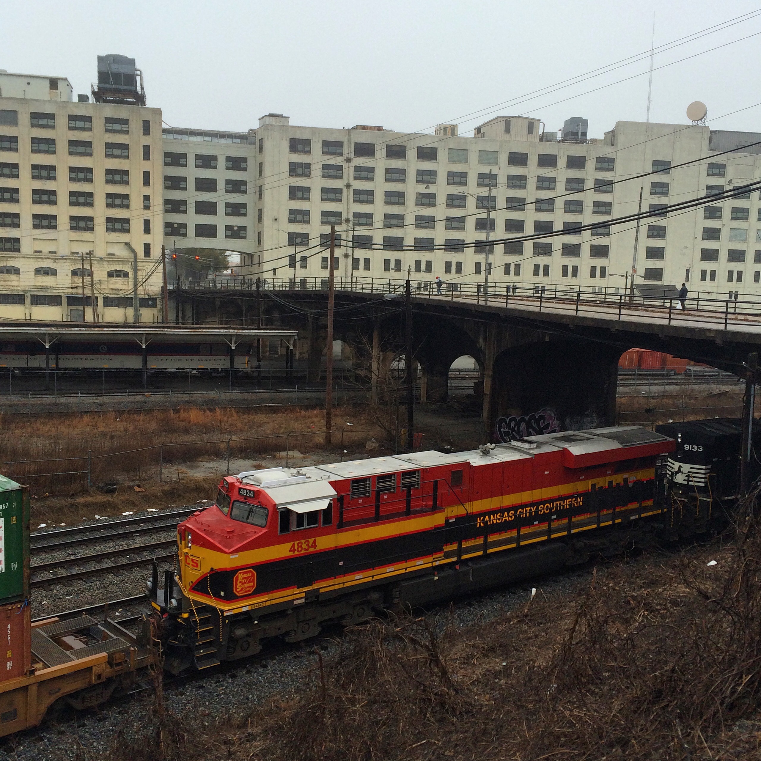
This is an NS train, seen from the other side of the gulch.

(null)

(null)

(null)


These next photos are taken down in the gulch. I was able to get down there by driving through the Phillips Arena parking lot. The first photo shows the crossing of a CSX line (the same line that the two locomotives were on) that is inside the parking area, which I found notable because of the lack of “railroad crossing” signs (even the normal “private railroad crossing” usually seen). The other two are of the tower.

(null)

(null)


(null)


Marengo County High School, 1909

As some of you may have heard me remark, I have driven from Atlanta to Mobile so many times that I will go to great lengths to avoid the normal I-85/I-65 route and get some variety.

This time I went to Tuscaloosa on Friday, spent the night and Saturday morning there, and headed south in the afternoon.

Ignoring the route suggested by Google maps, I decided to follow the way that was burned into my memory from 20 years ago. The route that at that time most Mobile-area UA students followed:

AL 69 to Greensboro, then AL 25 down to AL 5, which very shortly leads to US 43, which takes you all the way to I-65 north of Mobile.

The 25 stretch is the most rural. It is almost nothing but farmland alternating with the manmade lakes where catfish are raised.

The towns along the way are tiny, one traffic light (if that) affairs. The kind of places that have feed and seed stores. The kind of places where the main road in the middle of town has a passive railroad crossing with no lights or swinging gate arms.

In Thomaston a sign proclaiming “Eat Pepper Jelly!” caught my eye. Smaller signs indicated the “Alabama Rural Heritage Center” was nearby.

I know now the center was closed (it’s Saturday hours are only 10-1), but it would not have mattered anyway because I was too clueless to realize which building it was in.

Instead I thought the signs were directing me to a large old building that once I got up to it, turned out to be an abandoned high school. The doors were padlocked, the window glass was broken, and the wooden wheelchair ramp was rotting. Clearly this place has been unused for some time, although the mere presence of such a ramp showed it had probably still been in use in the 1990s.

I was at this point still confused thinking this was the heritage center, which I imagined as some kind of museum. Signs had promised a gift shop at least, and pepper jelly. Yet here it was, abandoned and decaying.

The gym was in even worse shape than the main building. Trees were growing out of its roof.

The ground around these buildings was not overgrown, indicating it is still cared for. A flag was loudly flapping atop the school’s flagpole, which presumably someone had to raise and lower.

I decided to walk around between the school and its gym. Behind the gym the tattered tin roof of an old shed was groaning in the breeze, metal scraping against metal with each gust of wind.

The back door to the gym was off its hinges, so I went inside to take pictures. The main roof was gone except for its skeletal ribs, the sun shining in fueling plant growth in what had presumably once been the basketball court and the scene of many a prom and homecoming dance. Nice touch for Valentine’s Day.

The actual heritage center turned out to be in a renovated outbuilding on the side of the school opposite the gym, actually closer to the Pepper Jelly sign. But like I said it was closed. No pepper jelly today.

(null)

(null)

(null)

(null)

(null)

(null)

(null)

(null)

(null)

Coming Soon: the most unique guided tours in Atlanta

I am about to start dabbling in the tour guide business. For a small fee (tbd), I will take a carload of site-seekers on a driving and walking tour of the greatest city of the modern south. Tours will be conducted only with pre-arrangement, and will need to fit around my work and life schedule.

Ads are going to be placed on Craiglist and other places. I don’t expect to make much money. I might get rolled. But it should be interesting.

The tours will cover overlapping areas. For example, more than one will include downtown, but each tour will have a unique emphasis.

Eastern Continental Divide Driving Tour

The ECD, little known and little remarked upon, is actually one of the important natural features of the area. This tour will follow the divide and include my ramblings about history and the areas through which it passes.

Railroad Tour

This tour emphasizes railroad history and trivia. Portions will take place on MARTA trains, for which the fare is not included in the tour price.

Gentrification Tour

Combined walking and driving tour, will visit many of the Intown neighborhoods that have bounced back from urban decay to affluence, or at least hipness.

Buford Highway

Driving tour with multiple stops at local businesses.

Brown’s Bridge

(null)(null)

Located on the border of Forsyth and Hall counties on state route 369, spanning Lake Lanier. There have been bridges at this spot over the Chattahoochee since before the lake was created. This current bridge was built in 1955.

There is a very similar bridge to the north on route 53. The part of Lake Lanier spanned by that bridge is actually the Chestatee River, above the confluence with the Hooch that is now submerged by the lake.

Both of these bridges are set for replacement. Two-lane through-truss bridges like this are an endangered species on our highways.

link to BridgeHunter page for Brown’s Bridge

Crazy Weekend Roadtrip Plans

Horseshoe Curve

altoona

Friday:

  1. Leave work in time to beat rush hour, drive up I-85 to Charlotte
  2. Turn north up I-77, to I-81
  3. Head up 81 until I get sleepy
  4. Flop somewhere for the night

Saturday:

  1. Drive to Horseshoe Curve near Altoona PA
  2. Watch trains for as long as I feel like
  3. Drive to Gettysburg
  4. Visit Civil War stuff
  5. Stay the night

Sunday:

  1. Get up early and drive all the way home, Googles say about 10 hours.


Folkston Funnel Florida Fun

folkston

No schedule for this one yet, but it involves:

  1. Watching trains in Folkston, GA
  2. Watching space launch at Cape Canaveral


Bourbon Country

This will probably require more than a weekend.

cincy